Geology and Paleontology of Elsmere Canyon
|
Elsmere Canyon is located at the western end of the San Gabriel Mountains in the Transverse Ranges geomorphic province of California. The Transverse Ranges are so named because they are crosswise to the usual landscape trends of California. They are characterized by an east-west landscape - the general direction of Elsmere Canyon.
Elsmere Canyon is also located in the easternmost part of the Ventura Basin. The Ventura Basin is a deep, narrow trough filled with sedimentary rocks of Cenozoic age. Its east-west trending axis closely follows the Santa Clara Valley extending out into the Santa Barbara Channel. The basin started forming at the beginning of the Tertiary period and began narrowing at the beginning of the Miocene epoch due to plate tectonic activity at that time.
The oldest rocks in Elsmere Canyon are pre-Cretaceous igneous and metamorphic rocks exposed in the upper part of the north-east fork of the canyon. These rocks consist mainly of gneiss, schist, quartzite, and diorite. These are generally grouped together as the "basement complex".
The next oldest rocks are a small outcropping of the Juncal formation (Squires, 2008). These upper lower Eocene (about 50 my ago) marine rocks consist of sandstone, siltstone, and conglomerate. Oil well cores in the area have provided some megafossils (visible to the naked eye), but not until only recently have megafossils been found on the surface in the canyon itself. All these Eocene fossils are located at the Natural History Museum of Los Angeles County. In 2008, a paper on the paleontology, stratigraphy, and deposional environments of the Elsmere Canyon by Dr. Richard Squires of California State University, Northridge, was published. In 1931 W.S.W. Kew first stated that these rocks were Eocene in age, although, based on their lithology, they were suspected as being Eocene by Homer Hamlin (see Watts, 1900).
The north-south trending Whitney Canyon fault cuts off the Eocene rocks in the northeast. Based on oil well core samples, it appears that there was a net vertical displacement of about 6000 feet (see Winterer and Durham, 1962) from two periods of activity on the fault - a pre-Pliocene movement and a post-Pliocene movement. The result was that the older Eocene rocks on the western side of the fault were raised to their present height. Overall, the Whitney Canyon Fault is poorly exposed and shows little evidence in landforms leading to inconsistencies in its mapping.
The next oldest rocks exposed are part of the early Pliocene Towsley formation (about 5 million years ago). This formation consists of sandstone, mudstone, and conglomerate. In some places the Towsley lies directly on the Eocene beds and in other places it lies on the pre-Cretaceous basement complex. It can be highly fossiliferous. Bones of marine and non-marine mammals have been found. Concretions containing fossils are common. Surface oil seeps are common. Subsurface oil has given many of the beds a distinctive color. Fossils (over 100 species have been identified) have shown that the Towsley formation was deposited in a shallow marine environment (50-200 feet according to Kern, 1973). It is the only large shallow water fauna of early Pliocene age in Southern California.
Above (and hence younger) the Towsley formation is the middle to late Pliocene Pico formation (about 4 - 2 million years ago). It too was deposited in a shallow marine environment, although not as deep as the Towsley. It mainly consists of siltstone, sandstone, and conglomerate. It contains graded and cross-stratified beds which indicate shallow water conditions close to the sediment sources. In Elsmere Canyon, Pico fossils are extremely rare.
Above the Pico formation, sometimes interfingering with it, is the late Pliocene to early Pleistocene Saugus formation (about 2.5 - .7 million years ago). The Saugus formation consists of shallow marine, brackish-water beds that grade into thick, non-marine sandstone, conglomerate, and siltstone beds. Fossils are extremely rare. These are the horizontal beds you see in the road cuts when you drive north on Sierra Highway between Newhall Avenue and the San Gabriel Fault (located just south of the new Golden Valley Road before you get to the top of the grade). In Elsmere Canyon you see a greenish-gray siltstone basal (at the base of) member of the Saugus called the Sunshine Ranch member. The greenish siltstone is very noticeable in the park-and-ride area, on the hike into the canyon, and the first part of the hike up the Whitney Canyon parkway.
There are also some Holocene alluvium and landslide deposits in the canyon.
Structurally, the features in the canyon were created by the same tectonic compression that formed the Pico Anticline (see Pico Canyon geology) and are quite complicated. Besides the Whitney Canyon fault, there are other faults in the canyon. A fault may have created the high ridge on the south side of the canyon especially since, in some places, rocks on one side of the canyon are older than rocks directly opposite on the other side of the canyon. Kew (1943) wrote that the oil was trapped in the west-dipping beds against a northwesterly trending fault along the bottom of the canyon. A monocline or shallow anticline may also be involved, but that is far from certain.

From California Geomorphic Provinces, Note 36, California Geological Survey.
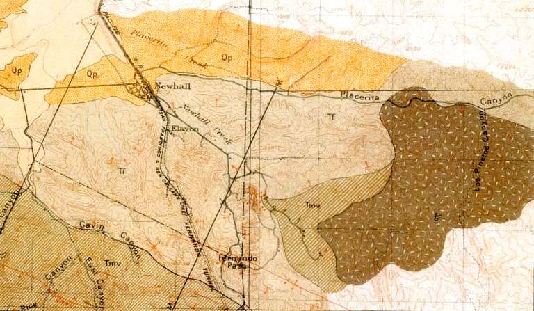
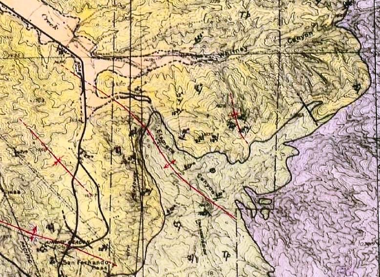
This is probably the first geologic map containing Elsmere Canyon. It if from Eldridge and Arnold (1907 - see sources) and was actually mapped by Eldridge in 1902. formation names and ideas have changed greatly since this map was created so it is not very accurate based on current maps. Interestingly, this map shows the road on top of the south ridge above Elsmere Canyon proving it was built by 1902.
Legend: Qal-Pleistocene aluvium; Qp-Pleistocene formations; Tf-Fernando formation (Pliocene); Tmv-Varqueros formation (Miocene); gr-granite and gneiss (pre-Cretaceous)
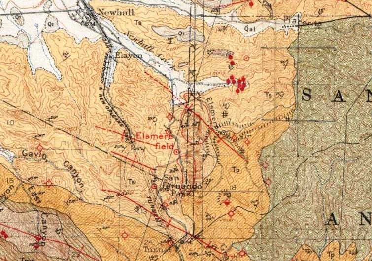
This map by Kew (1924) shows an anticline right through Elsmere Canyon.
Legend: Qal-aluvium (Recent); Qt-Terrace deposites (Pleistocene); Ts-Saugus formation (Late Pliocene); Tp-Pico formation (early Pliocene); bc-Basement complex (pre-Jurassic) (in San Gabriel Mts)
This map is from a thesis by Garn Rynearson (CIT - 1938). It is kind of hard to see, but Elsmere Canyon consists of Saugus formation (light yellow) and Pico formation (light green). Like Kew, he also maps an anticline (red line) through the bottom of the canyon.
Legend: Ts (light yellow) Saugus formation (Late Pliocene/early Pleistocene); Tp (light green) - Pico foramtion (middle Pliocene); Bc (purple) - basement complex (pre-Cretaceous)

This geologic map is from Winterer and Durham (1962).
Legend: Qal,Qt-Alluvium and terrace deposits (upper Pleistocene); QTs,QTsu,Tsr-Saugus formation (late Pliocene/lower Pleistocene); Tp,Tpc,Tps-Pico formation (lower Pliocene); Tt,Tts,Ttc-Towsley formation (Upper Miocene/lower Pliocene); Tsc (unnamed Eocene); bc-basement complex (pre-Tertiary)
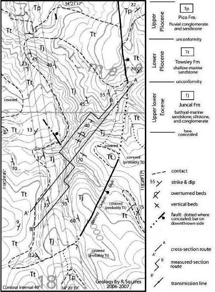
From Squires (2008). Since his paper focused on the Eocene of Elsmere Canyon, this geologic map mainly shows the Eocene Juncal formation. However, he mapped much more of the canyon that could not be included due to space limitations.
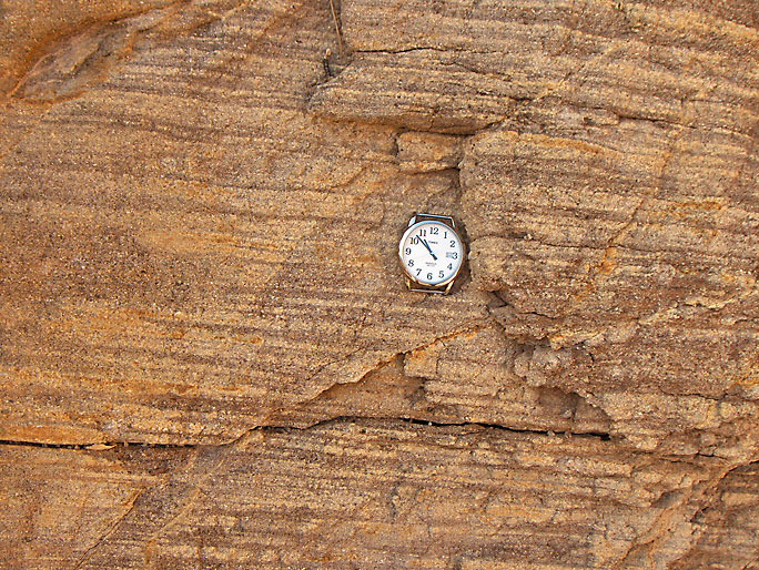
Nice contact between members in the Saugus formation on the Whitney Canyon trail just to the north of Elsmere Canyon. The greenish siltstone is part of the Sunshine Ranch member of the Saugus formation. (Photo taken on 12/18/2004)
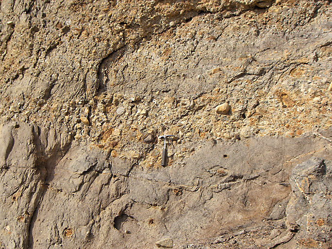
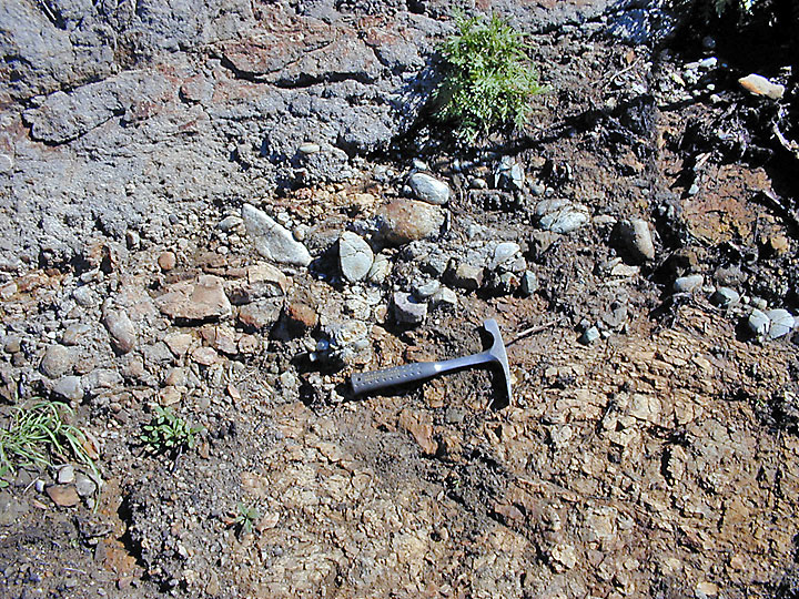
Contact (at hammer) between different members in the Saugus formation on the road down into Elsmere Canyon. (6/16/2007)

Saugus formation showing the greenish siltstone of the Sunshine Ranch Member, sandstone, and conglomerate. (7/8/2007)

Saugus formation on top of Pico formation with nearly vertical fault lowering both formation in the left center of the photo. The Saugus formation is the greenish siltstone and is covered with brush. (11/17/2007)

Differential weathering in the Pico formation. The softer clay areas weather first creating cavities. These cavities sometime get large enough to look like caves from a distance. (12/24/2006)

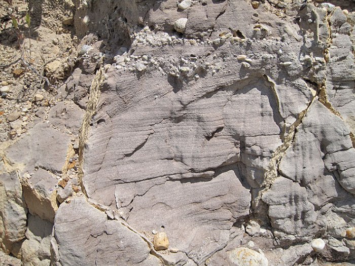
Contact between two beds in the Pico formation. The upper bed was deposited in a high energy environment and the lower bed in a quieter environment. (5/2/2009)
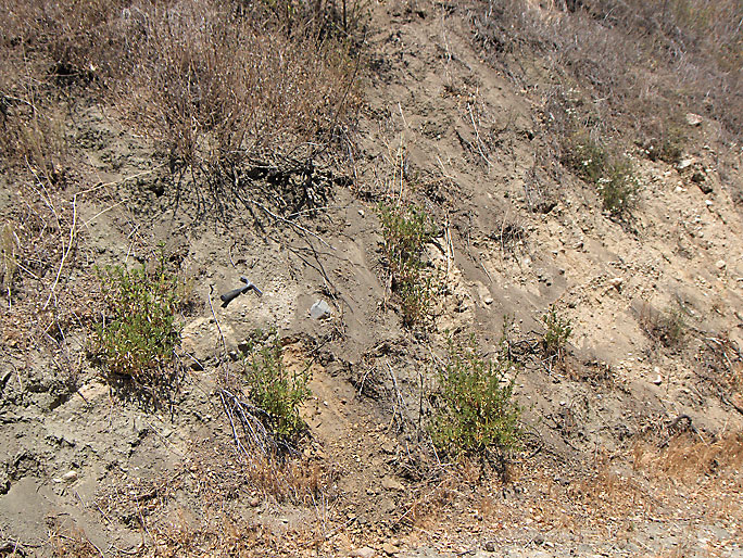
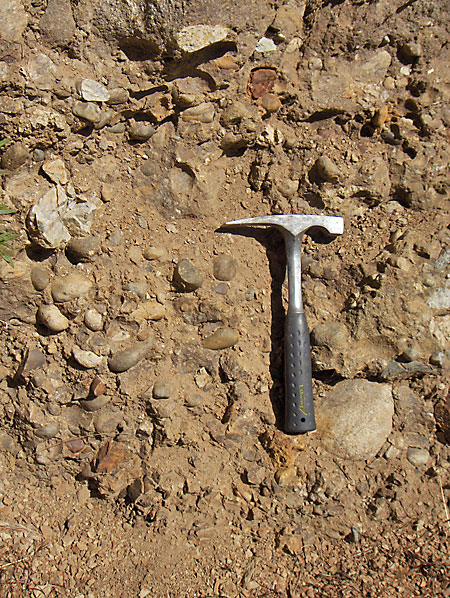
Erosion surface under my hammer in Pico formation. (9/29/2007)
Cross bedding in the Pico formation near the jack plant. Cross bedding does occur in marine deposits. (6/9/2011)
A more obvious example of cross bedding on the road south of the jack plant. (11/23/2008)

On the steep face of Elsmere Canyon, sections of the Pico formation break off. This piece looks like it is about ready to do so. (7/30/2007)

Also high up on the steep face is this huge diagonal (upper right to lower left) fracture in the Pico formation. Left of this fracture are other fractures parallel to it. (1/26/2008)
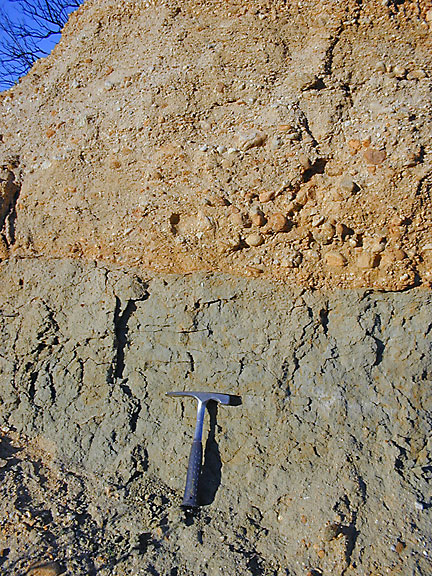
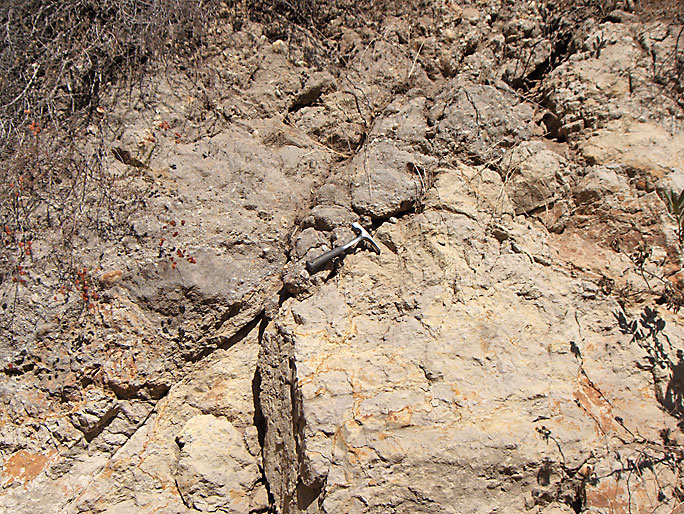
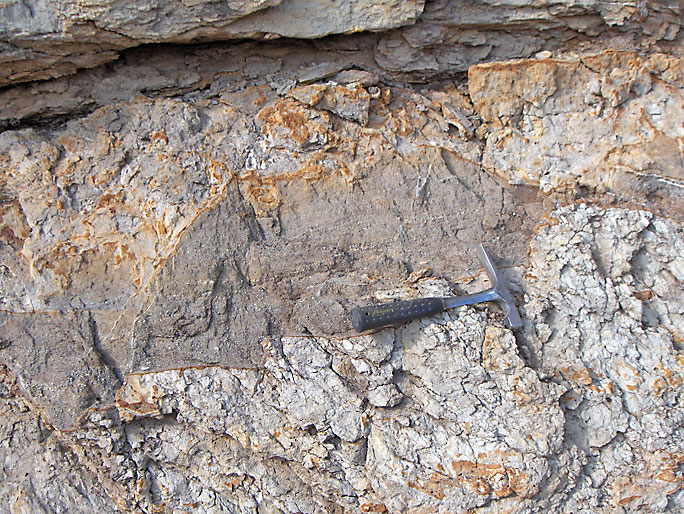
Contact between the Pico formation (on the left) and the Towsley formation on Elsmere parkway going into the canyon from the Whitney Canyon trail. The contact is just above the handle of my hammer going from lower left to the upper right at about a 45 degree angle. This picture was taken soon after the 2004 fire so the brush has been burned off. The Towsley formation is older then the Pico formation. (12/18/2004)
Closer view of contact from previous picture. (12/18/2004)

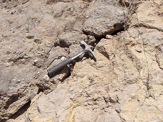
Looking down on a slickenside between the Towsley formation (shown here) and the Pico formation (just out of the picture). This shows that, at least here (in a gulley below the "Elsmere" 18 well site on the south face of Elsmere Canyon), the two formations were in fault contact. You can barely make out the striations running in the same direction as the hammer. (7/21/2007)
Pico-Towsley contact at location of "Elsmere" 11 oil well site north of canyon bottom. Note that this is not a fault contact. The underlying Towsley formation has an eroded surface. (9/16/2007)
Closer view of contact. (9/16/2007)
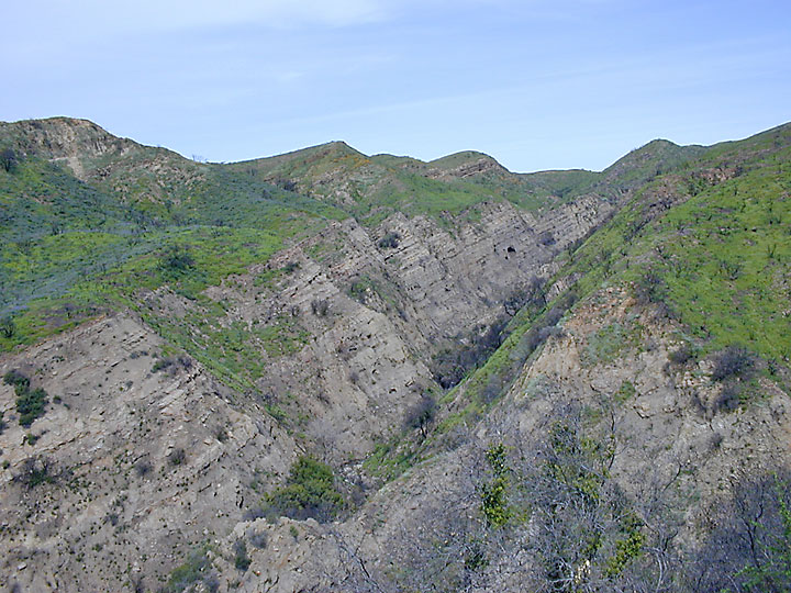
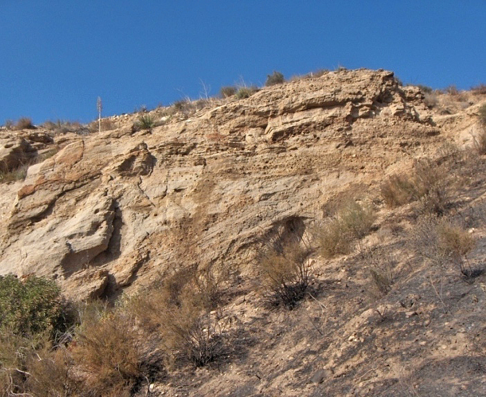
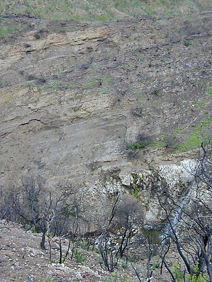
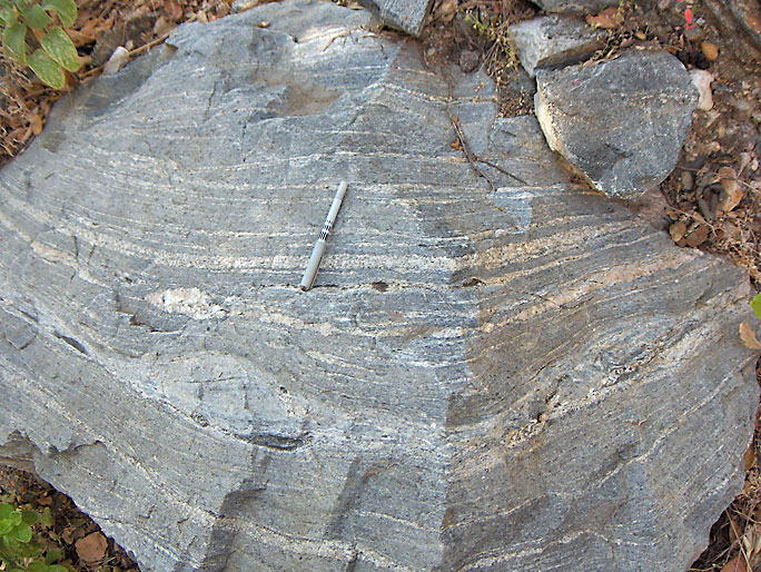
Long-range view of Towsley formation bedding on the left of the picture above the north-east fork of Elsmere Canyon. (3/26/2005)
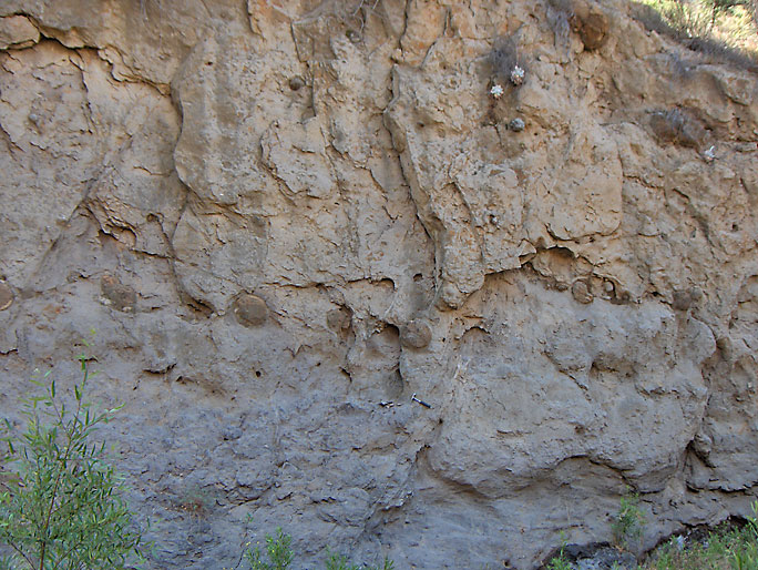
Concretions are common in the Towsley formation. Here is a bed of concretions that appear to be offset upward on the right by a normal fault. The fault runs diagonally at an almost vertical angle from the bottom to the top through my hammer (which may be difficult to see). (6/10/2007)

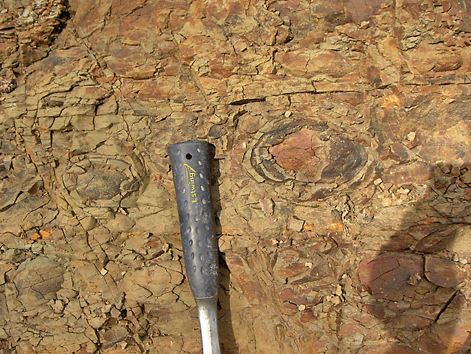
Closer view of a concretion that has been broken open by nature. Concretions in the Towsley formation commonly have fossils in them. The fossils were probably the "seed" that started the creation process of the concretion. Concretions come in all sizes from a few inches in diameter to almost three feet in diameter. (6/10/2007)

Very large (note backback) Towsley concretion up small tributary. There are some fossils in it. (9/1/2007)
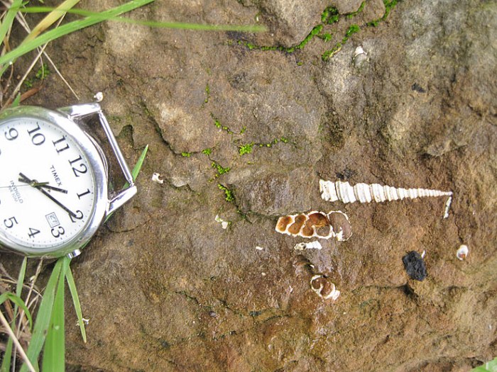
Turritella cooperi in the Towsley formation
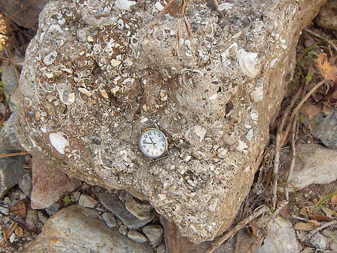
Fossiliferous boulder in creek bed from Towsley formation. (6/7/2008)
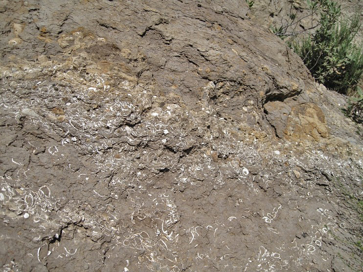
In situ fossils in the Towsley formation. (5/13/2012)
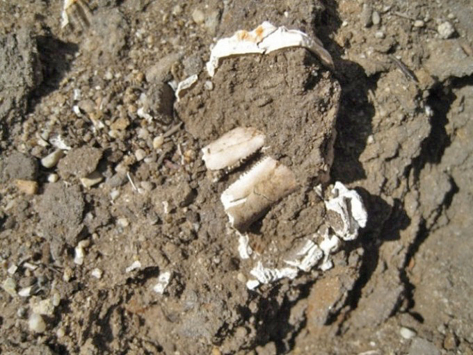
Close-up. (5/13/2012)
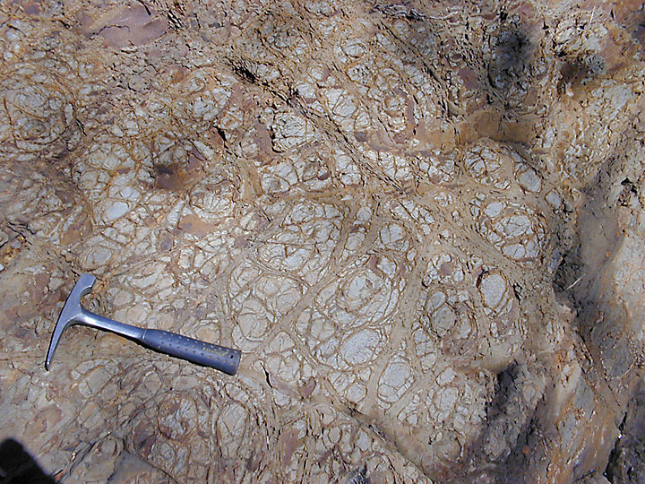
Odd sandstone structures in siltstone (Towsley formation). (12/8/2007)
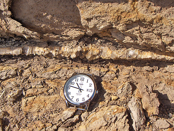
Gypsum (Satin Spar variety) vein in Towsley formation. (12/8/2007)
More gypsum veins (slender, white color) near above picture. This time they are more chaotic. (12/15/2007)
Interesting sandstone laminations in Towsley formation. (12/8/2007)
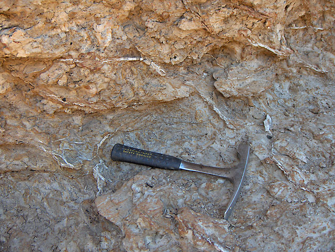
Towsley formation contact with the Eocene Juncal formation. Here the Towsley conglomerate bed rests unconformably on the Juncal beds. My hammer marks the contact. (3/6/2005)

Dipping Eocene beds. The Eocene in Elsmere Canyon is virtually barren of fossils. Only one fossil site was reported in the literature (at least until 2008). Winterer and Durham (1962) reported a megafossil site that was discovered by Kew. They did not put it on their geologic map because they did not know where it was. Kew, however, never reported the site. Winterer (personal contact - 2002) could provide me with no information except to suggest that I check Kew's U.S.G.S. notes (for his Bulletin 753 of 1924), which I did. Not only was there no mention of the fossil site, but Kew did not even map the area as Eocene. In 1940, when Waldo Ford was doing his M.A. thesis (see sources below), Kew told him that the outcrop was of Eocene age based on microfossils, not on megafossils found by him. Therefore, the site reported in Winterer and Durham was probably an oil well core mistakenly reported as a fossil site found by Kew. If Kew had found fossils in Elsmere Canyon he most certainly would have reported them somewhere. (3/26/2005)
Recently (2003), megafossils were found in the canyon. They are now at the Los Angeles County Museum of Natural History. As previously mentioned, in 2008 Dr. Squires published a paper on the fossils and geology of the canyon. He has spent years studying not only Elsmere Canyon, but the Eocene in Southern California, making him the expert on the Eocene of Southern California.
Eocene conglomerate. There are large deposits of conglomerate up the southeast fork. (6/10/2007)
Weathering in Eocene beds. (3/26/2005)
Close-up. Notice the spheroidal weathering. (3/25/2006)
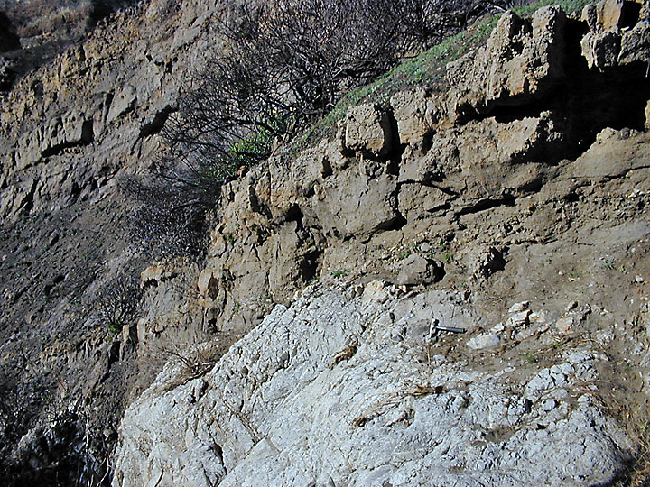
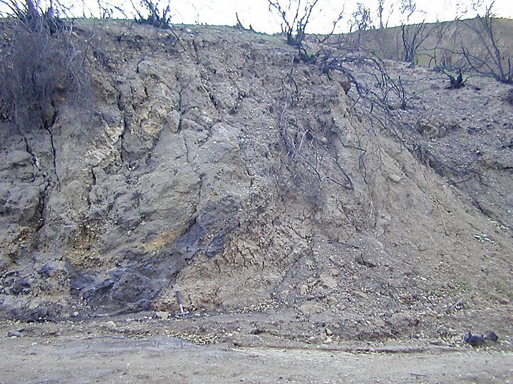
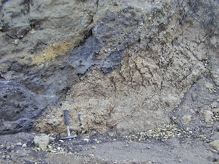
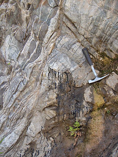
Contact between Towsley formation on the top and the light-colored basal metamorphic/igneous rocks. (12/18/2004)
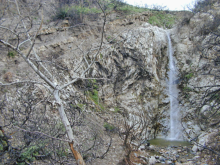
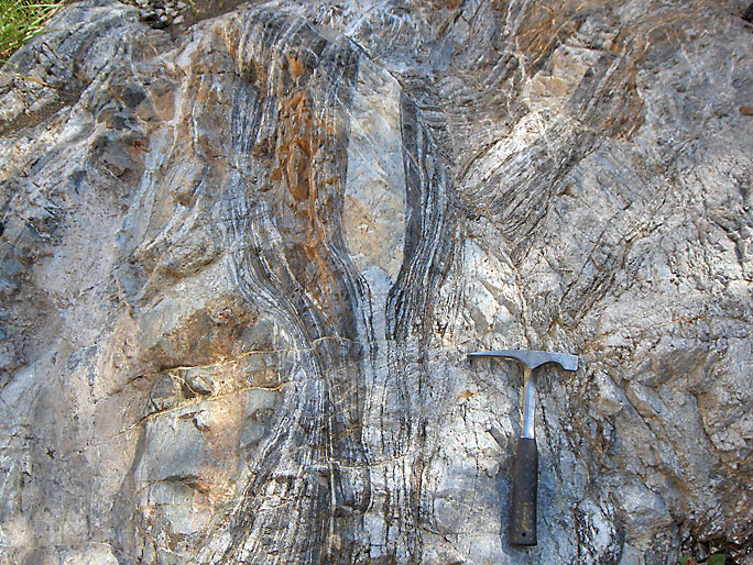
Another contact area between the darker Towsley formation and the lighter metamorphic/igneous basal rocks on the left part of the picture near the waterfall. (2/5/2005)
From way above the waterfall, the contact can still be seen. (2/5/2005)
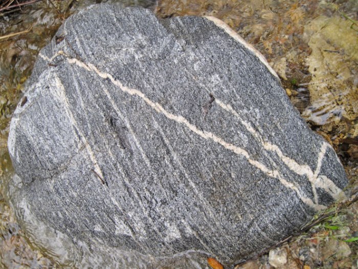
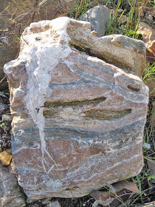
Basal metamorphic rocks (gneiss). (3/10/2007)
Basal metamorphic rocks. Can you explain why oil is seeping out of a crack in the metamorphic rock? (5/12/2007)
Nice basal metamorphic rock in the creek bed. (6/10/2007)
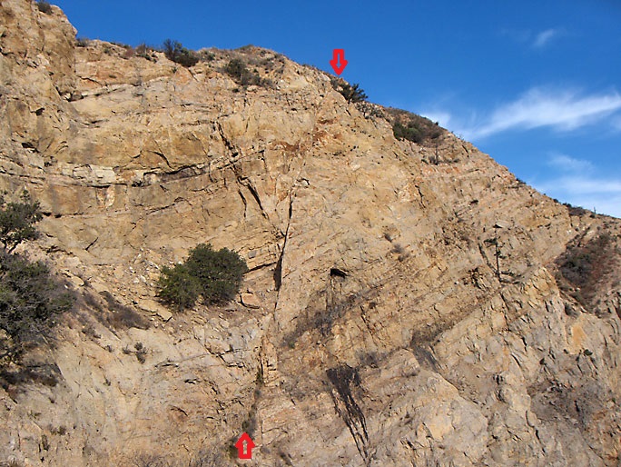
East face of Elsmere Canyon showing nearly vertical fault and oil seeps. (3/4/2007)
There are a lot of interesting rocks in the creek bed