Sterling Borax Mine/Tick Canyon Historic Photos
All images from the U.S. Borax Collection (except for a couple of exceptions), National Park Service (NPS), Death Valley National Park. Used by permission. Thank you NPS. Descriptions by the NPS in quotes. My descriptions are not in quotes.
The Sterling Borax Company was formed in 1908. Their assets were purchased by the Pacific Coast Borax Company in 1911. In 1956, the Pacific Coast Borax Company and the U.S. Potash Company (both owned by Borax Consolidated Limited) were merged into the U.S Borax. and Chemical Corporation. In 1968, U.S. Borax was acquired by Rio Tinto. In 2007, when the Valencia, California, corporate offices of Rio Tinto Minerals were closed, the collection was donated to the National Park Service in Death Valley National Park.
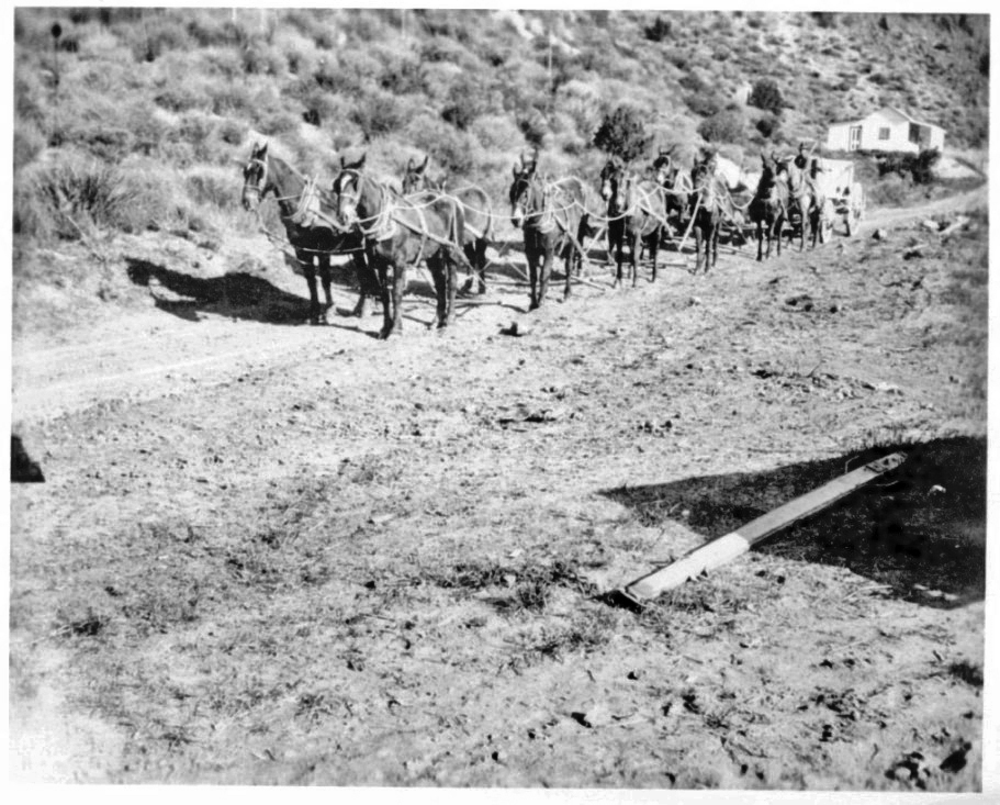
"Twenty Mule Team at Sterling Borax, 1905".
This date is incorrect because the mine didn't open until late 1907. Also, they can't mean the historic 20 Mule Team because that was discontinued in 1898. This wagon is being pulled by only 10 or 12 mules (the two nearest the wagon may be horses). Before the narrow gauge railroad was constructed in 1909, ore was taken down to Lang in wagons. Since this photo does not show the railroad tracks (unless they are out of view on the right), it must be an early photo of the hauling of the ore. I think that the next image shows a later view of the building and outhouse in this photo. The view here is about towards the north.

Close-up of photo taken on 4/9/1915 by G. Haven Bishop. From The Huntington Library, Art Collections, and Botanical Gardens. Photo Archives. Southern California Edison Photographs and Negatives.
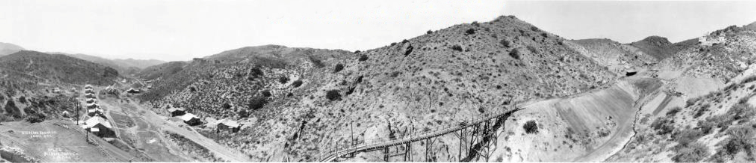
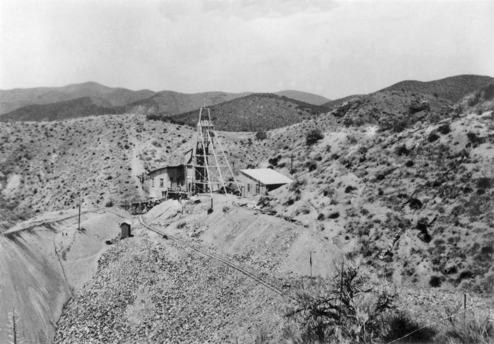
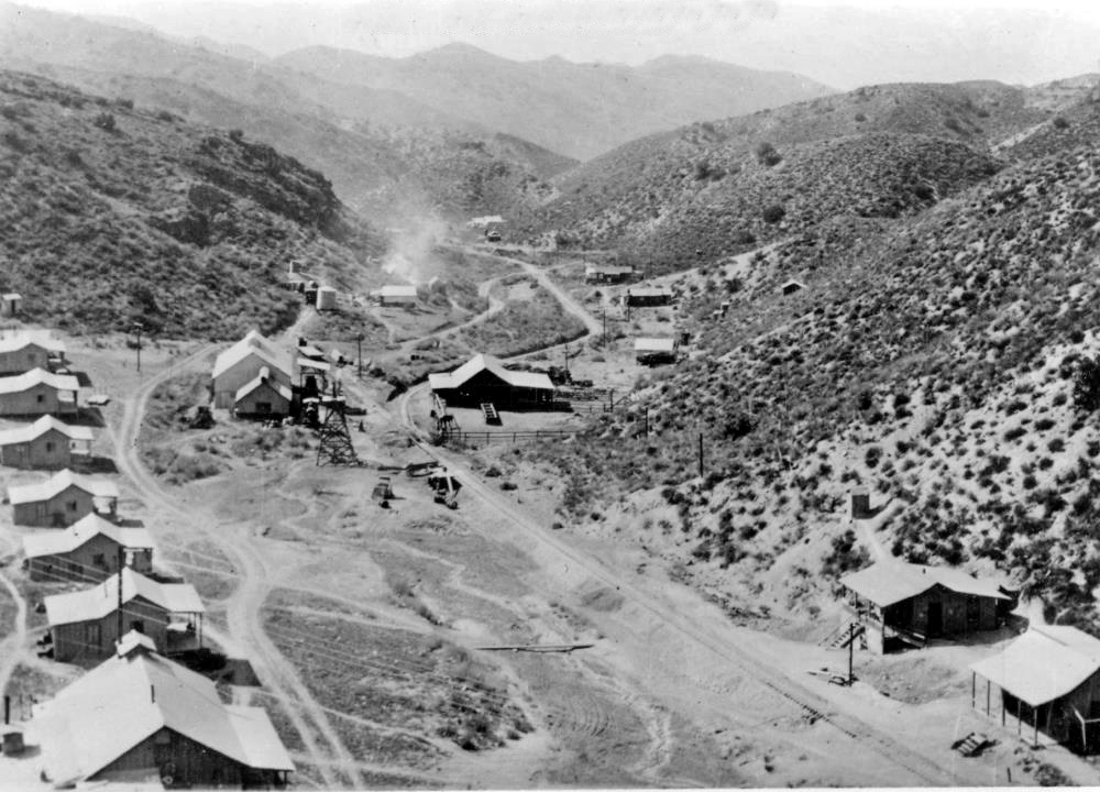
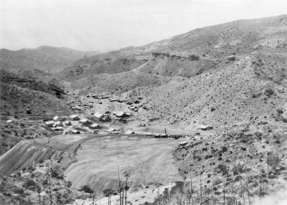
"The mine, mill, and camp in operation in 1912"
This great panorama image can be zoomed on the SCV History website here.
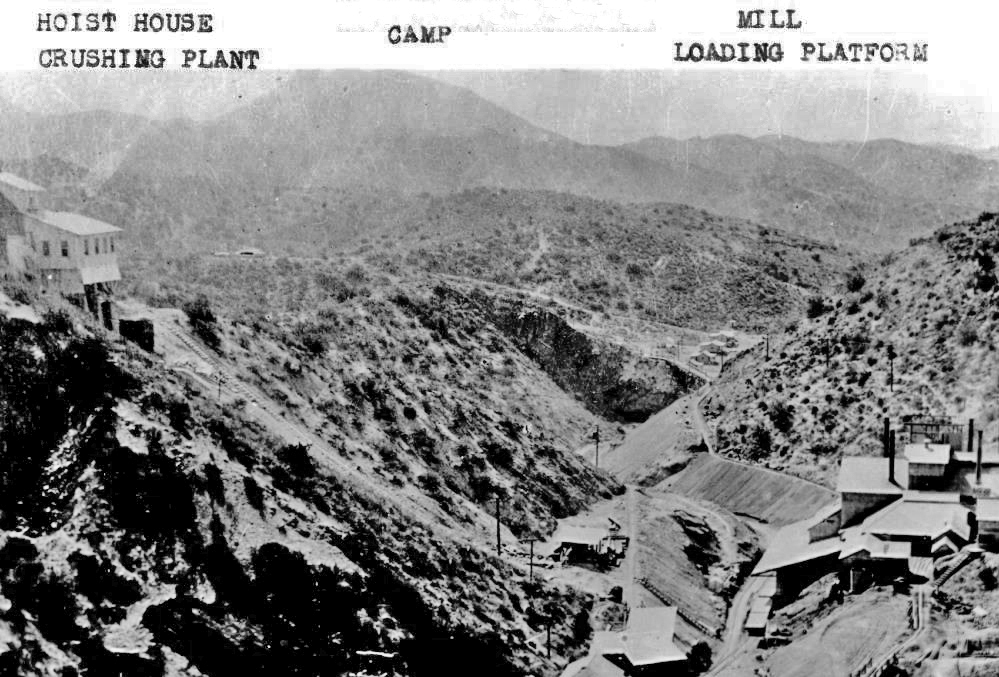
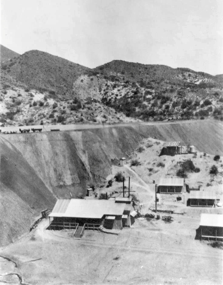
"1917 - Hoist house, crushing plant, camp, mill loading platform"
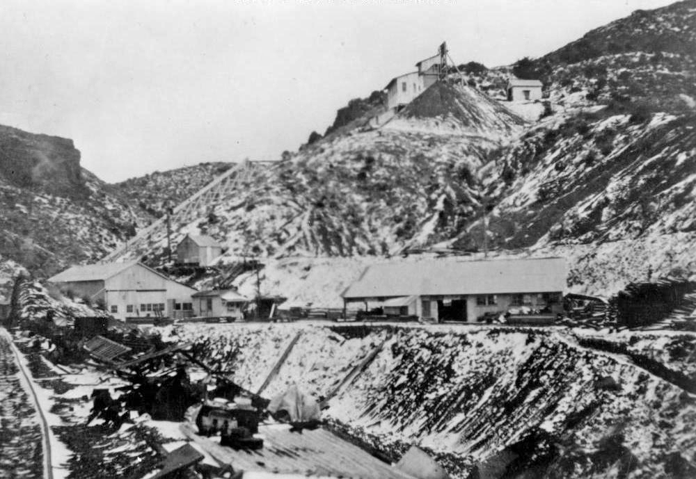
"1917 - Late development"
"1917 - Machine shop, hoist house, framing shed"
The machine shop and framing shed are on the same level. The hoist house is the small building at the top to the right of the headframe.
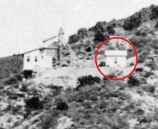
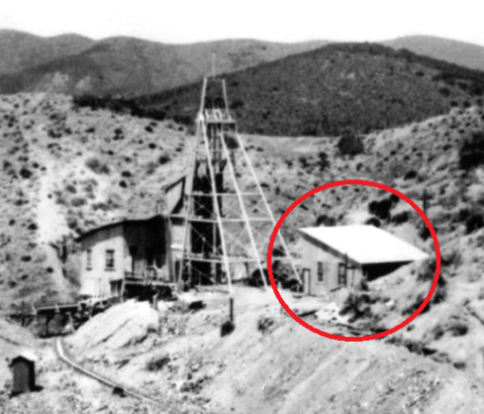
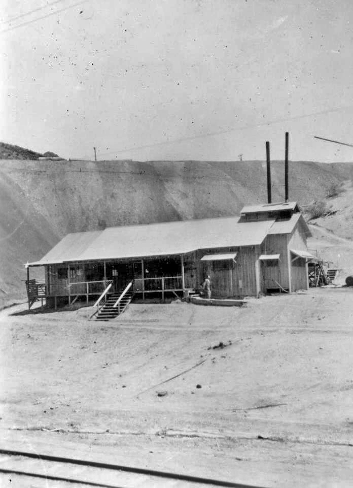
The image on the left is a close-up of the 1912 panorama photo. It shows the original hoist house in the red circle at the right of the headframe. This building, with a gabled roof, is also on a 1915 photo. It was replaced during or after 1917 (assuming the photo dates are correct) with a building having a shed roof (flat and sloped). This is shown within the red circle on the right-hand image.
"View of No. 1 shaft headframe"
The headframe is at the top right of the image.
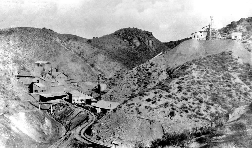
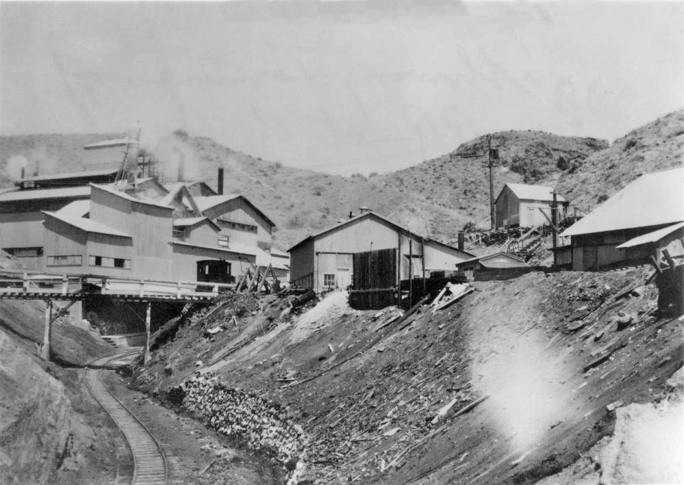
"Mill and mine in Tick Canyon"
The upper hoist house is the building on the right with the shed (flat and sloped). The headframe is the triangular shaped structure. The covered ore bins are to the left of the headframe. The tracks are for a waste car.
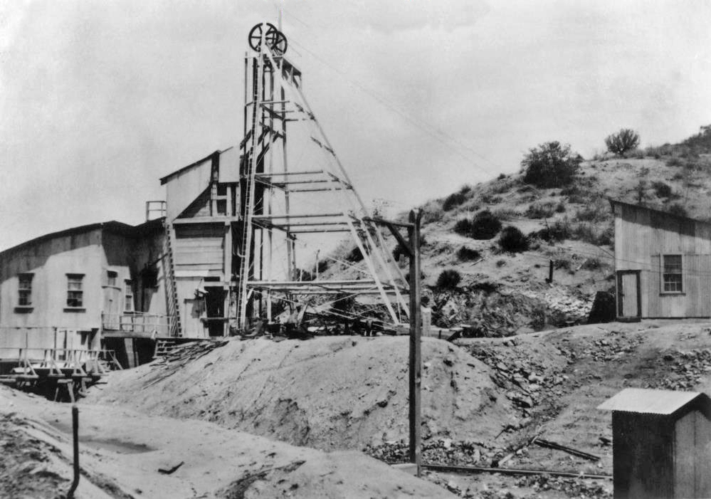
"Headframe at main shaft"
The headframe is the triangular structure with two sheaves (pulleys) at the top. The hoist house, containing the actual hoist, in on the right. There is a vertical shaft into the mine below the headframe. The cables pull and lower a mine car (or skip) up and down the shaft. When the car reaches a certain height on the headframe, it is automatically tipped so that the material in the car falls into the bins, which are on the left of the headframe and are covered. From the bins, the ore is sent to the mill and the waste material is sent to the dumps via cars on tracks.

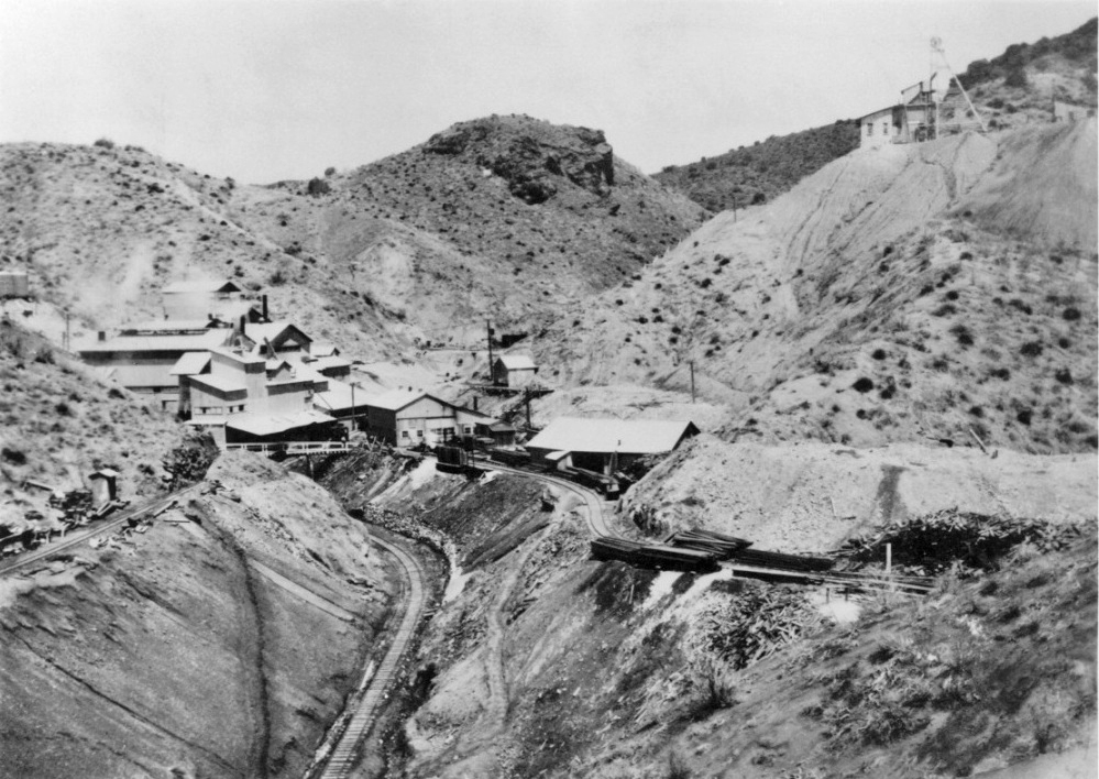
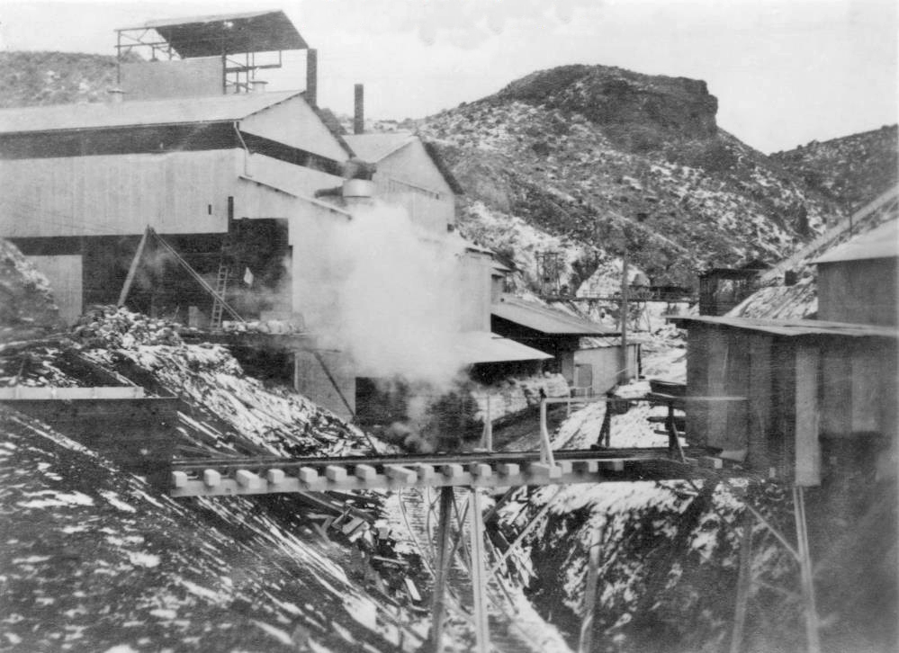
"1917 - Mill and bottom of tramway"
"Mill showing loading platform at the end of the Lang railroad"
"Showing terminus of Lang railroad at the borax mill"
"1917 - Boarding house, bunk houses, corral, office, and store"
The camp was often called Sterling.
"Boarding house and tailings dump"
"Boarding house"

Lang railroad cut near the mine
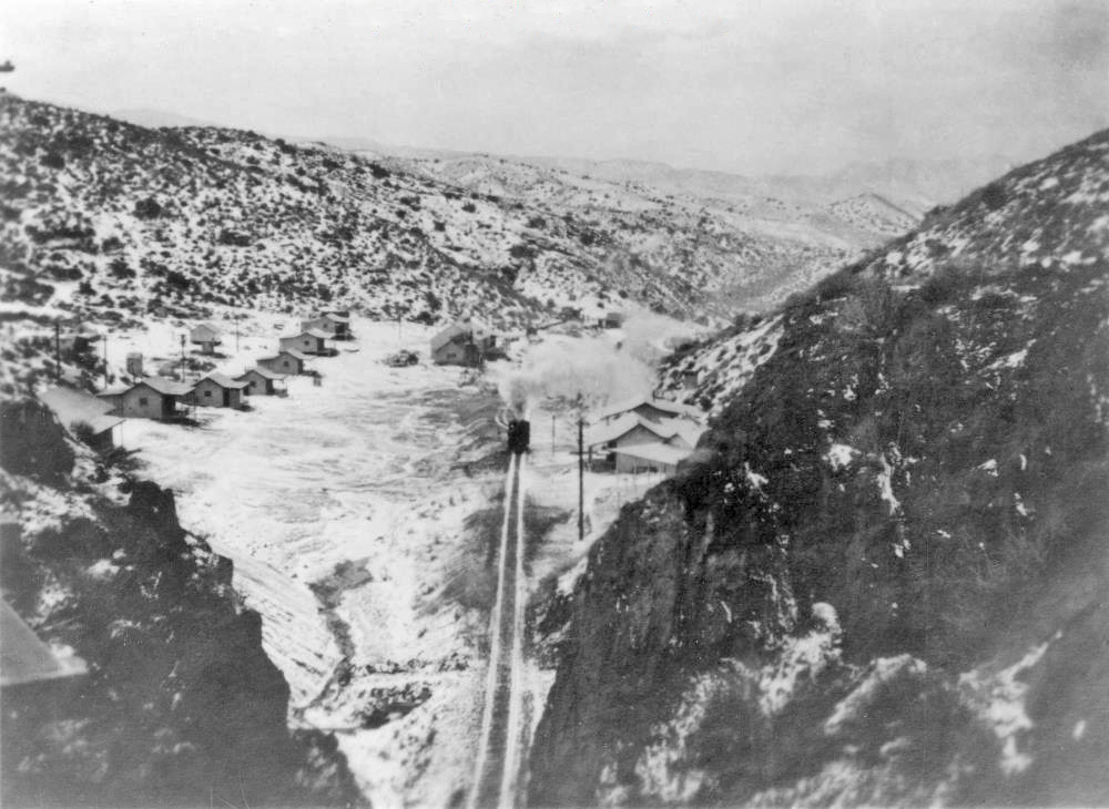
"Ore train passing through camp on way to mine"
It sure looks like snow on the ground.
"1917 - The employee's camp adjoining the mine property"
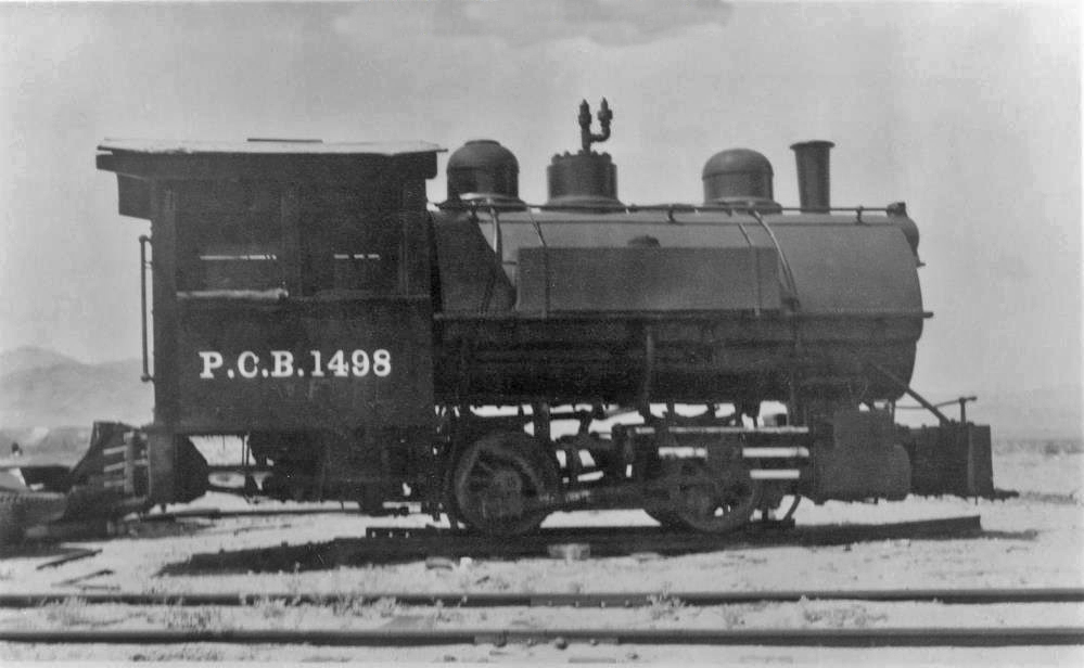
"Vulcan locomotive on Lang railroad"
Of course the P.C.B. stood for the Pacific Coast Borax Company, the owner of the mine at that time.
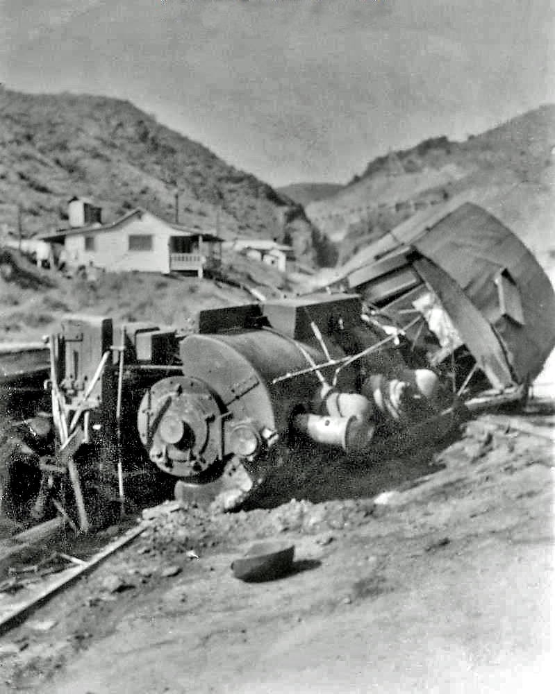
"Wreck of narrow gauge locomotive leaving the mine"
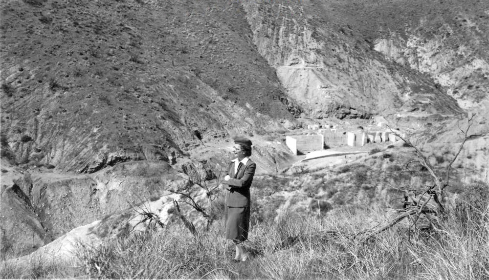
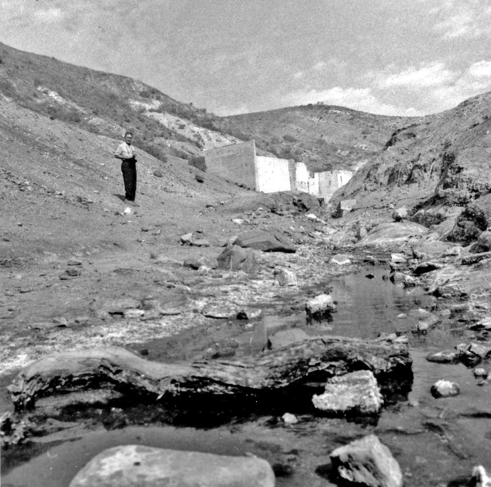
"Mrs. Ruth Woodman at Sterling Borax Mine site in 1950"
Mrs. Woodman is the author of Lang - The Sterling Borax Company, which can be found elsewhere on the Tick Canyon website.
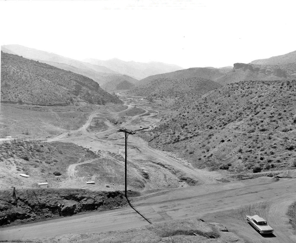
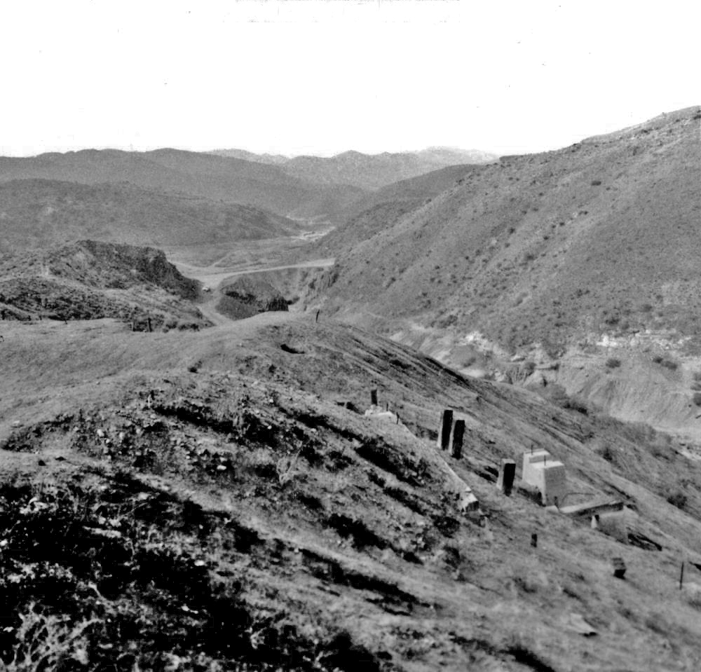
"View from Davenport Road overlooking former camp"
This part of Davenport Road was constructed between 1954 and 1959. (Davenport Road already existed before this, but with a different alignment.). I would think that the road would have been paved as part of the construction, making this photo from the late 1950's.
"1971"
"1971"
"1972"
"1972"
"1972"
1972
"1972"
Davenport Road is in the distance and it looks like it hasn't been paved. I do not know for sure if it was paved when the road was re-aligned through the lower dump in the late 1950's, but the 1972 date for this photo (and the other 1972 photos) is questionable in my mind.
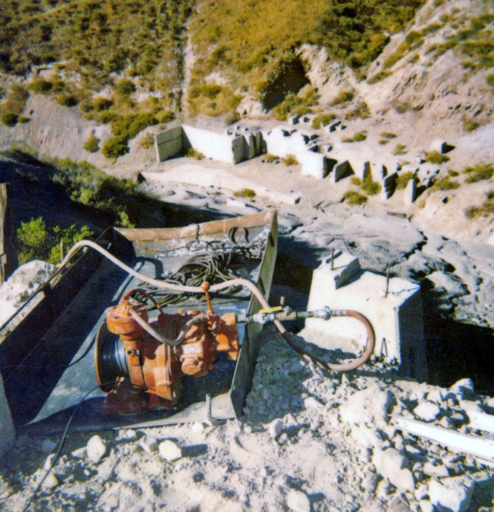
Circa 1984 - Above ground, hoist"
Circa 1984 - Above ground entering shaft"

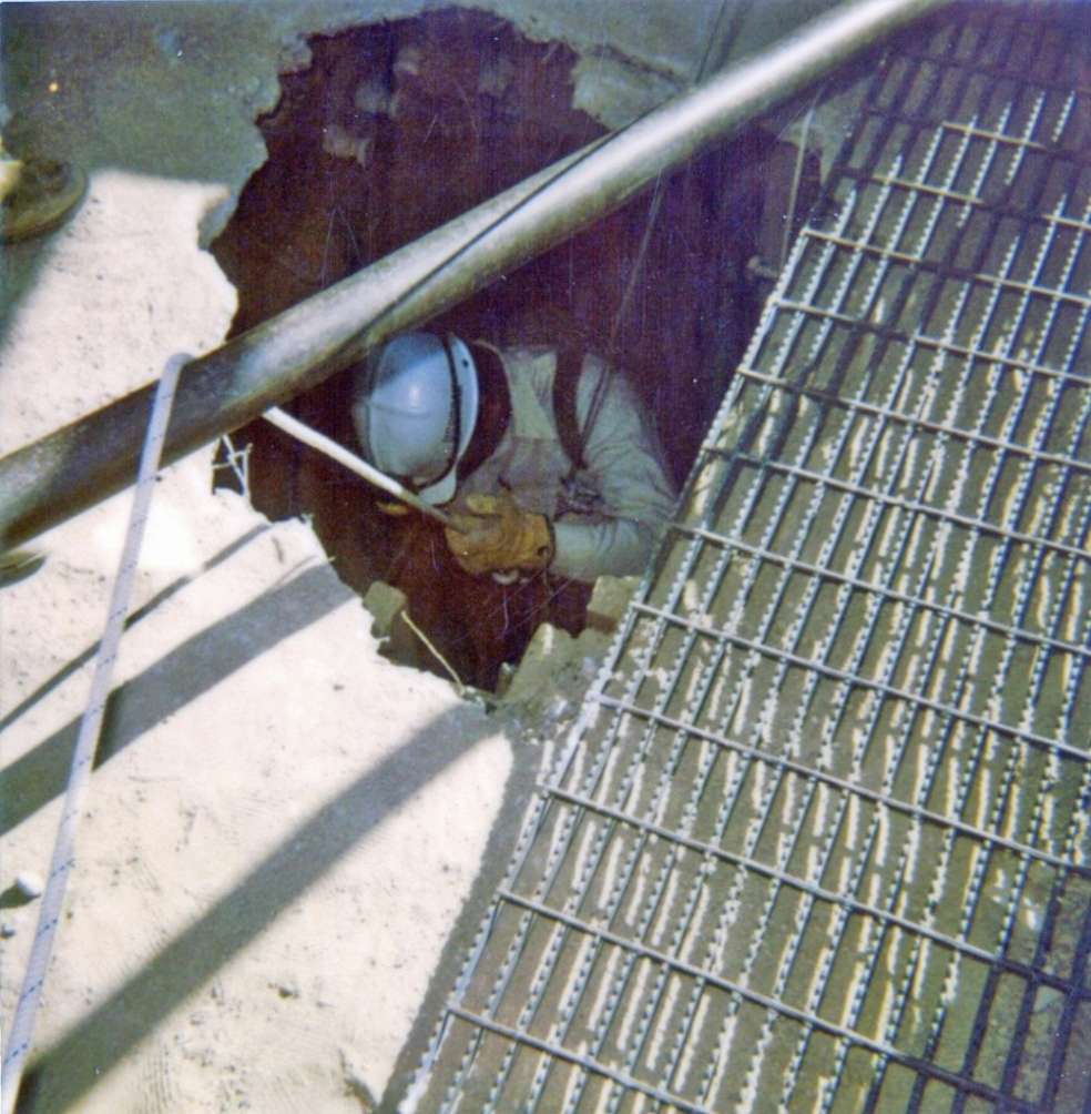
"Circa 1984 - Looking up shaft entrance"
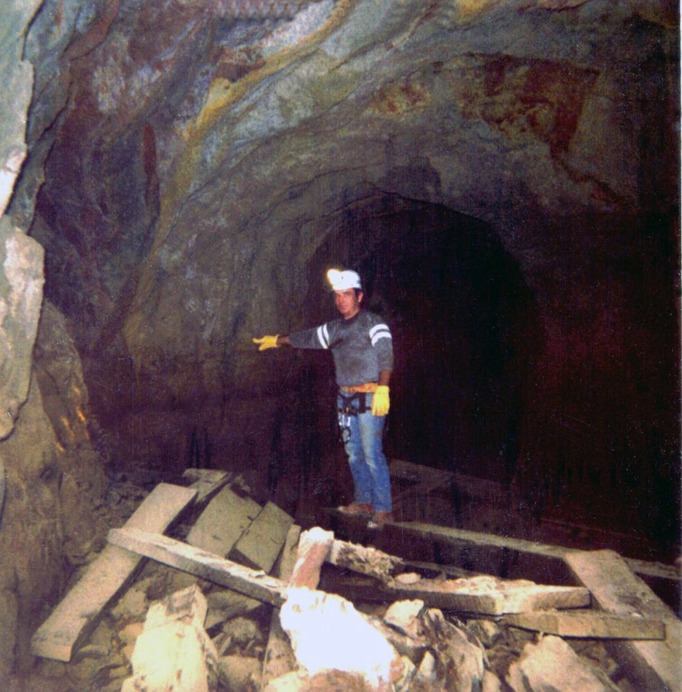
"Circa 1984 - Underground collapsed timber" Man is Melvin English, an employee of U.S. Borax & Chemical Corporation.

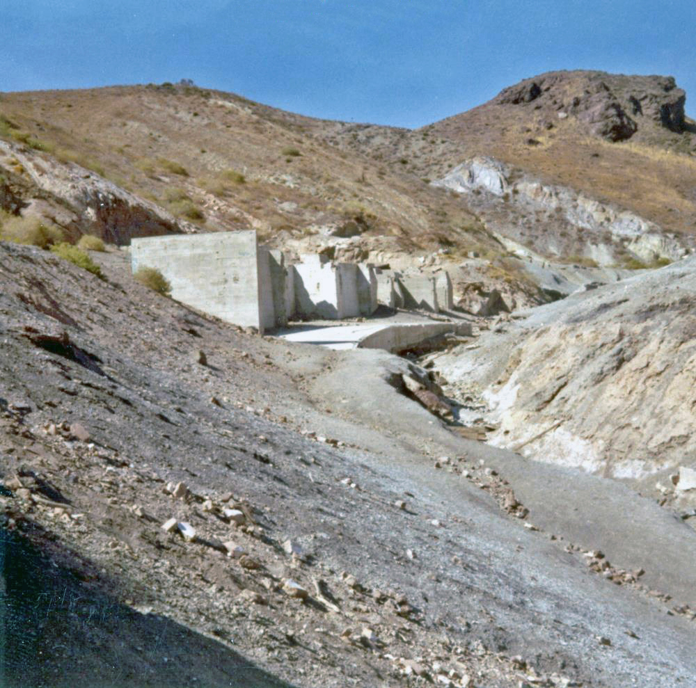
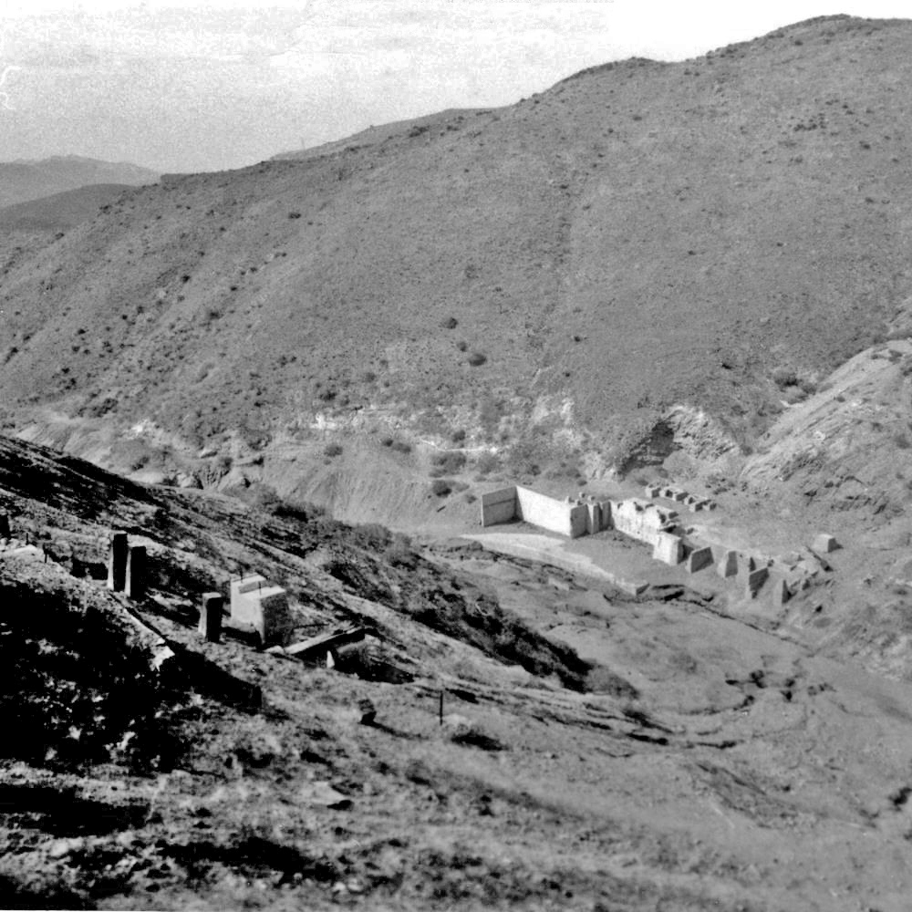
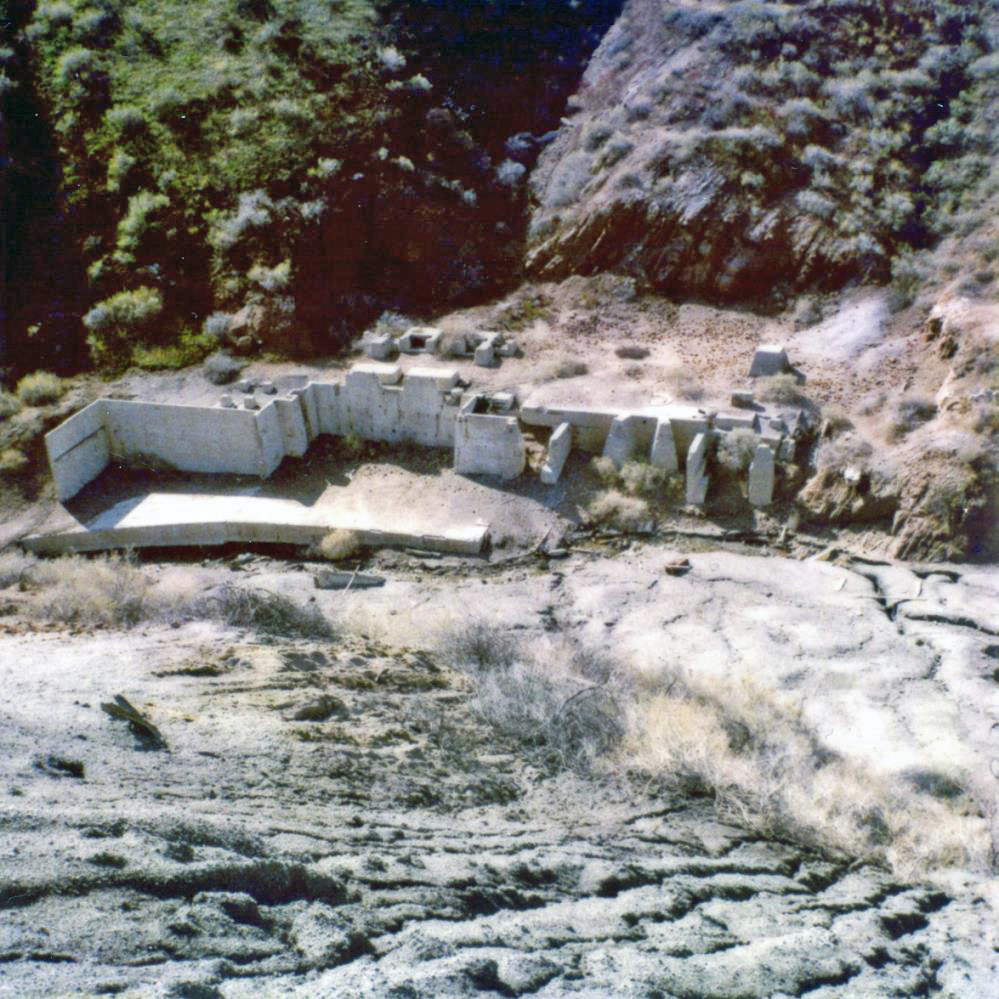
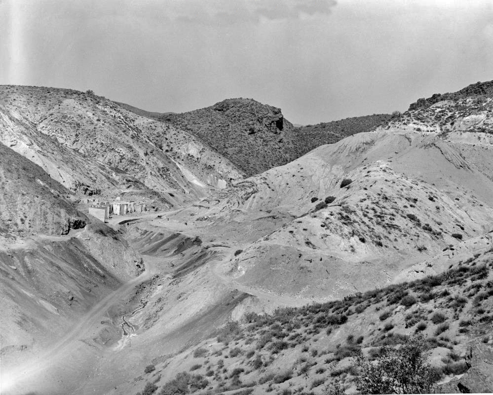
Circa 1989 - View of Lang mine mill ruins and tailings pile"
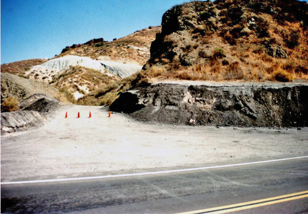
"02/18/1992 - Site inspection after rains"
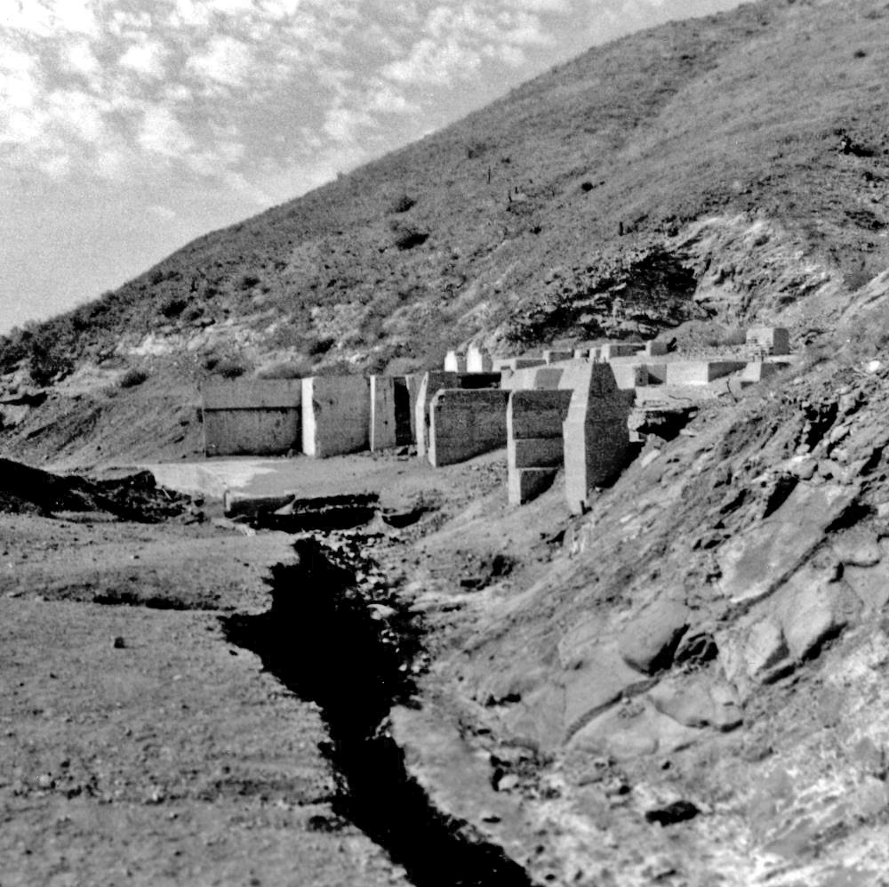
"08/15/1996"
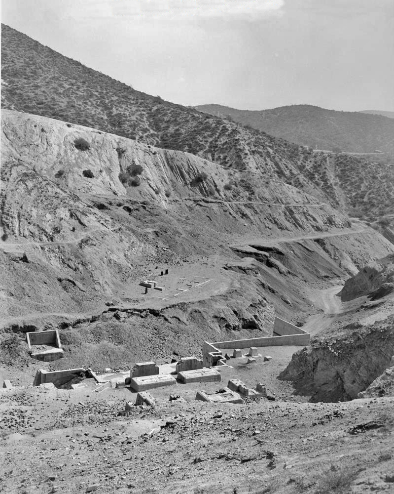
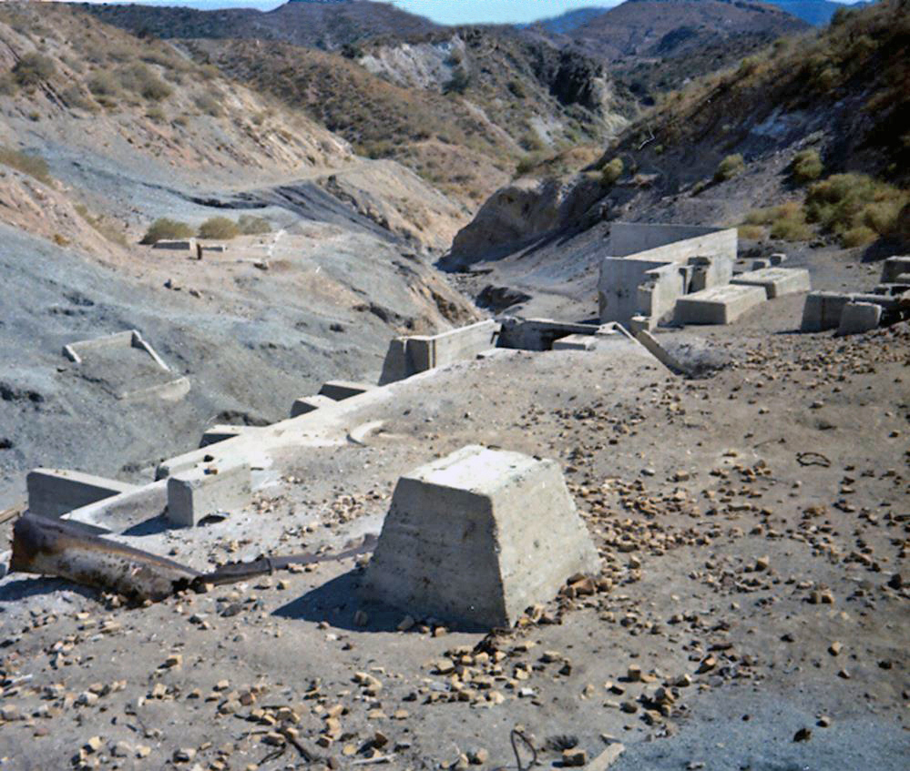
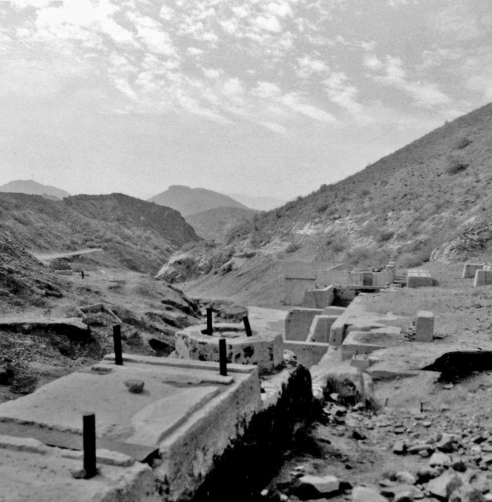
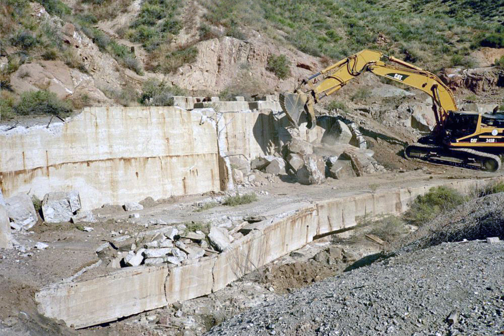
"All that is left of old borax mill in Tick Canyon"
"Left center - all that remains of Lang mill. Upper right - mine dump and site of No. 1 shaft."
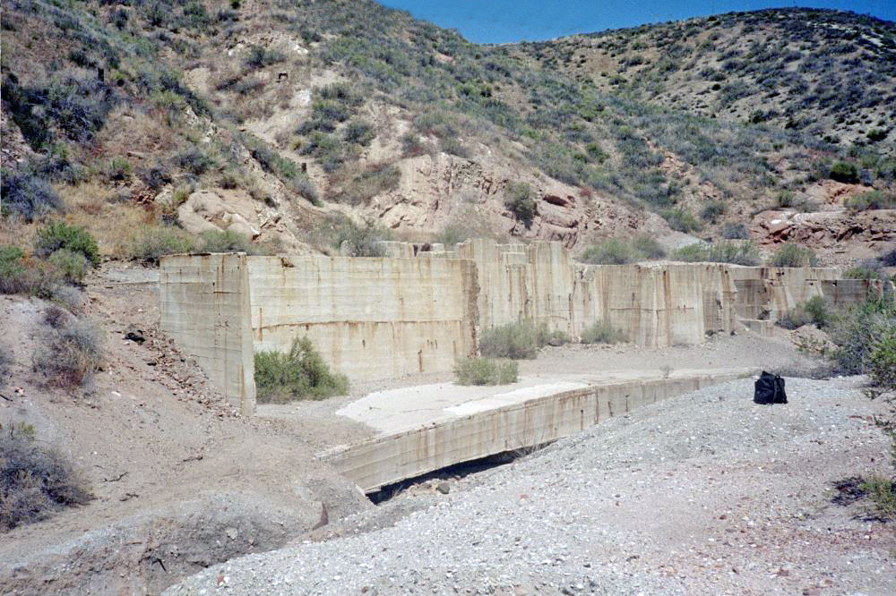
"Circa 2001"
"Circa 2001"