Towsley Canyon, Santa Clarita, California
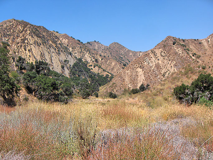
Looking west into Towsley Canyon showing the north flank of the Pico Anticline. This is before "the Narrows" and nearly a mile west of the parking lot.
Towsley Canyon was named for Darius Towsley. However, Towsley was probably Tousley. Due to fact that the "u" can look so much like a "w" in 19th century handwritting, the two letters were often mixed up. Towsley was the first to file claims in the canyon.
The canyon drains north from the Oat Mountain Syncline perpendicularly through the Pico Anticline and then easternly into the Santa Clara River valley.
After a relatively open westernly hike of a little over a mile from the parking lot, the road/trail makes a sharp turn to the left as it enters a narrow opening. This the start of what is commonly known as the "Narrows." The Narrows cuts through the north flank of the anticline through a narrow opening. Here are excellant exposures of Towsley Formation conglomerates and sandstones. After passing through the narrows, the canyon opens up and you are looking at the area where most of the early oil wells were. There were originally many oil seeps in the canyon and, even today, there are still about five that I have seen. From here the public road/trail loops up to the east (left) face of the canyon where it eventually decends into Wiley Canyon on the other side.
To the right on the other side of the creek bed, you can make out the old oil well road near the bottom of the canyon that runs west up the tributary (Temple Canyon). There are very few oil artifacts in the canyon. Most of them are pipes and steel cables.
The Orange County Register of 4/7/1983 reported that Towsley Canyon was a recommended site for a toxic waste dump by the state. Towsley Canyon, along with Elsmere Canyon, was also considered for a dump by Los Angeles County in the 1980's and 1990's (see the Elsmere Canyon Dump Page).
In December of 1989 the Santa Monica Mountains Conservancy (MRCA) purchased 145 acres from the Rivendale Ranch Company for $500,000 at the mouth of Towsley Canyon. This new "Towsley Canyon Park", which included deed restrictions not allowing industrial traffic such as dump trucks, just about killed plans for a dump in Towsley Canyon. The Santa Monica Mountains Conservancy is a state agency that acquires parks and trails in the Santa Monica Mountains and the Rim of the Valley Corridor, which includes the Santa Susana Mountains.
In April of 1991 the MRCA purchased an additional 453 acres in Towsley Canyon consisting of two parcels of land for $6.5 million. This land was also owned by Rivendale. Rivendale bought one of the parcels from the landowner (Joel Brandon) and resold it to the MRCA at a $1 million loss. Rivendale absorbed the loss because, at the time, they planned a commercial and residential development along the Old Road opposite the entrance to Towsley Canyon and prefered a park there instead of a dump. In October of 1992 that park would be named the "Ed Davis Park in Towsley Canyon".
In April of 1995 the MRCA bought 3035 acres of land in the Santa Susana Mountains for $4.9 million from Chevron Corporation, who had owned the land for more than a century. The land included portions of Pico, Towsley, Wiley, Leaming, Rice, and East canyons. It also included Mentryville. The City of Santa Clarita provided about $2 million by purchasing the MRCA owned 53 acre Rivendale tract along the Old Road near the mouth of Towsley Canyon. The MRCA had bought the land from Rivendale sometime after 1991 as a further step in stopping the proposed Towsley Canyon dump. The MRCA was later deeded the land to own and manage. Parking is free on the city owned land in the first large parking lot.