Tunnel Area Geology
|
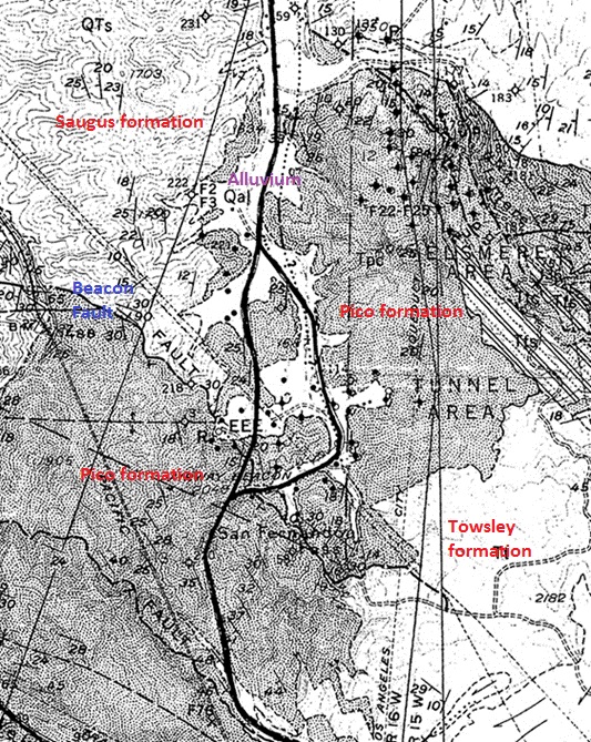
The above geologic map (from Geology of Southeastern Ventura Basin, Los Angeles County, California, Winterer and Durham, 1962) shows that the Tunnel area surface exposures mainly consists of the Pico formation (Tpc) with some Saugus formation (QTs), Towsley formation (Tt), and some alluvium deposits (Qal). Sierra Highway is the vertical road on the map with the Clampitt/Remsen road loop on the right.
The recent (Holocene) alluvium consists of clay, silt, sand, and gravel deposits. Alluvium are deposits made by streams on river beds, flood plains, and alluvial fans.
The Saugus formation in the northwest is late Pliocene and lower Pleistocene in age. It consists of brownish and tan sandstone and conglomerate, reddish-brown mudstone and some greenish-gray sandstone. There is some interfingering with the upper part of the Pico formation. It was deposited mostly on land.
The Pico formation is middle Pliocene in age and consists mainly of light brown and gray sandstone and conglomerate. It was deposited mostly in a shallow sea.
The Towsley formation is early Pliocene (and maybe late Miocene) in age. It consists of brown siltstone and mudstone, light-brown and gray sandstone and conglomerate. There is some interfingering with the Pico formation. It was deposited in a shallow sea.
The Mint Canyon formation (middle Miocene) and an Eocene age formation has also been seen in well core samples.
Most of the Tunnel area is a monocline with about a 29 degree dip to the southwest. When you look at those old photos and postcards of the Newhall tunnel you can easily tell which portal you are looking at by observing the slope of the beds - the low side points to the west.
The major structural feature of the Tunnel area is the Beacon fault, named for an airway beacon that used to be in the area. This is a thrust fault that, in the Tunnel area, dips about 38 degrees to the south and roughly parallels the bedding planes. It can be seen clearly on the west side of Sierra Highway just north of the entrance to the Newhall refinery.
There is also another nearly north-south fault that Walling shows clearly on his map (see below). The above map barely it shows with a dotted line (which means the fault is hidden on the surface) that comes down on the east side of Sierra Highway, crosses Remsen Road, and then runs parallel to it until it crosses it again.
The Tunnel area is not a very interesting place for geology, especially if you compare it to the other canyons. There are few good exposures of bedrock. The most interesting features are on Sierra Highway. There is the Beacon fault exposure and also the road cut where the Newhall tunnel used to be.
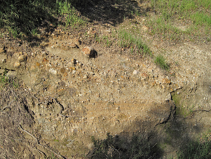
Pico formation in the creek bed (Photo taken on 2/13/2010)
Pico formation above a Newhall refinery foundation (2/13/2010)
Another Pico formation view. There really aren't very many good exposures of any formation in the Tunnel area. (2/13/2010)
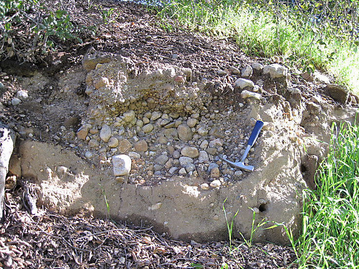
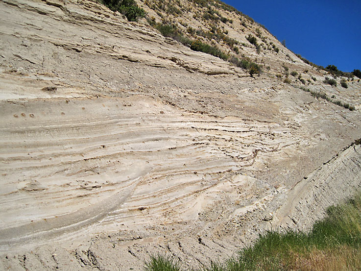
Nice little cut and fill structure on the side of the creek bed (2/13/2010)
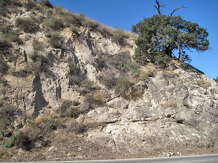
Beacon fault exposure on Sierra Highway. The fault plane is quite sharp here almost parallel to the bedding plane. (5/1/2010)
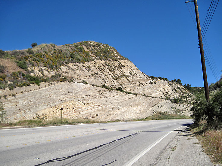
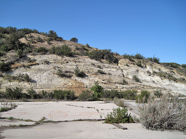
Looking north down Sierra Highway at the roadcut where the Newhall tunnel was. (5/1/2010)
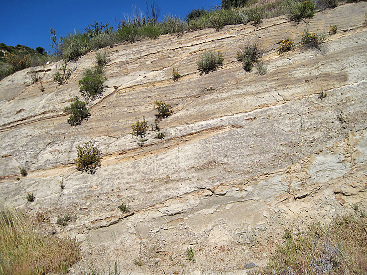
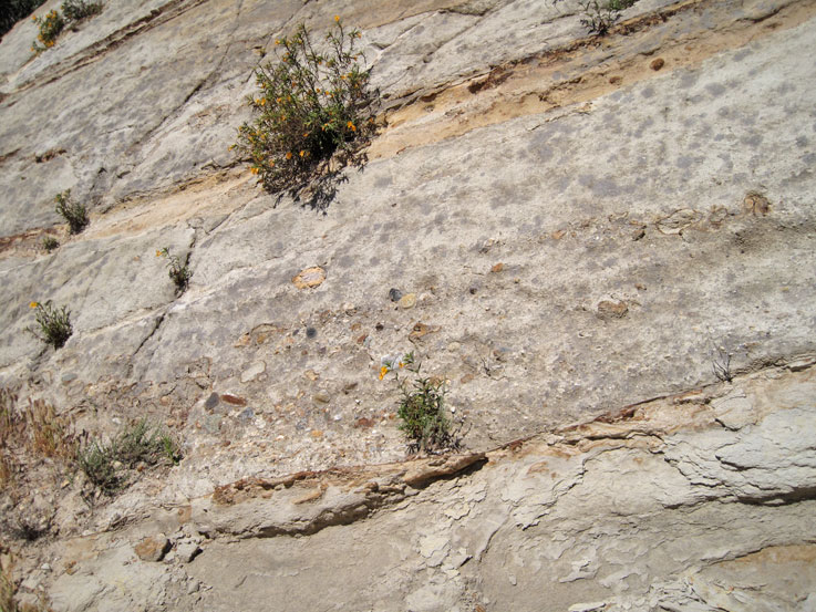
These are exposures of the Pico formation (5/1/2010)
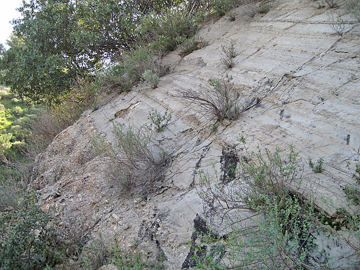
You can see mild cross bedding here and maybe some cut and fill. Cross bedding does occur in ocean deposits. The Pico formation was deposited in a shallow sea. (5/1/2010)
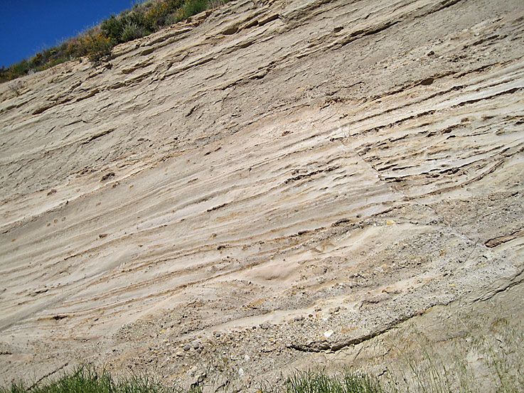
More features in roadcut (5/1/2010)
Here you can see an interesting coarse sandstone - almost a conglomerate in places - bed above a fine-grained mudstone or siltstone bed. The larger clasts are not at the bottom of the bed so it is not very well sorted and yet it seems to be one bed taking up most of the middle of the photo. (5/1/2010)
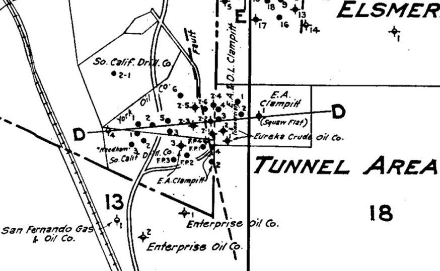
Location of nearly north-south unnamed fault and wells (from Walling, 1934)
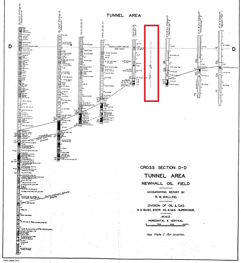
Vertical cross-section D-D showing fault in the red rectangle and geologic data from well logs. The fault was deduced from the correlation of the beds from well to well.