Tunnel Area Historic Photos
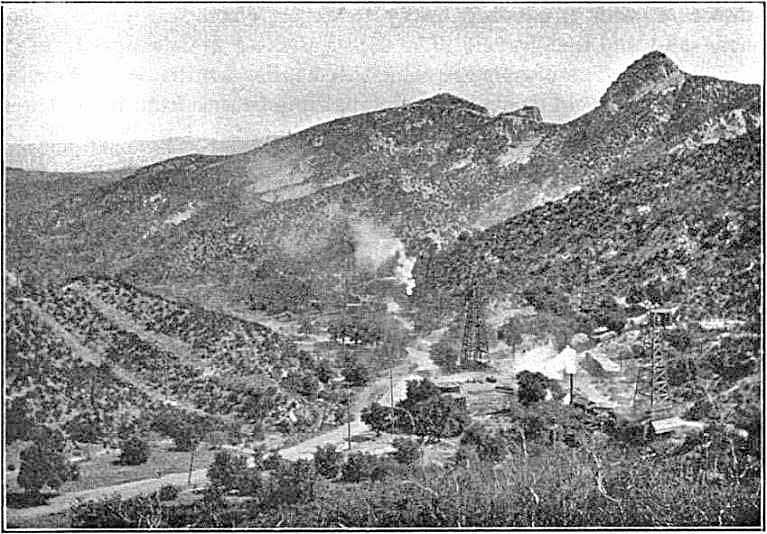
This picture was taken between 1902 and 1904 showing the Newhall Creek looking northeast. This is part of the Tunnel area. It was first published in Production and Use of Petroleum in California, California State Mining Bureau, Bulletin No. 32, 1904, by Paul Prutzman. It later showed up in Petroleum in Southern California, California State Mining Bureau, Bulletin 63, 1913, also by Paul Prutzmen. Unfortunately, the California Geological Survey could not find the photo for me. They had a fire in the 1950's that, along with the water to put out the fire, destroyed a lot of important historical documents. The smoke is coming from boiler smokestacks. The boilers were powering either the engines, if the well was being drilled, or the pumping "power", if the well was being pumped. There are actually five oil derricks barely visible in the picture. The two high areas left of the "tower" on the right of the ridge line are part of Elsmere Ridge with Elsmere Canyon on the other side. You can barely see a road that runs horizontally beneath them. That road still exists and was built by 1902 (see Eldridge 1902 geologic map on geology page). Beale's Cut was behind the photographer.
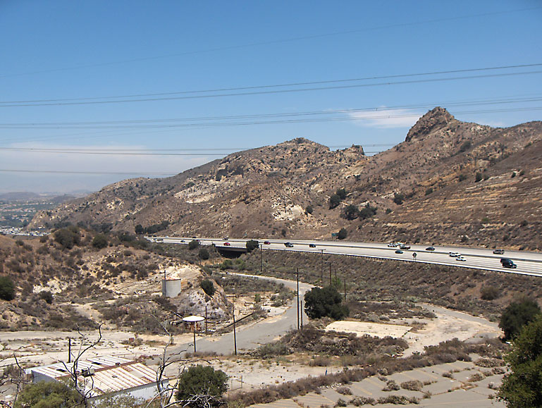
About the same view on 6/23/2007. The hills where I am standing have been greatly altered by the Newhall Refinery (now defunct - operated from 1930 - December of 1989) so this is about as close as I could get to where the original picture was taken. State Route 14 (the Antelope Valley Freeway) has also obviously altered the landscape.
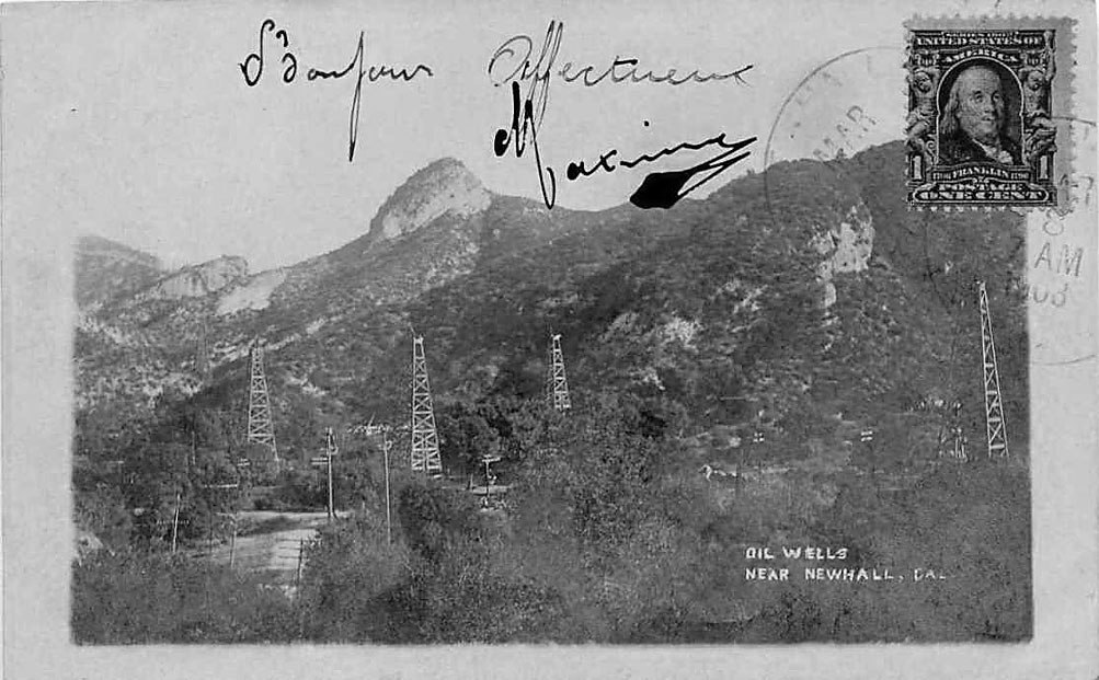
This postcard postmarked March 8, 1908, owned by Alan Pollack shows the same wells from the above picture, but closer up and at a different angle. Follow the word "oil" up and note the tank. That same tank is in the previous historic photo right at the top of the first rig on the right. There's that unique "tower" geological landmark a little to the left of center in the photo, still obvious today. It is difficult to identify the oil wells because the Pearl Oil Company, the Eureka Crude Oil Company, the Commercial Oil Company, and the Zenith Oil Company all had oil wells close together in that area. But the dates when the wells they were drilled is, more or less, known making the date of the postcard photo between 1901 and 1905.
Copyright Note: This image is NOT in the public domain and is protected by the copyright laws of the United States.
Used by permission of Alan Pollack.
About the same northeast view as the above photo on 2/13/2010
Another northeast view toward the "tower" at about road level. Three wells are visible in the background.
Copyright Note: This image is NOT in the public domain and is protected by the copyright laws of the United States.
Used by permission of the Security Pacific National Bank Collection/Los Angeles Public Library.
About the same view as the above photo on 10/4/2010
Close up of above historic photo showing the three wells.
Copyright Note: This image is NOT in the public domain and is protected by the copyright laws of the United States.
Used by permission of the Security Pacific National Bank Collection/Los Angeles Public Library.
Another photo like the previous ones. Same fence around the curve. The two wells in the photo match two in the previous historic photo.
Photo used by permission of theSanta Clarita Valley Historical Society
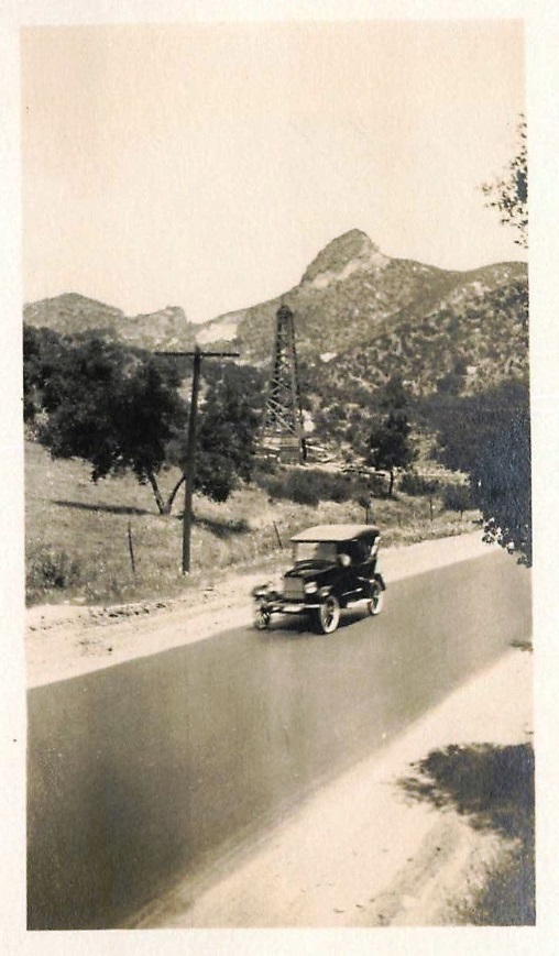
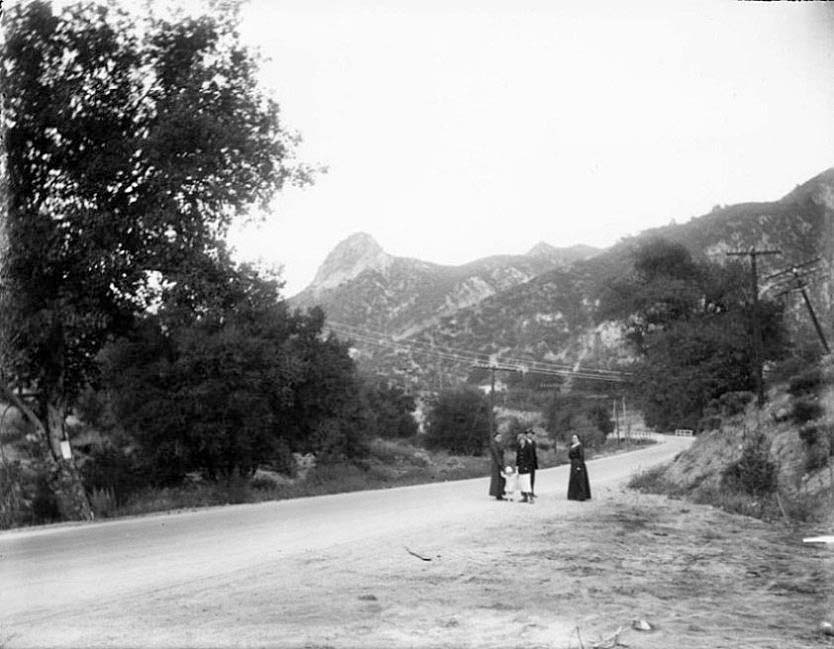
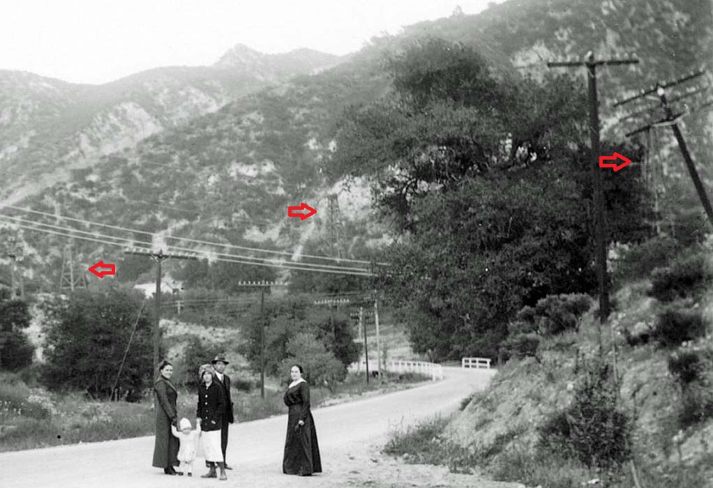
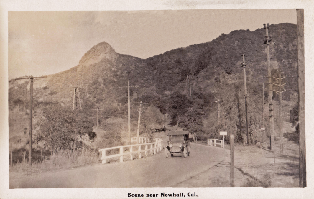
Similar view of the "tower", San Fernando Road (name at that time), and an oil well from an old postcard. Date unknown. The back of the postcard reads "A machine coming towards Newhall Tunnel from the North".
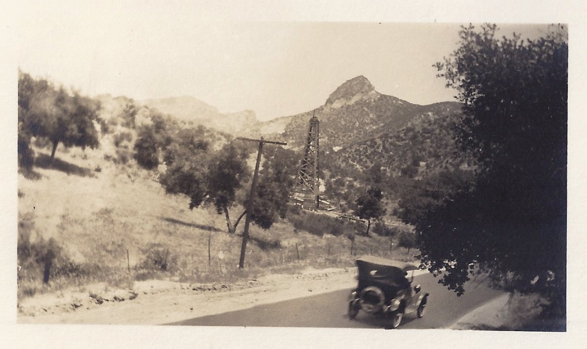
Same car but going in the opposite direction.
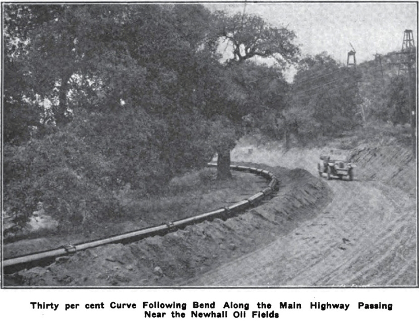
This is from the San Joaquin Light and Power Magazine, Vol. I No. 7 July 1913. The Midway Gas Company layed a natural gas pipe line (12 3/4 diameter, 30-44 foot lengths of pipe) from Kern county to the city of Los Angeles in 1912-13. It probably went through Beale's cut and not the Newhall Tunnel. The view is probably toward the northeast and this road heads up to the cut, behind the photographer. The wells are to the east of the road and are probably some of the same wells from the above old photos. If I tried to recreate this photo, I would probably be about 50 feet from SR-14 and staring right at it.
Photo showing 12 oil wells in the area where the future refinery would be built in 1930. Taken on March 17, 1928, by Ralph Arnold. The road was San Fernando Road at that time. More historic refinery area photos on the Newhall Refinery website.
Photograph No. 2 in letter from Ralph Arnold to J. H. Gilliland, Dated March 19, 1928, Ralph Arnold Papers, The Huntington Library, San Marino, California.
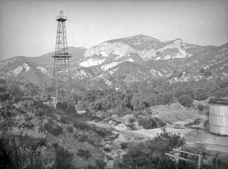
1937 - Tunnel area looking northeast. The derrick is York 5 (photo by Herman J. Schultheis).
Copyright Note: This image is NOT in the public domain and is protected by the copyright laws of the United States.
Used by permission of the Herman J. Schultheis Collection /Los Angeles Public Library.
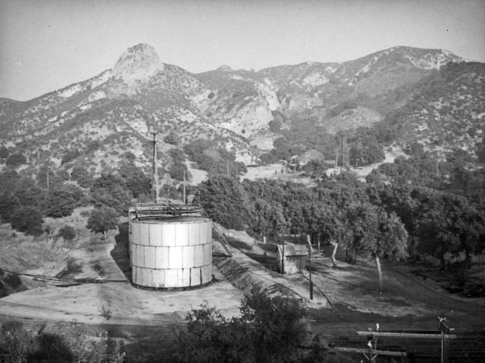
1937 - Tunnel area looking east. The big tank overlaps this photo with the previous photo. The two wells in the distance could either be Commericial 2, Commercial 3, or Commercial 4. They were still operating in that area in 1937. (photo by Herman J. Schultheis)
Copyright Note: This image is NOT in the public domain and is protected by the copyright laws of the United States.
Used by permission of the Herman J. Schultheis Collection /Los Angeles Public Library.
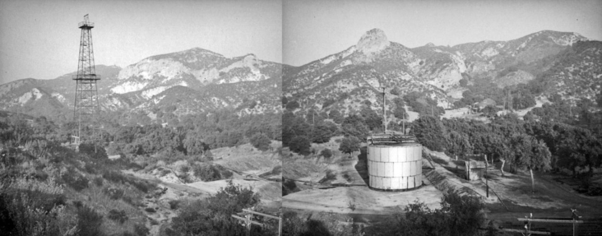
Both photos roughly pasted together. Mr. Schultheis didn't just take the first photo and turn slightly to take the second photo. He changed positions.
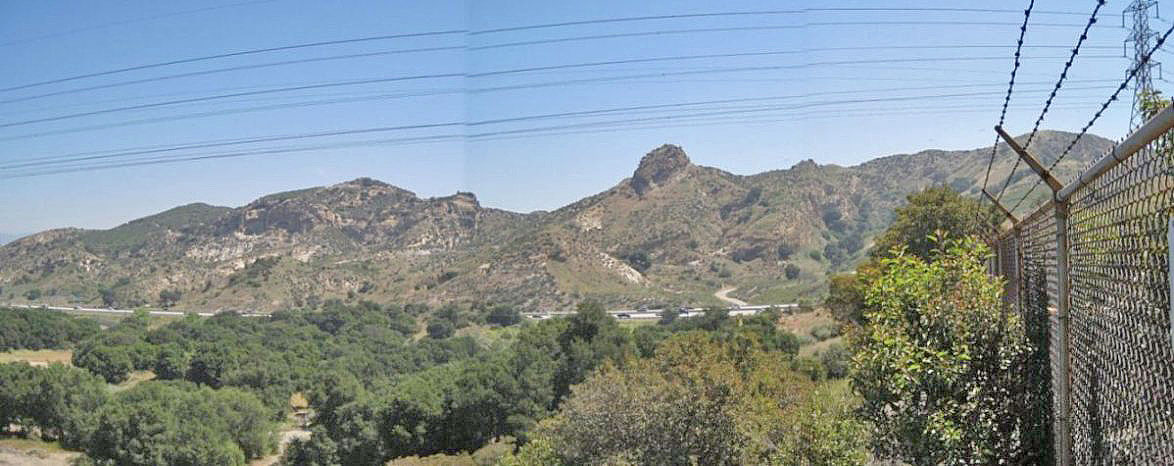
Trying to recreate the previous photo is very hard considering all the changes that have been done at the Newhall Refinery site since 1937 (5/13/2012)
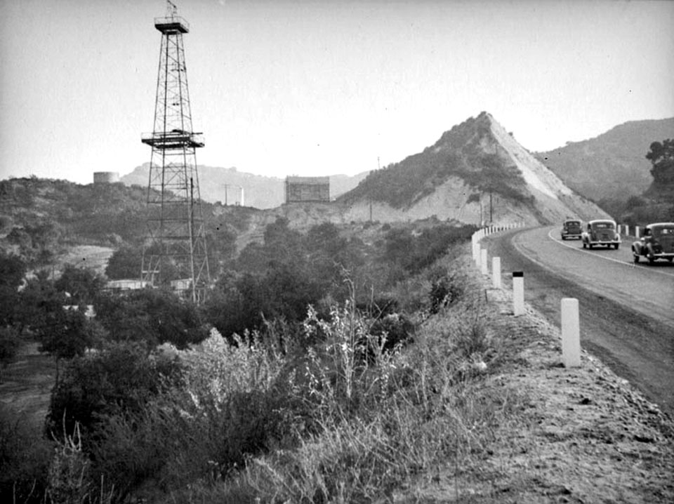
1937 - A little further down Sierra Highway (which was San Fernando Road at that time) looking south to the York 5 derrick that was in the first photo by Herman J. Schultheis. The part of the hill left of the roadcut was flattened out after this photo was taken.
Copyright Note: This image is NOT in the public domain and is protected by the copyright laws of the United States.
Used by permission of the Herman J. Schultheis Collection /Los Angeles Public Library.
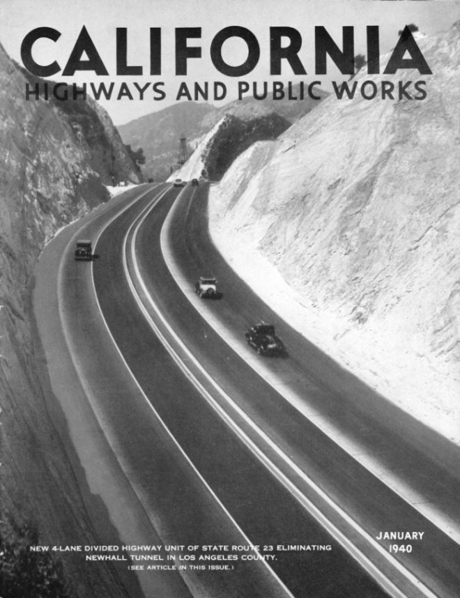
This photo from the cover of California Highways and Public Works for January of 1940 showing the cut and highway that replaced the Newhall Tunnel. York 5 (the well shown in Herman Schultheis' 1937 photos) is the oil derrick in the distance. This view is toward the north and would have shown the south portal of the Newhall Tunnel if it was still there.
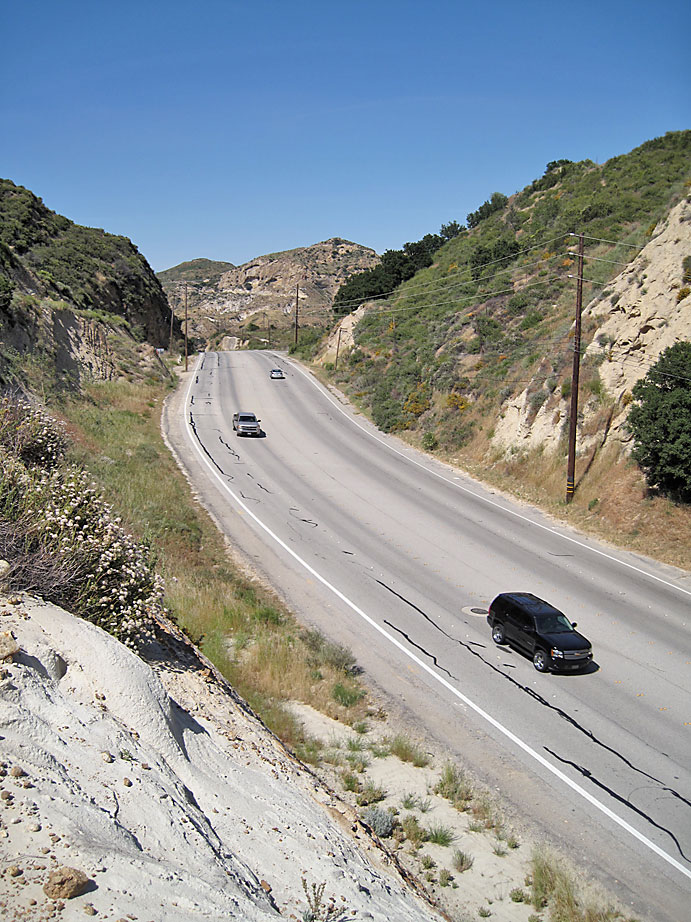
Here is a similar photo on 5/12/2010. The road cuts on both sides of Sierra Highway have been expanded over the years, so it is impossible to get the same camera angle.
Closeup of York 5 oil derrick from the magazine cover. The opening on the right at road level in front of the hill before the oil rig is Clampitt Road. The hill between the rig and Clampitt road was greatly cut down (as you can see in the above modern photo) sometime after this photo was taken to make more room for the refinery.