Tunnel Area - The Wells
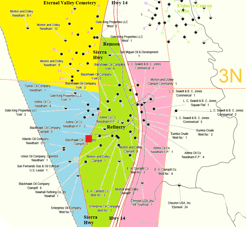
The Newhall Tunnel was located at the red box on Sierra Highway near the middle of the map. It was opened in late 1910 replacing Beale's Cut, which was just east of the tunnel. The tunnel was eliminated by the current cut, completed in 1939. The Tunnel Area Oil Field was named for the tunnel. (Map modified from DOGGR Map 254)
Only the wells that were still visible in 2010 will be shown. Some of these wells have been plugged and abandoned since 2010. Some may not be abandoned for many years (such as the wells in the Newhall Refinery, closed since 1989 - center part of green area on map).
From the CalGem (the old Division of Oil, Gas, and Geothermal Resources - DOGGR) website:
"How are wells plugged and abandoned?
When a well is no longer needed, either because the oil or gas reservoir becomes depleted, or because no oil or gas was found (called a dry-hole), the well is plugged and abandoned. A well is plugged by placing cement in the well-bore or casing at certain intervals as specified in California laws or regulations. The purpose of the cement is to seal the wellbore or casing and prevent fluid from migrating between underground rock layers. Cement plugs are required to be placed across the oil or gas reservoir (zone plug), across the base-of-fresh-water (BFW plug), and at the surface (surface plug) (watch a movie). Other cement plugs may be required at the bottom of a string of open casing (shoe plug), on top of tools that may become stuck down hole (junk plug), on top of cut casing (stub plug), or anywhere else where a cement plug may be needed. Also, the hole is filled with drilling mud to help prevent the migration of fluids."
Many of the steps during the abandonment process must be witnessed by someone from DOGGR. The last step normally consists of cutting the well casing about five feet below the surface and leaving the site in a natural condition with no evidence of a well ever being there.
DOGGR was formed in 1915. Some of the wells here were drilled and abandoned before its existence. If located, these old wells might have to be either abandoned or re-abandoned (because of new, stricter abandonment laws in effect now).
A note on the Needham wells: Due to the large size of the Needham Ranch, multiple wells had the same well number. There were four different Needham 1 wells, two Needham 2 wells, two Needham 3 wells, and two Needham 4 wells. Wells with the same number was drilled by different companies on different leases in the ranch.
WELLS WEST OF SIERRA HIGHWAY - NORTH PART - including The Center at Needham Ranch (yellow area on map)
WELLS WEST OF SIERRA HIGHWAY - SOUTH PART (blue area on map)
WELLS BETWEEN SIERRA HIGHWAY AND HIGHWAY 14 - including the Newhall Refinery (green area on map)
WELLS EAST OF HIGHWAY 14 (light red area on map)
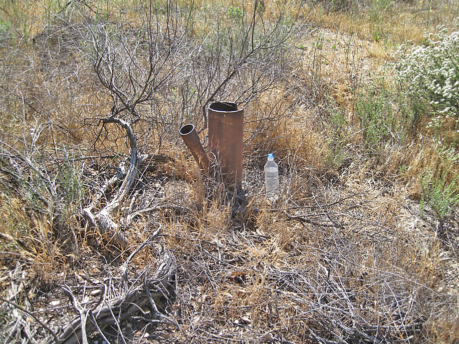
Deserted well. (Photo taken on 6/10/2018)
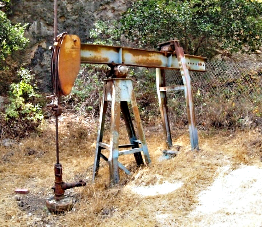
Needham 3. (9/4/2017)
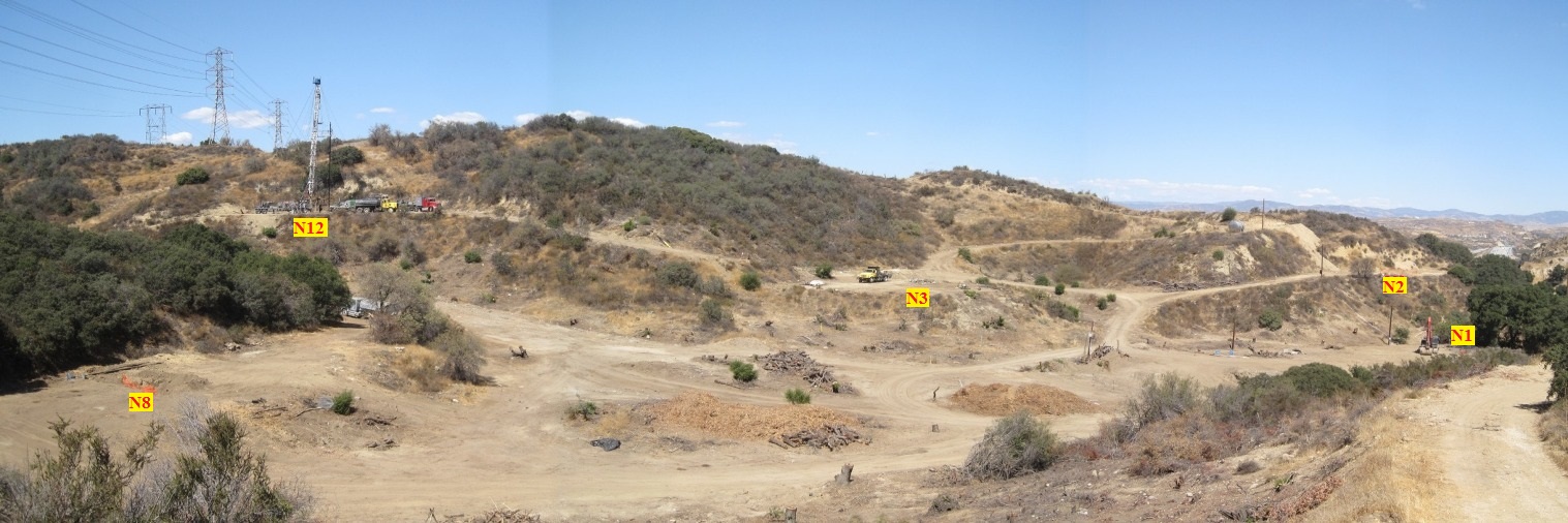
Panorama view towards the north of southern part of The Center at Needham Ranch showing five Needham well sites in red. Needham 12, with the portable rig, is being abandoned. The others are in the process of being abandoned. (9/23/2017)