Wiley Canyon Geology
Wiley Canyon cuts into the Pico Anticline. As you hike into the canyon you are in the north flank of the anticline until you get to the bench. Around the the bench, you are in the axis of the Pico Anticline. South of the bench area, you get into the south flank of the anticline.
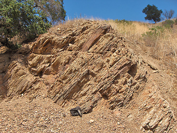
As in Towsley Canyon, all the productive wells were drilled in the Modelo Formation, which is the exposed shale. The shale in Wiley Canyon is especially thinly bedded and, in places, greatly contorted. You see this contortion as you hike up the canyon. It is caused by the tight folding of the anticline.
Looking north on the road you can see this Pico formation high up on a cliff. You will soon be hiking into the Towsley formation. (12/5/2009)
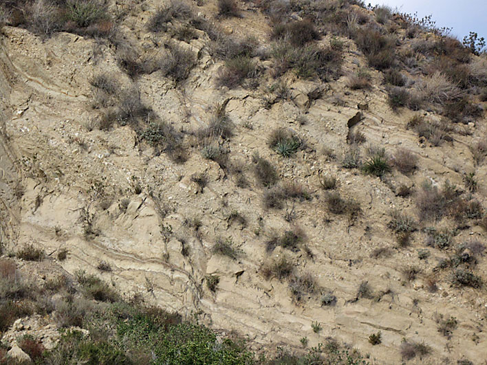
North flank of the Pico Anticline exposed as you near the bench area. (9/28/2008)
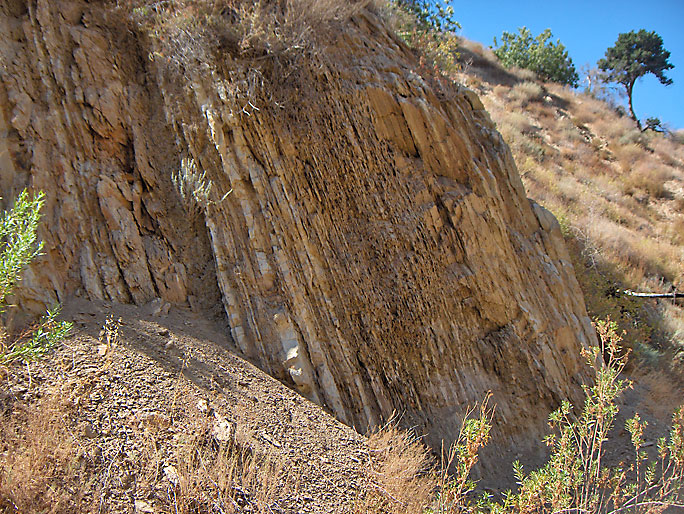
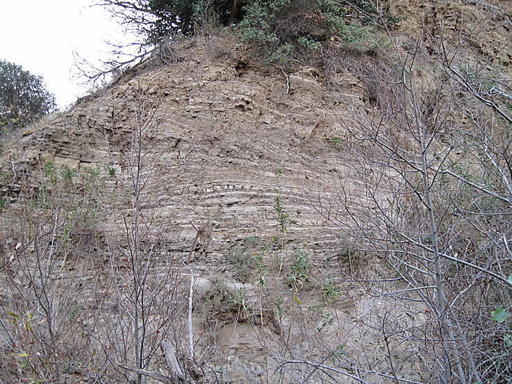
Unusual erosion in the sandstone of the north flank of the anticline somewhat similar to erosion in the Narrows in Towsley Canyon. You are probably still in the Towsley formation. (9/6/2008)
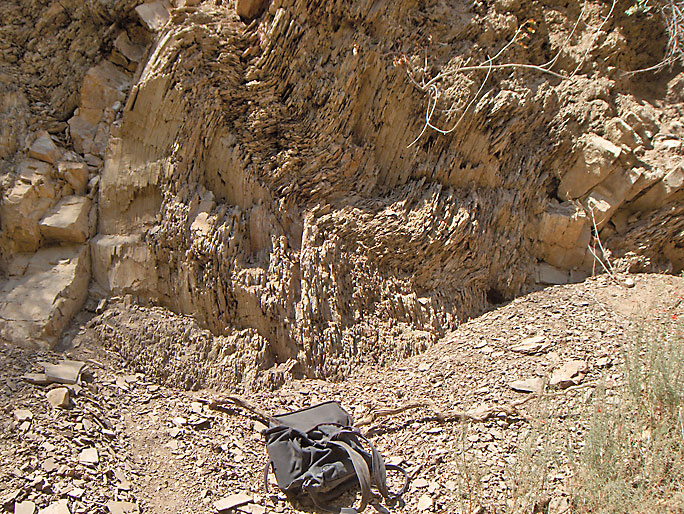
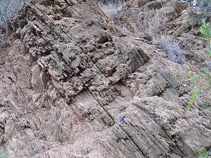
Greatly contorted beds of what appears to be overturned beds of the north flank of the anticline. Modelo Formation shale beds. (9/6/2008)
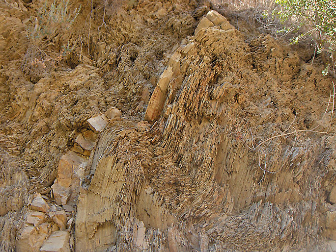
Another view of same beds (3/23/2008)

Here is the bench. We are in the middle of the axis of the anticline where the beds become horizontal as the angle of the slope changes from dipping to the north to dipping to the south. (10/5/2008)
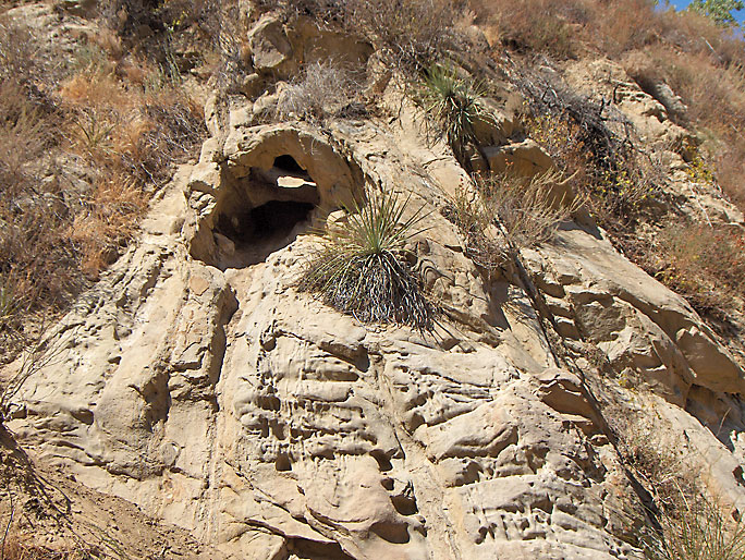
Closer view of cliff behind the bench. (12/5/2009)
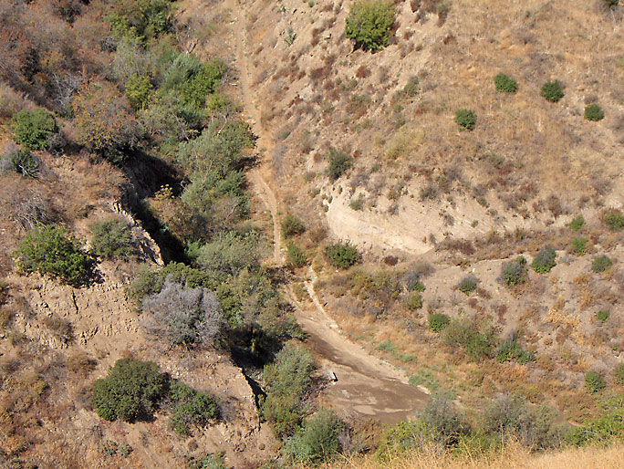
High above the bench area looking west up the trail. The axis of the anticline follows the trail straight up the canyon. Although hard to tell in this photo, the exposed beds on the left and right of the bench are nearly horizontal. (10/5/2008)
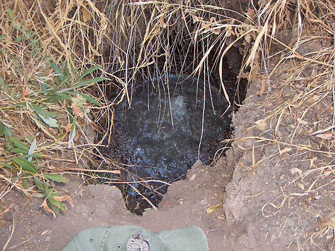
This is one of the most unusual and unique features in all of the Newhall Oil District. Gas is violently bubbling out of this hole almost like a geyser. However, instead of being hot like a geyser, the water is cold. It is very close to the location of the Wiley #6 oil well site. In 1972, DOG records report that (before the well was capped) gas was bubbling from the well and escaping through at least 6 small holes at the ground surface as far away as 10 feet from the well head. After it was plugged and capped in late 1972, it was reported that there was water seepage in the area - perhaps natural. I think that if the well was never drilled, this hole would not exist. It is one of those small reported holes in 1972 and has just gotten larger over the years. If it was that big in 1972, it would surely have been reported. (9/28/2008)
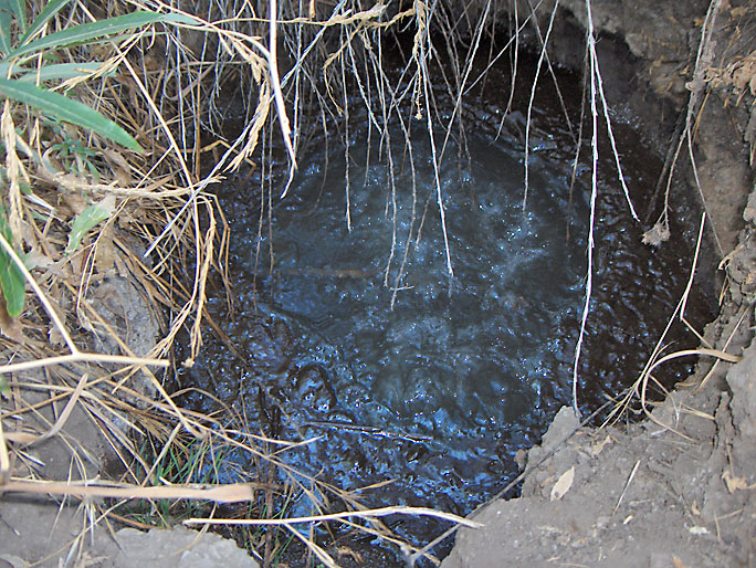
Closer view. (9/28/2008)
This is the south flank of the Pico Anticline south of the bench area. (12/5/2009)
This is also the south flank of the Pico Anticline but it is located about a 1/4 mile west of previous picture (10/5/2008)