Elsmere Canyon Historic Photos
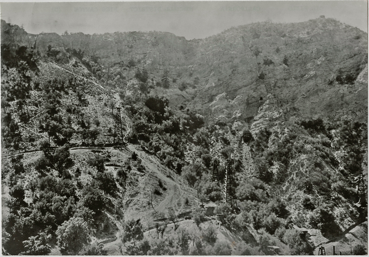
This is oldest photo of Elsmere Canyon that I have seen. It was probably taken in 1899. We are looking at the steep south face of the canyon. The west is to the right. From right to left, the wells visible are Elsmere 7 (spudded in 1898), the top of Elsmere 2 (spudded in 1890), Elsmere 5 (spudded in 1898), Elsmere 6 (spudded in 1898), and Elsmere 9 (spudded on 2/16/1899). What's missing here is Elsmere 18 (above Elsmere 9 on same diagonal ridge below the top) spudded in 1900, Elsmere 15 (on top of canyon way above Elsmere 5) spudded in 1900, Elsmere 20 (also on top of the canyon) spudded in 1900, and Elsmere 19 (would be in the lower left) spudded in 1900. That same tank is visible in Arnold's 1905 photo (see below).
Copyright Note: This image is NOT in the public domain and is protected by the copyright laws of the United States.
American Petroleum Institute Photograph and Film Collection, Archives Center, National Museum of American History, Smithsonian Institution. Used by permission.

Here is the same photo with the wells numbered.

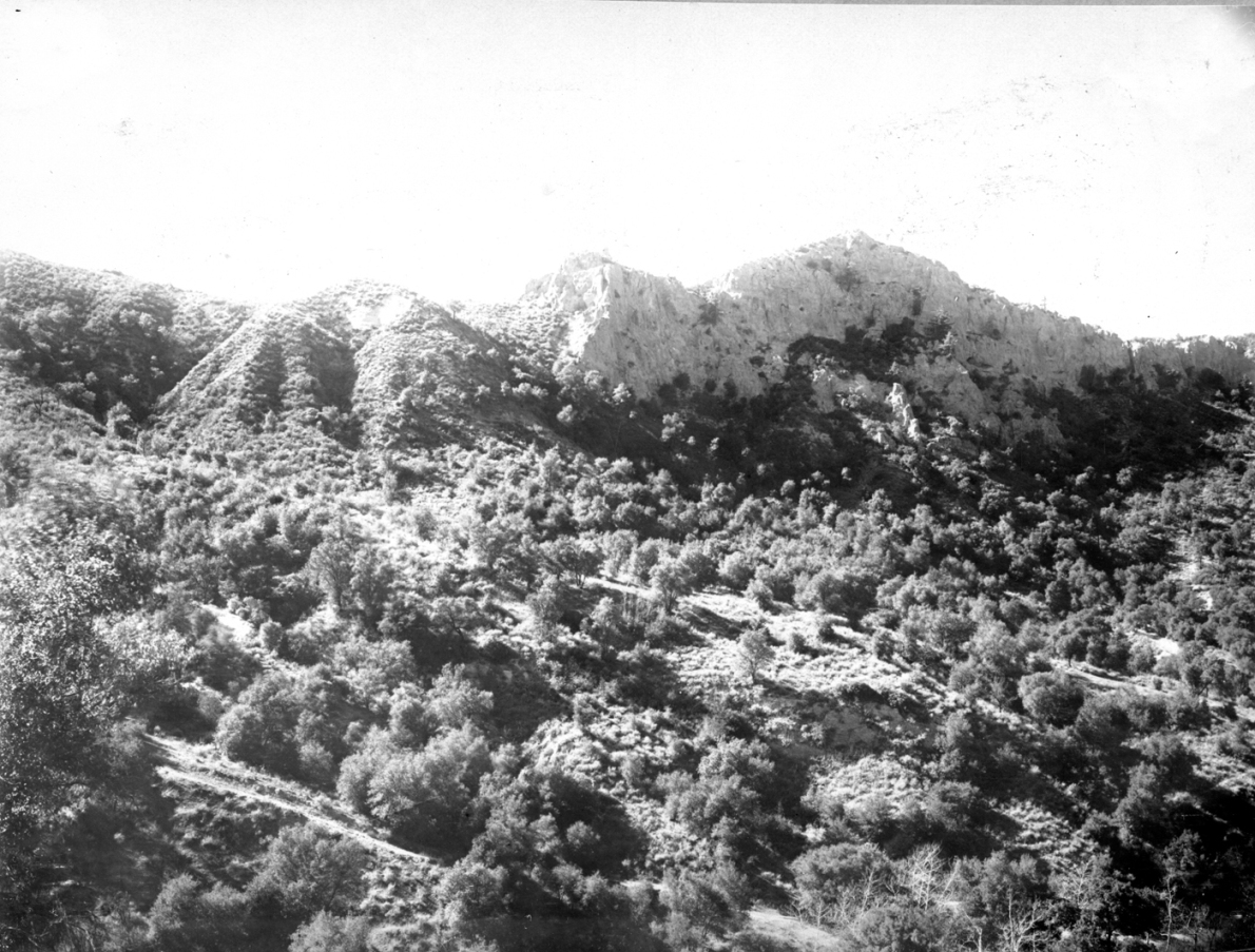
Here is about the same view on May 30, 2008.

This photo shows Elsmere 8 (spudded in 1899) and was probably taken about the same time as the previous historic photo
Copyright Note: This image is NOT in the public domain and is protected by the copyright laws of the United States.
American Petroleum Institute Photograph and Film Collection, Archives Center, National Museum of American History, Smithsonian Institution

With all the growth, it was impossible to get the same view as above. Here is the best I could do (on May 13, 2012), although I had to get much close to even see the cliff above the well site. There has been a lot of erosion to the cliff above and below the site.
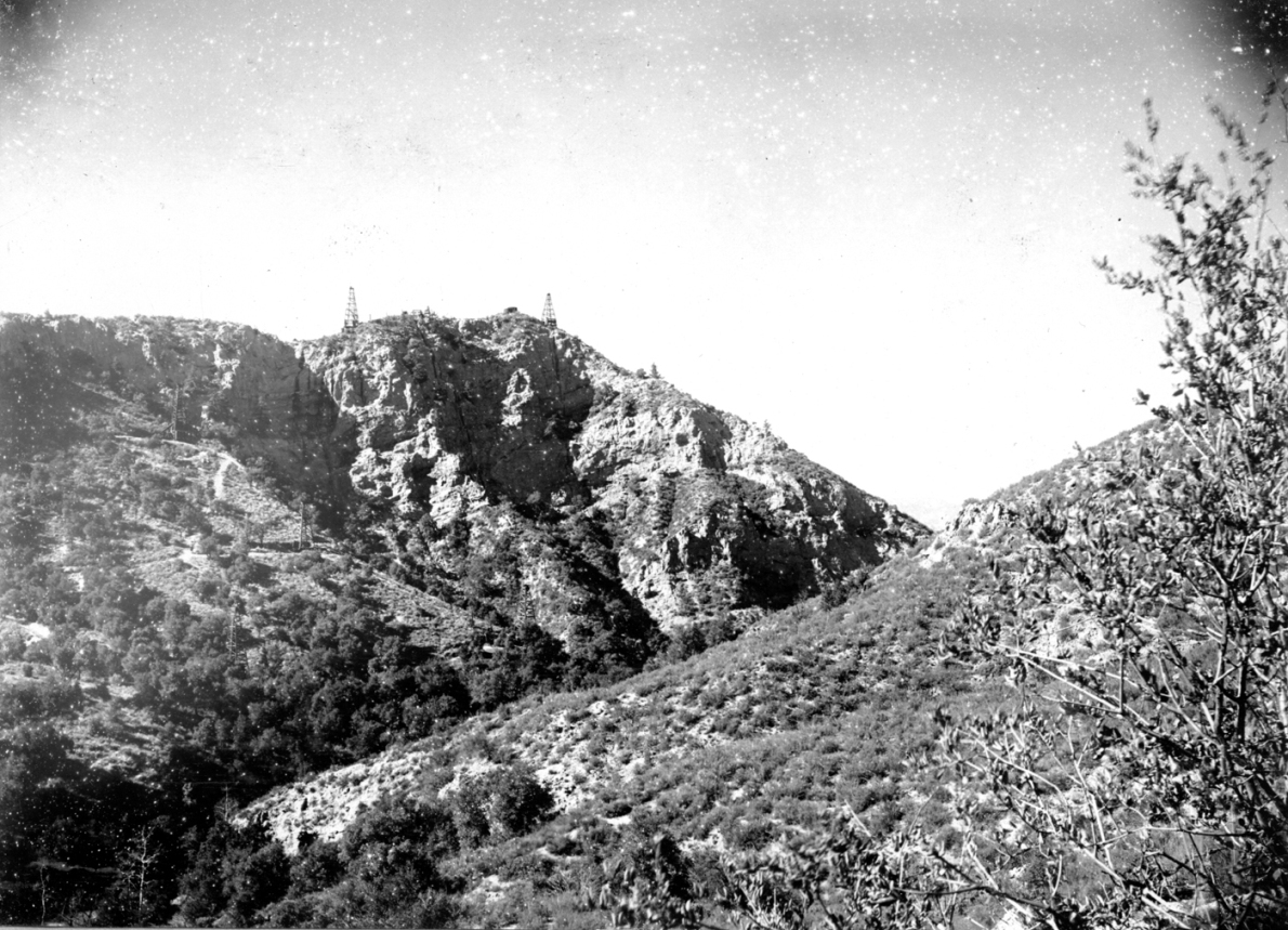
Elsmere Canyon looking southwest (photo taken in 1905 by Ralph Arnold). There is one well (Elsmere 16) barely visible in the right center.
From U. S. Geological Survey Bulletin 309: The Santa Clara Valley, Puente Hills, and Los Angeles oil
districts, Southern California, by George H. Eldridge and Ralph Arnold, 1907 (Plate 7B Left)
Right section of above photo looking more toward the west (Plate 7B Right).

12/24/2006
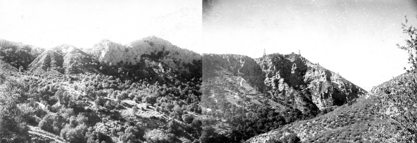
Both sections joined together.

Here are all the visible wells
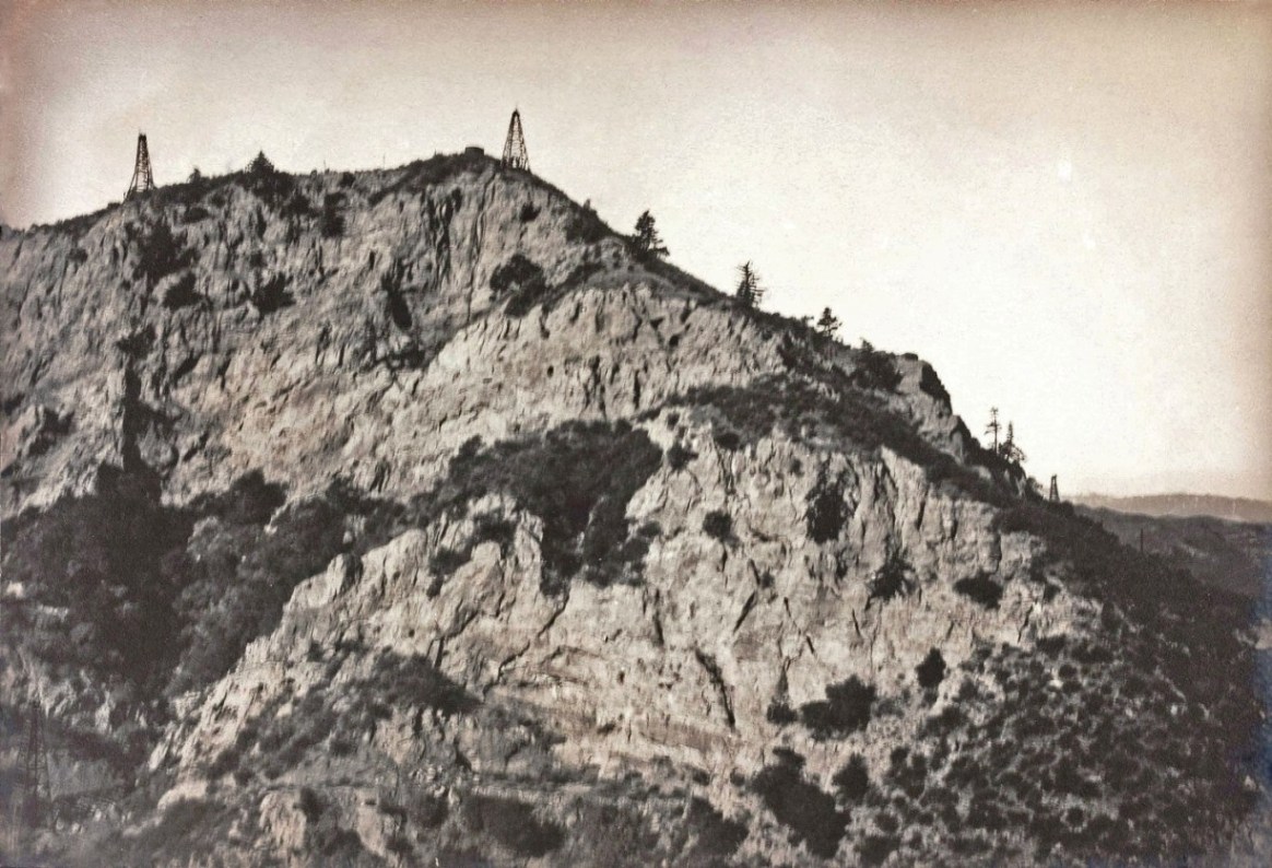
Elsmere ridge showing, at the top left, Elsmere 15 (spudded in 1900) and, at the top right, Elsmere 20 (spudded in 1900). On he bottom left is Elsmere 8 (spudded in 1899). Also visible on the right is the very top of one of the Santa Ana wells. Pre-1916 photo.
Copyright Note: This image is NOT in the public domain and is protected by the copyright laws of the United States.
Courtesy of the Robert B. and William R. Moran papers. Mss 282, Department of Special Collections, University Libraries, University of California, Santa Barbara.
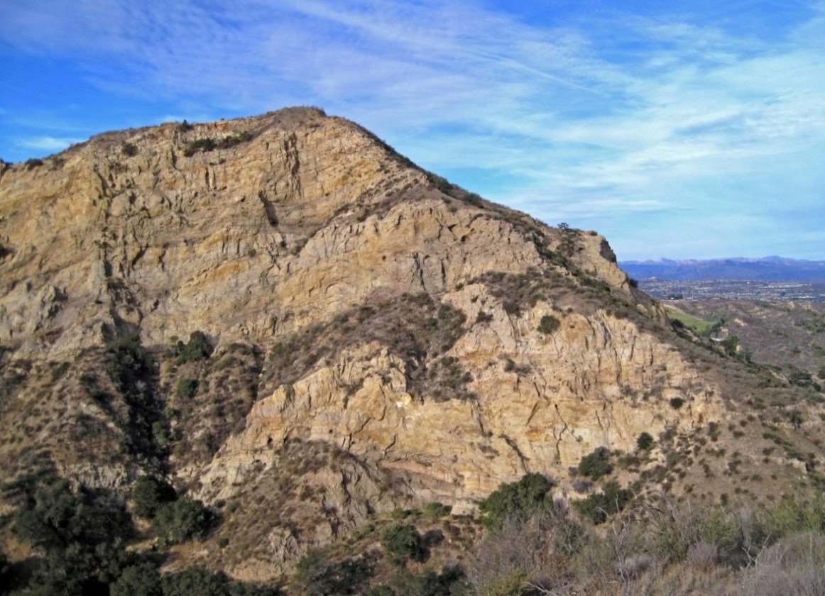
About the same view today (1/14/2014)

This photo is zoomed in from a photo on the Whitney Canyon Los Angeles Aqueduct page. This is a view of the south side of Elsmere Canyon near the mouth. The three wells visible here, from the photo middle, top to bottom, are Clampitt 8 (originally Santa Ana 1, spudded in 1901), Clampitt 9 (originally Santa Ana 2, spudded in 1902), and Clampitt 10 (originally Santa Ana 3, spudded in 1902). The three Santa Ana wells were purchased by E.A. Clampitt in about 1907. There is a tank where the jack line cradle is today. There is another tank on highest point in the photo. Just to the left of the tank, is the faint view of Elsmere 20 (spudded in 1900). Photo was taken about 1909. The well heads of Clampitt 8-10 are still visible on the trail.
Copyright Note: This image is NOT in the public domain and is protected by the copyright laws of the United States.
Courtesy of the Robert B. and William R. Moran papers. Mss 282, Department of Special Collections, University Libraries, University of California, Santa Barbara.
This is a view (1/19/2014) from Whitney Canyon parking lot towards just west of south. The original photo was taken further away, but that property is restricted.
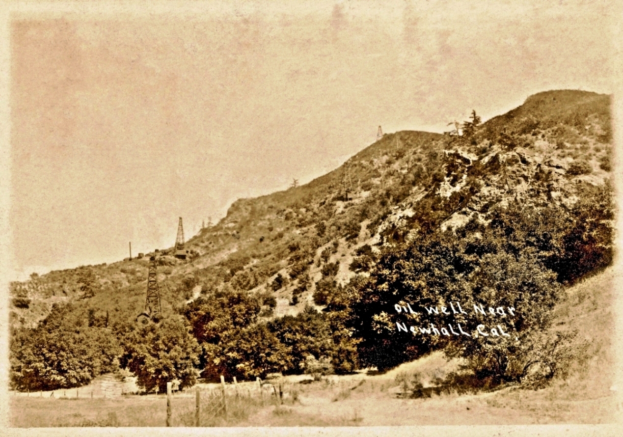
Postcard photo from no later then September 7, 1909 (the postmark date). View looking a little south of east showing the oil wells on the south slope of Elsmere Canyon. The previous historic photo shows the same ridge from a different direction with almost the same wells. Well names from left to right and bottom to top: Safe Oil Company No. 1 (drilled and abandoned in 1901 - rig still standing in 1913), Clampitt 10, Clampitt 9, Clampitt 8, and Elsmere 20 (just above and to the left of Clampitt 8 with only the top of the derrick showing).

Today's (5/11/2017) view (almost) of the previous photo. I am standing in Eternal Valley almost on Sierra Highway. Highway 14 is blocking the view, so the lower part of the photo can't be seen. Also, I can't really get close enough for the right angle.
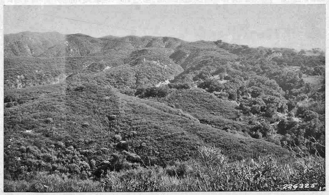
Elsmere Canyon from above south tributary looking southeast. Main canyon to left of photo. (Taken 1-23-1928 by Lynne M. Correll).
Photo caption: "In Elsmere Canyon. A small area of Quercus agrifolia in the draw to the extreme right. Chamise, Ceanothus, manzanita in the background."
Images from the Wieslander Vegetation Type Mapping Collection are courtesy of the Marian Koshland Bioscience and Natural Resources Library, University of California, Berkeley, http://www.lib.berkeley.edu/BIOS/vtm/

About the same view almost 80 years later (2-17-2007)
There are more historic photos on the Los Angeles Aqueduct page for Elsmere Canyon