Elsmere Canyon Recent Photos
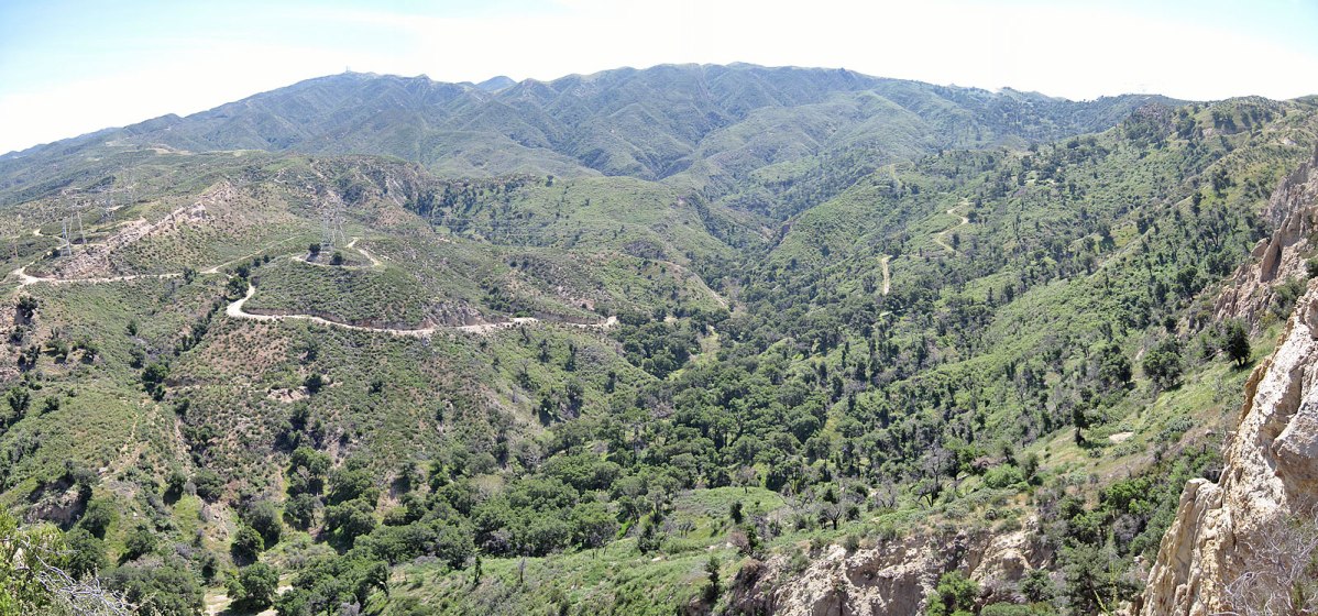
Looking southeast up the canyon (Photo taken on 4/21/2011)
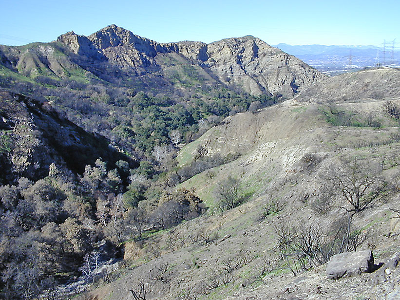
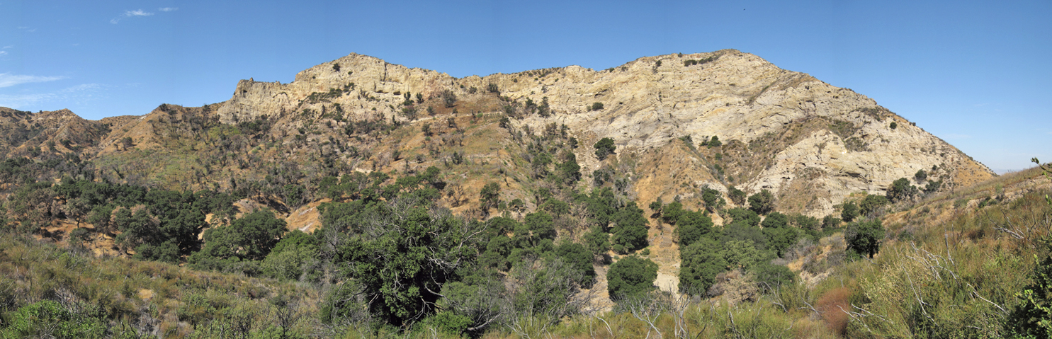
Elsmere Canyon looking west. This picture taken in January of 2005, about 6 months after the 2004 fire. The fire burned off most of the vegetation around the canyon but jumped over the bottom of the canyon leaving all the trees in this photo virtually untouched. (1/30/2005)
(11/11/2007)

Looking east where the canyon starts to narrow. (12/30/2006)
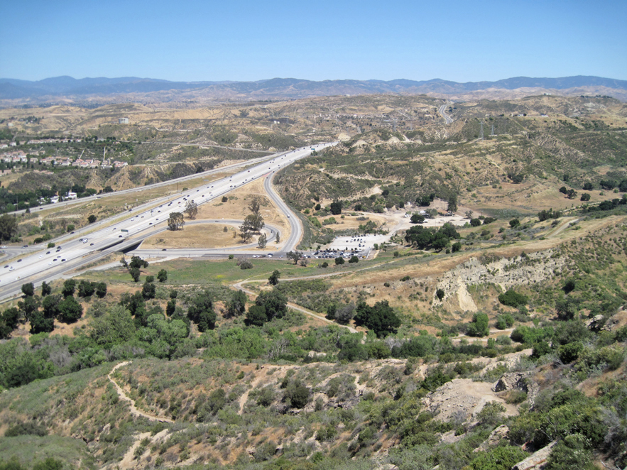
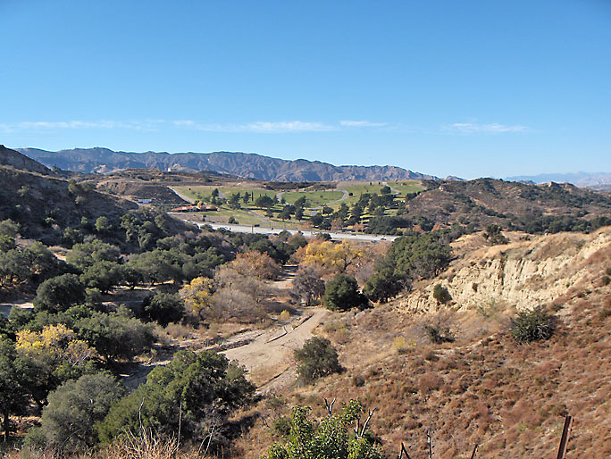
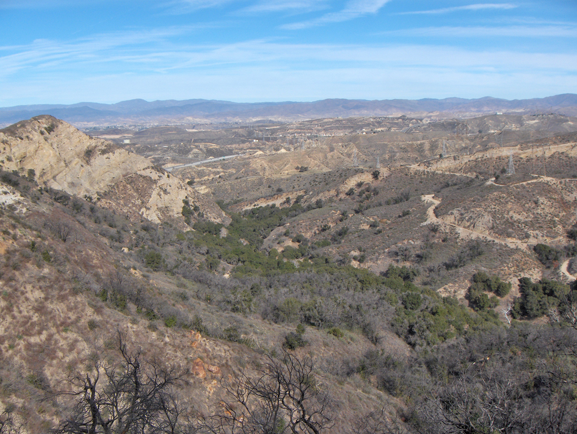
Looking north toward the park-and-ride at the end of Newhall Avenue with Whitney Canyon in the right center. (4/30/2017)
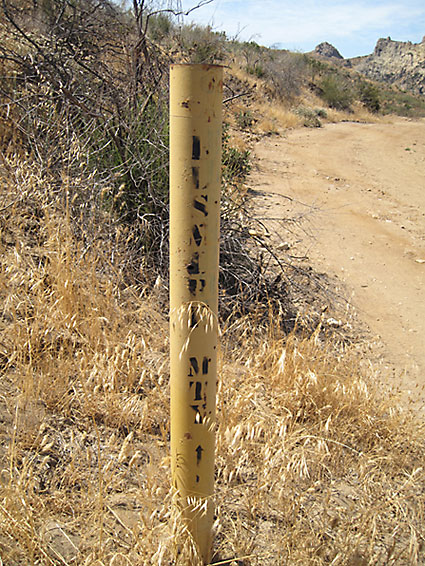
Marker for Elsmere Mountainway road. This is the road that goes down into the canyon from the Whitney Canyon Mountainway. (7/18/2009)

(12/2/2006)
(12/30/2006)
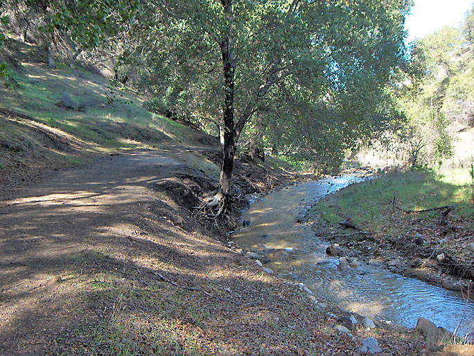
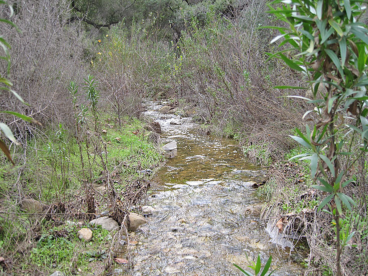
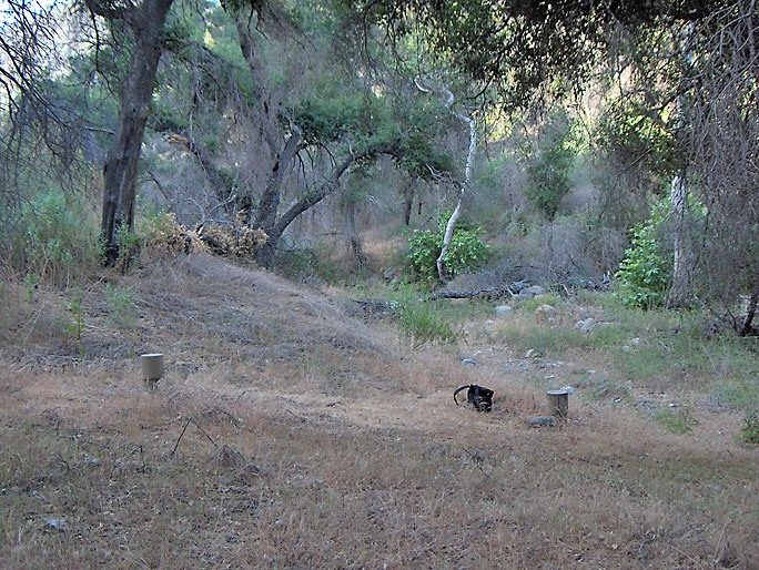
The creek has water at certain times of the year. (1/26/2008)
(12/26/2010)

This old pipe was probably for water. There is no evidence of dried up oil inside the pipe. (12/26/2010)

This tree fell down almost where the aqueduct crosses under Elsmere creek. (12/26/2010)
(12/26/2010)

(12/26/2010)

(12/26/2010)
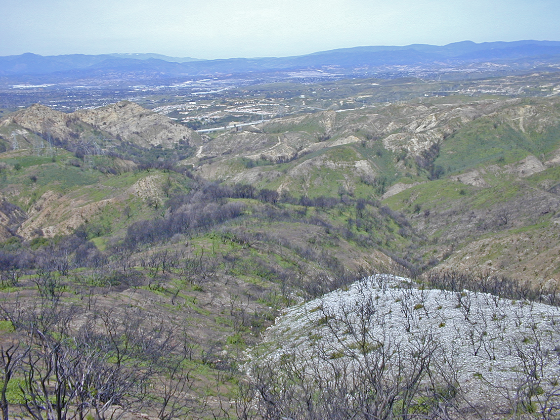
January 1, 2008 on an exceptionally clear day. Looking northwest toward Santa Clarita.
The white rock in the foreground is a granitic igneous rock. After the 2004 fire features like this were easy to see. Now, they are not so easy to see. View to the west far above Elsmere Canyon. I could get up this high because, as you can see, the fire burned away much of the brush. (3/26/2005)

View to the west a little closer than the previous photo and a few years after the fire. (12/24/2007)
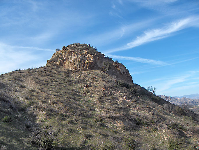
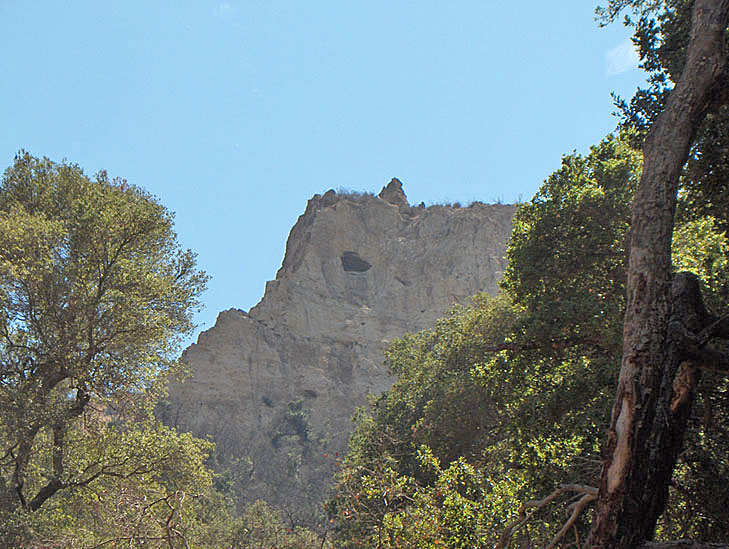
The "Tower". This view is from the upper Elsmere road looking south west. Highway 14 is on the lower right. Elsmere Canyon is behind me. (1/1/2008)

From another direction. (1/1/2008)

See 2004 fire page. (8/29/2004)
This is an old oil pipe that once stretched from the top of Elsmere Canyon to the bottom. (2/17/2007)
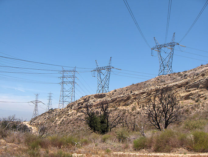
Five sets of power lines cross over the canyon. The oldest is the Big Creek line constructed in 1913. (6/10/2007)

This small arch (notice glove for size) is found high up on the northeast facing wall of Elsmere Canyon. (2/10/2007)
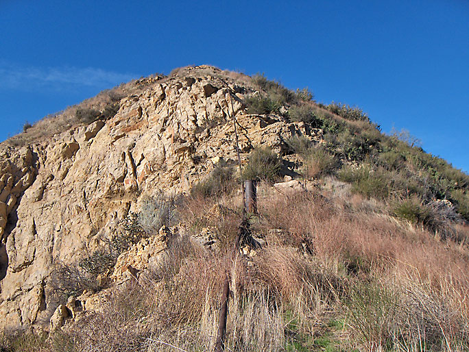
South face (7/18/2009)
The divider of this fork up the northeast fork of Elsmere Canyon has been mistakenly called La Puerta (see the La Puerta page). (3/10/2007)

1928 telecommunication line from the San Fernando Power plant #3 in Sylmar to the Dry Canyon Maintenance Yard coordinating the water flow between Fairmont and Dry Canyon reservoirs to meet power demands. The Dry Canyon Reservoir is located at the end of Seco Canyon Road and has been empty since the 1960's. (3/17/2007)
These are two test holes drilled by the dump company next to the creek bed. There are others in the canyon. (6/10/2007)
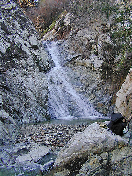
Waterfalls are common in the canyon, although for most of the year they are just cliffs. See the waterfall page. (1/22/2005)
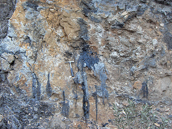
Oil seeps are also common. See the Oil History page. (2/10/2007)
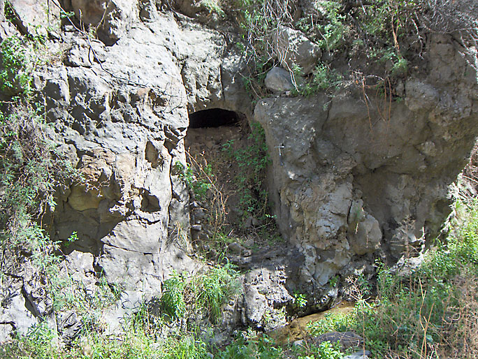
This is a hand excavated cave into the side of the canyon up the northeast tributary. My hammer is on the upper part of the right side for scale. The bottom of the cave is about 3 feet above the current canyon bottom and is about 20 feet deep. Notice the arched entry way. The cave has been partially filled in. According to the EIR there is another cave about 20 feet directly above this cave. However, it appears that the upper cave has been covered by a landslide. I climbed up and looked for it, but could not locate it. Although there is no evidence, the cave was probably dug around 1900 or before as a means to collect oil. This was an early way to get oil by having it seep into a cave bottom and run out into some container. (3/17/2007)
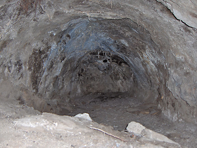
This is what the above cave looks like on the inside. It has been filled in at the mouth, but there is enough room for this to be a nice animal den. (9/12/2007)
This small dam was possibly constructed by the forest service. (5/12/2007)
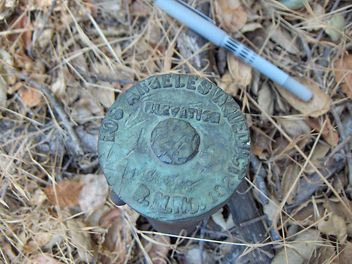
This pipe marker is located about 1700-ft east of where the Los Angeles Aqueduct crosses Elsmere Canyon and about 20-ft above the trail. Why it is at this location is a mystery. It says "Los Angeles Aqueduct Elevation 1491 988 R.M.No. 132". I'm not sure of what that all means. An elevation of 1491.988 feet seems to more or less correct. I don't know what RM No 132 means. (9/1/2007)
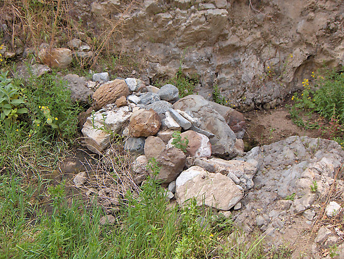
This site is located just above a tributary of Elsmere Canyon just off the main utility road below a 20-foot cliff. According to the EIR, it is a water collection site possibly used to collect water for cattle. There are pipes coming in from above that may have been attached to a water tank (now gone) about a mile away. Water could also have been collected when it flowed over the cliff. There were 19th century nails in some of the wood suggesting an old date for its construction. One of the metal water tanks (see next picture) is constructed with rivets also suggesting an older date. The 1900 U.S.G.S. Fernando Quadrangle topographic map (surveyed in 1897) has a structure at this location so it is probably safe to assume that this site was here in 1900. (3/24/2007)

(3/24/2007)
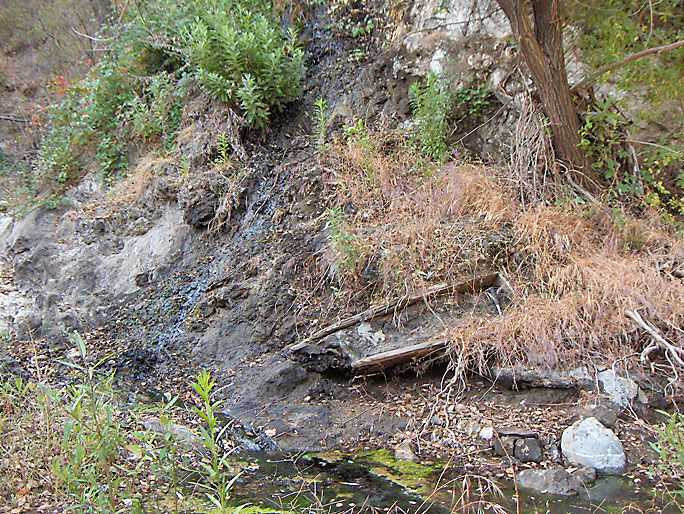
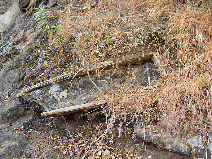
This old wooden structure looks like it was used to collect the oil that seeped out at this location. It appears to have been there a very long time considering it is full of dried oil and looks like it has flowed along with the oil for a long time. (6/10/2007)
(6/10/2007)

This is a metamorphic rock called gneiss, the oldest rock in the canyon. (3/10/2007)
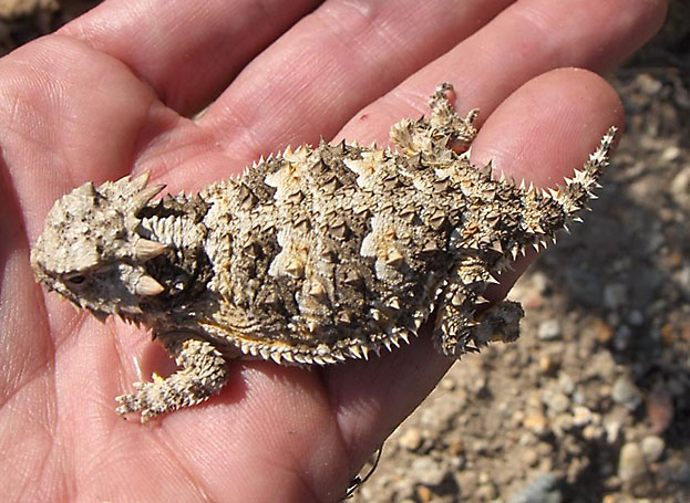
Horned toad (7/8/2007)
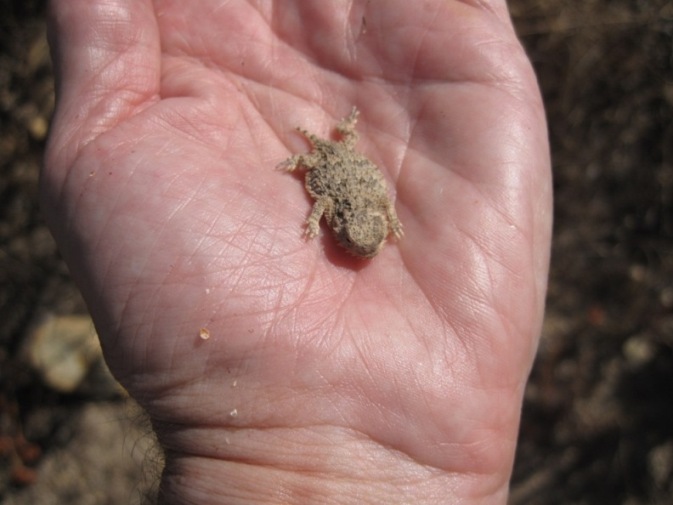
Baby horned toad (8/25/2019)
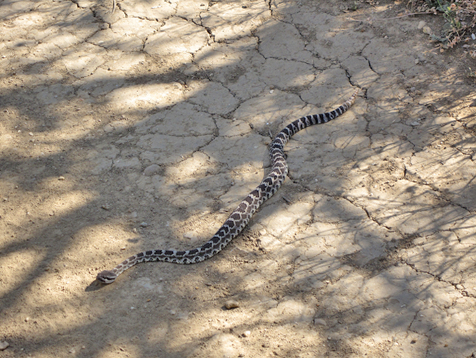
Rattlesnakes are common in the canyon. They like to warm their bodies on the trail. (5/15/2009)
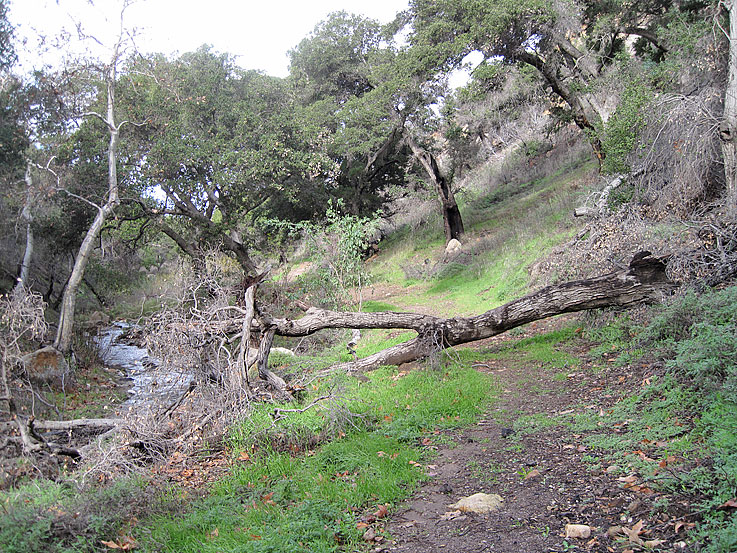
Here a large branch of an oak tree has fallen over the upper road. My backback sits on the trail for scale. The tree was burned in the 2008 fire. (1/1/2008)
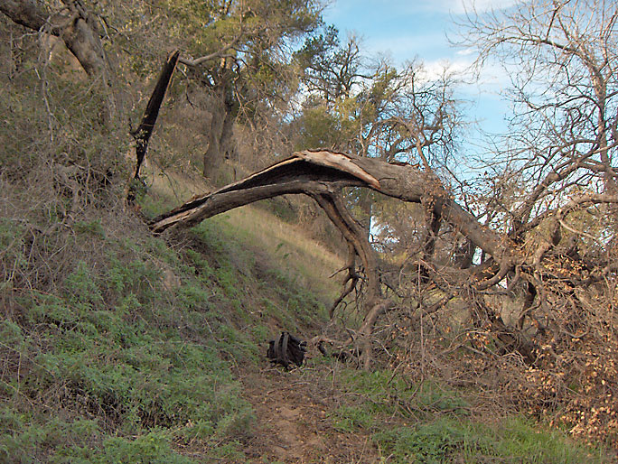
Here is another tree that has fallen down. (1/1/2008)
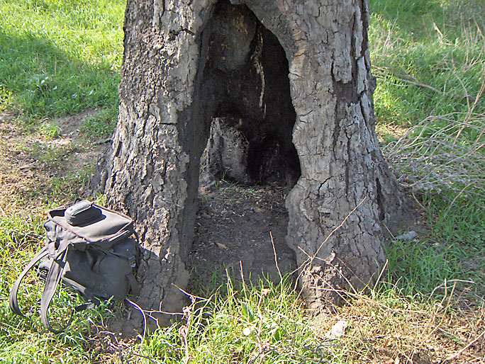
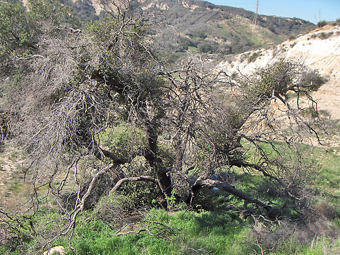
Most of the trunk of this oak tree is gone. This tree will fall over in the next few years like so many other trees are doing. (3/24/2007)
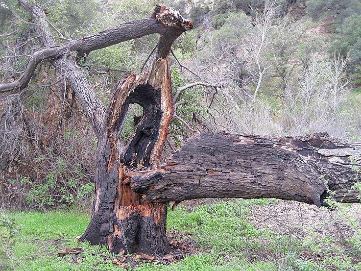
This tree (not the above tree) broke open in late 2010. (12/26/2010)

These number tags were placed on all the oak trees in and around Elsmere Canyon for the dump company. Over 8500 oak trees (those with diameter of 8 inches or larger) were counted. 98% were the Coast Live Oak and the remaining 2% were the Canyon Oak. Over 3500 would have been destroyed by the construction of the dump. (1/20/2007)
This cluster of four oaks is not location in Elsmere Canyon but just east of highway 14 near the Los Pinetos undercrossing. They probably had tag numbers 1-4. The 2008 fire basically burned them all down. (2/16/2008)
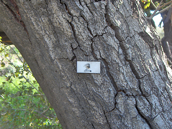
One of oaks in the above cluster has tag number 2. The other tags are gone, but I would guess tag number 1 was on one of the four oaks. This tree was burned down in 2008. (2/16/2008)
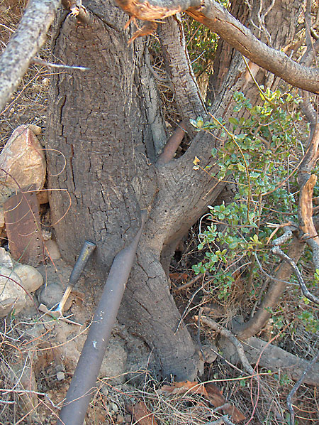
This 100-year old pipe has been overgrown by the tree near Elsmere 10 well site. (12/22/2007)

This is all that remains of an old oil well (Santa Ana 2). See the Oil History page. (2/4/2007)
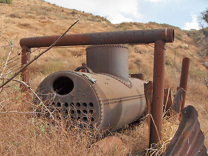
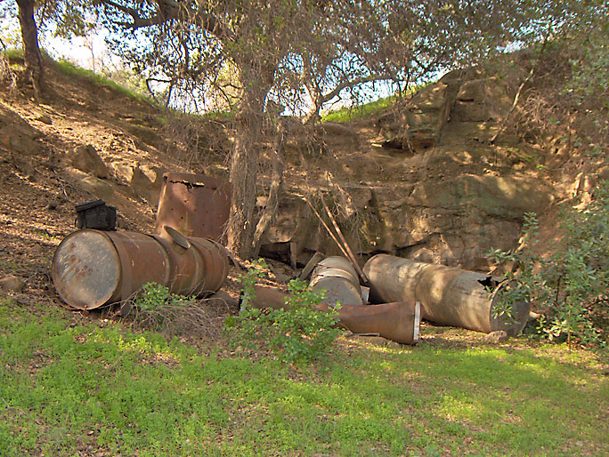
Here is an old steam boiler. It was probably placed here around 1900 by the Alpine Oil Company. See the Oil History page. (12/9/2006)

Here is an old steam engine. It was probably used starting around 1902 by the Santa Ana Oil Company. (2/10/2007)
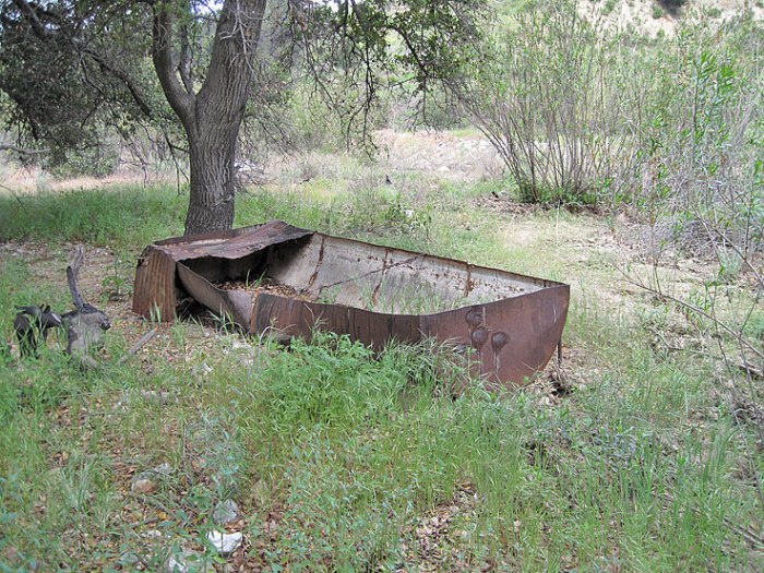
Old watering trough for animals at creek level near the aqueduct (04/21/2011).

The only private residence in Elsmere Canyon is this ranch at the mouth of the canyon next to Highway 14. It was built in 1962. Unfortunately, when Elsmere was being pushed as a dump, the company owning most of Elsmere at that time, did not also purchase this ranch. The ranch owners have always treated the canyon as almost their own personal property. They hunted, dumped, and allowed their animals to graze. I know because I saw it happen. They still have unlimited access into the canyon from their property. (4/30/2017)