Lang Maps and Diagrams
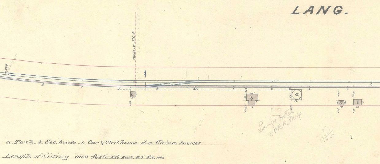
A plan of Lang. The actual date was not indicated, but it was likely between February of 1882 (which is noted on the diagram) and August of 1884, when Lang's Hotel (shown in pencil on map) was opened. If the hotel was there, it probably would have been included in the diagram. The Section house (b) was also used as the depot during almost all the years there was a Lang's Station. Only two actual Southern Pacific Railroad depots were built (1888 and 1905 or 06) and both burned down. The full version of the plan can be seen here. (Lang Station Plan, Nineteenth-century Southern Pacific and Predecessor Companies Station Drawings, California State Railroad Museum Library & Archives, Sacramento, California.)
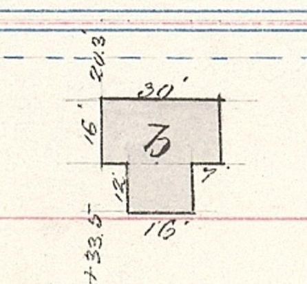
Dimensions of section house (a.k.a. Lang's Station) from above.
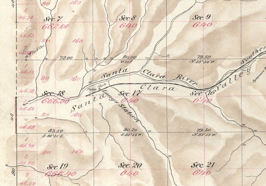
1880 plat map of Township 4 North, Range 14 West, San Bernardino Meridian, Lang Station section. View full map (PDF) here. (From the US Department of the Interior, Bureau of Land Management, General Land Office Records website.)
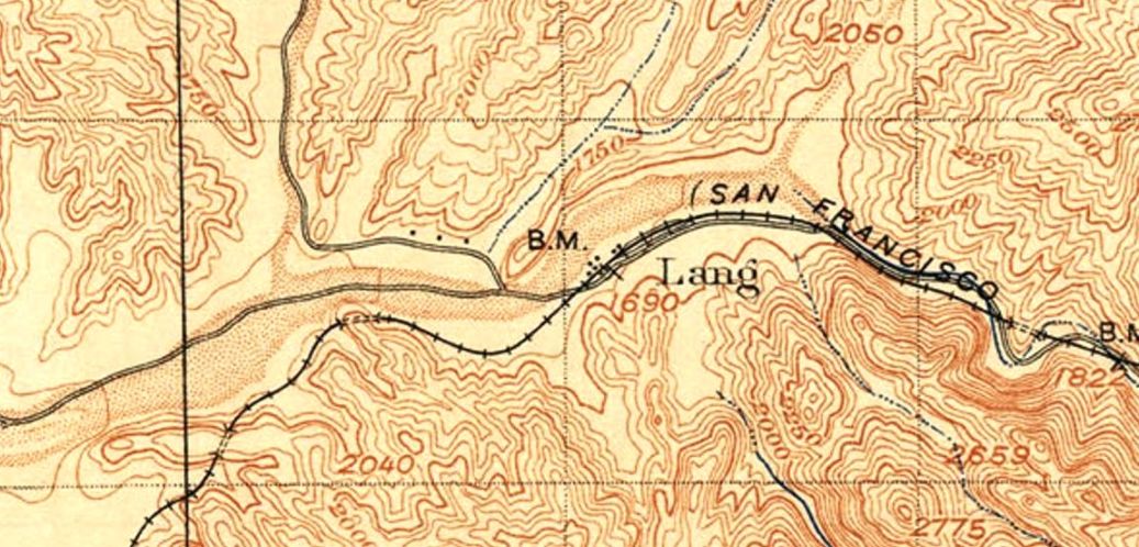
Section of 1897 US Geological Survey Fernando Quadrangle topo map. Edition of 1900. Full map here.
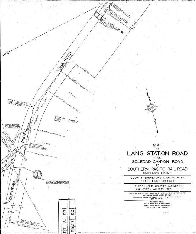
Page 4 from Map of Lang Station Road from Soledad Canyon Road to Southern Pacific Rail Road near Lang Station, 1925, Los Angeles County Surveyor's Map No. 8795. Full map (PDF) here.
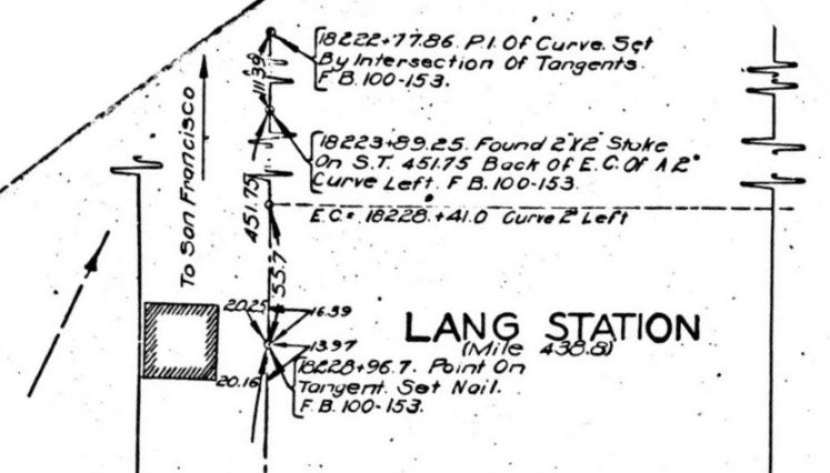
Close-up of station location from above County Surveror's Map 8795. Lang Station is at mile 438.8, the railroad distance to San Francisco.
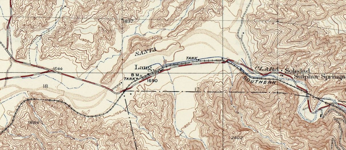
Section of 1929 US Geological Lang Quadrangle topo map. Edition of 1933. Full map here.
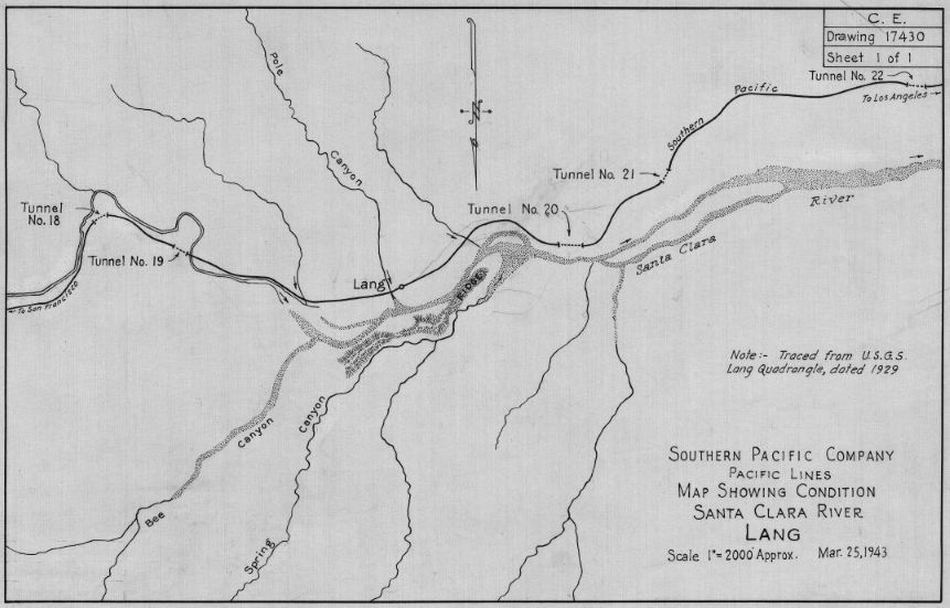
March 25, 1943. The railroad has to go through five tunnels. Lang is between tunnels 19 and 20. In the near future, the tracks would be re-aligned to eliminate all those tunnels. Map (CE 17430) showing condition, Santa Clara river, Nineteenth-century Southern Pacific and Predecessor Companies Station Drawings, California State Railroad Museum Library & Archives, Sacramento, California. Larger version here.
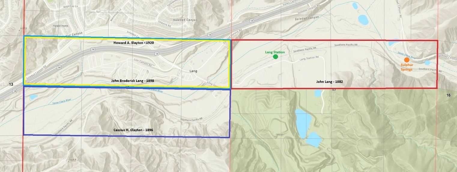
Here are the four main land patents in the Lang area. 1882 - John Lang, 1896 - Cassius H. Clayton, 1898 - John Broderick Lang (son of John Lang), 1920 - Howard A. Slayton (the same land as J.P.'s, which should not happen).