Ferguson Lease
Ferguson 8 on October 20, 2014. It was plugged and abandoned in late 2020 or early 2021.
With the 1937 success of Barnsdall Oil Co. on their Rancho San Francisco lease in the newly named Newhall-Potrero oil field, other operators began drilling just outside of the lease boundaries hoping that the oil deposits extended there. One of these operators was Cornelius G. ("Neal") Willis (1899-1983). He was a geologist and petroleum engineer and, in 1922, had married the Mildred Hoover, the niece of future president Herbert Hoover.
On June 6, 1941, the Newhall Corporation (represented by Joseph K. Ferguson, its president and Burnett Wolfson, its secretary) and C. G. Willis signed a 20 year lease giving Willis the rights to drill and remove oil and gas from a certain 500 acre parcel of land owned by the Newhall Corporation for $500. The land was located just south and east of the Rancho San Francisco with its southern boundary at Pico Canyon Road. The Rancho was owned by the Newhall Land & Farming Company and, as far as I can determine, was not associated to the Newhall Corporation. The lease, which includes a map, can be read here. It was obviously named for Joseph K. Ferguson, president of the Newhall Corporation.
The royalties to the Newhall Corporation was 16% of the value of the oil, less the oil used in operation and development of the property. In comparison, the royalty from the Barndall Oil Company to the NL&F Co. for the Rancho San Francisco lease was only 8%. There were many other items listed on the lease, which you can read there. On September 15, 1941, the lease was recorded by the Los Angeles County Recorder in county records.
On that same day, June 6, the lease was amended. Oddly, the first item on the amended lease changed the royalty payout from all 16% to Newhall Corporation to 11% to the Newhall Corporation and 5% to the Citizens National Trust & Savings Bank of LA. Also, an additional parcel of land (maybe 500 acres although not specifically stated) was added. This may be the "Parcel 2" indicated on the map on the first Ferguson lease, but the land description given does not seem to match that parcel. The amendment can by read here. It was also recorded on September 15.
On November 11, 1941, Willis and Associates (one associate being his brother Robin Willis) spudded Ferguson 1. It was completed on March 6, 1942, at a depth of 7519 feet. The initial production was 265 barrels of oil per day. After 30 days, production dropped to 111 b/d. Almost immediately, the Ferguson lease became part of the Newhall-Potrero oil field.
In late 1942 C.G. Willis incorporated the General Exploration Company of California (Santa Barbara News, December 9, 1942). It was capitalized at $500,000. The directors were Howard W. Wright, Jacques Vinmont, Dwight Whiting, and Robin Willis. C.G. Willis was the president. Ownership of the Ferguson lease and the Ferguson 1 well was transferred to the new company. In February of 1943, the Hildon Oil Company was merged into the General Exploration Company (Los Angeles Daily News, February 16, 1943). In the 1920's, the Hildon Company was organized by C.G. Willis, who was also its president.
Ferguson 2 was spudded on October 20, 1943, and completed on February 12, 1944, at a depth of 7114 ft. The initial production of this well was 420 b/d. After 30 days it was 215 b/d.
In 1947 the General Exploration Co. entered into an agreement with Union Oil Co. to jointly development of the Ferguson lease with Union obtaining a one-half interest of the Ferguson lease. General would develop and operate the Ferguson property jointly for itself and Union. The California Oil World of April, 1947, Vol. 40, No. 7, p. 27-28 stated:
"Newhall-Potrero Exploratory Scene - A development campaign of much interest is beginning on General Exploration Co.'s 532-acre Ferguson lease in the Newhall-Potrero area. The company has entered into an operating agreement with Union calling for joint development of the property in Secs. 26 and 31-4n-16w on the southeast flank of the Newhall-Potrero field. Roads are being graded for a deep test in Sec. 36. It will seek production in the lower sands opened up by Barnsdall Oil Co., northwest of the Ferguson lease. Union is reported to have obtained a half interest in the Ferguson property, formerly held by C.G. Willis."
Ferguson 3 was finally spudded on May 6, 1947, almost four years since Ferguson 2. Ferguson 3 was completed on August 20, 1947, at a depth of 9147 ft. Its initial production was 103 b/d. After 30 days it was 110 b/d.
Fergusons 4 through 10 were all drilled between 1948 and 1951 with pretty good success.
Ferguson 8 (spudded on July 23, 1950, and completed on September 21, 1950) reached an initial production of 775 b/d at a depth of 7459 feet, the best production obtained from any of the ten Ferguson wells. After 30 days the production, normal for all wells, dropped to 230 b/d.
In 1961, General Exploration re-acquired Union's half interest in the Ferguson lease for shares of their stock (LA Times, May 9, 1961). Then, in 1965, Sunray DX Oil Company, owner of the Rancho San Francisco lease, purchased the Ferguson lease from General Exploration. From then on, the owner of the RSF and Ferguson leases would be the same company.
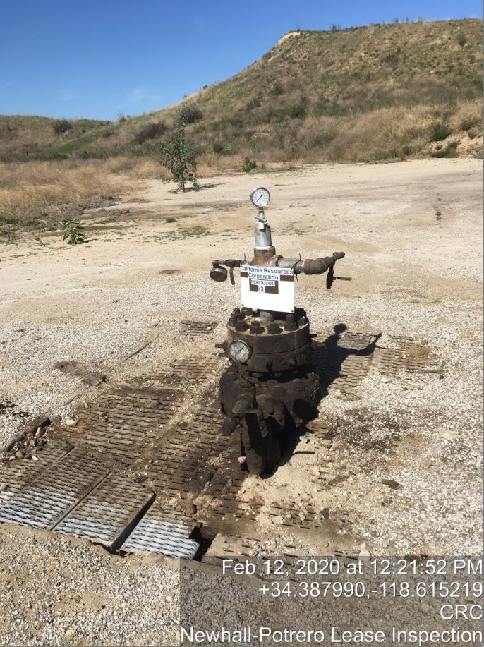
Ferguson 3 (photo from its well records)
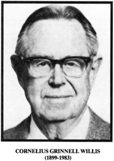
The original holder of the Ferguson lease, Willis was a geologist and petroleum engineer..
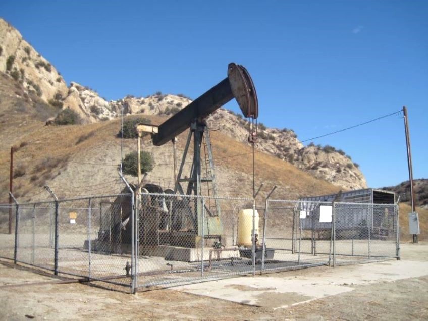
Another view of Ferguson 8 (10/20/2014)
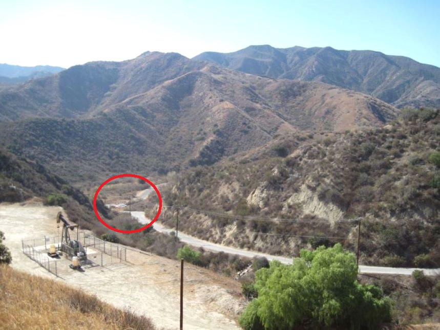
Ferguson 8. Looking south over the well site to the "Y" parking area (in red circle) and the road to Mentryville. (10/20/2014)
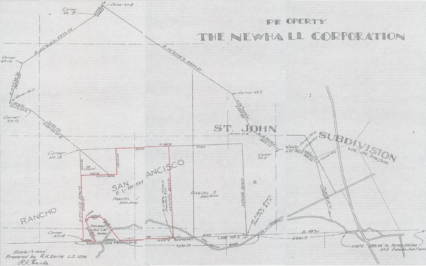
Here are the three map pages at the end the Ferguson lease roughly pasted together. The area in red is the original land leased based on the legal description in the lease. It is indicated on the map as "Parcel 1". To the right (east) of Parcel 1 is Parcel 2, evidently added to the original lease from the lease amendment. Both parcels were 500 acres, so the map does not look quite right.
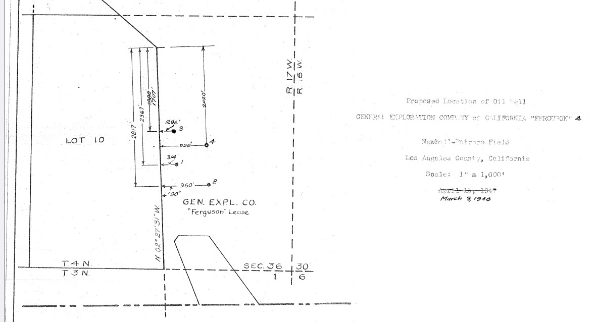
1948 map showing location of Ferguson 1 - 4 (From the Ferguson 4 well records).
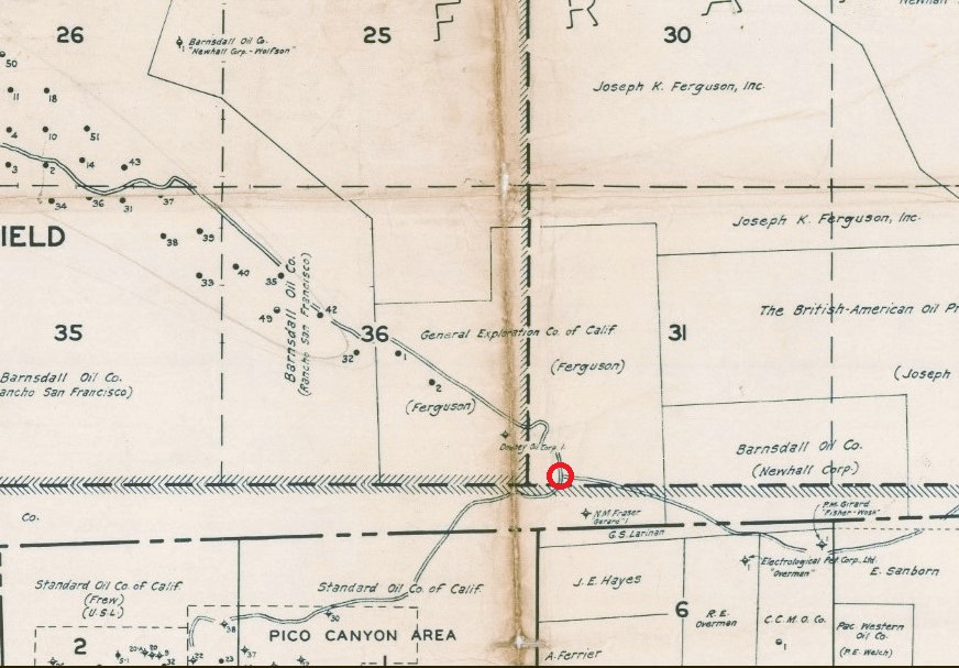
Ferguson claim shown on a 1945 Division of Oil & Gas map. It is adjacent to southeast corner of the Barnsdall Oil Company's Rancho San Francisco claim in the Newhall-Potrero oil field. The red circle encloses the "Y" free parking area at the entrance to the road to Mentryville in Pico Canyon. From here, you can either park for free and walk or drive down to the pay parking lot at Mentryville.