Geology and Structure
Winterer & Durham provided a fine geologic map of the Potrero Canyon area in their 1962 U.S. Geological Survey Professional Paper 334-H. Below is a close-up showing the oil field with Pico Canyon at the bottom. The complete (and easier to read) version with legend can be seen here.
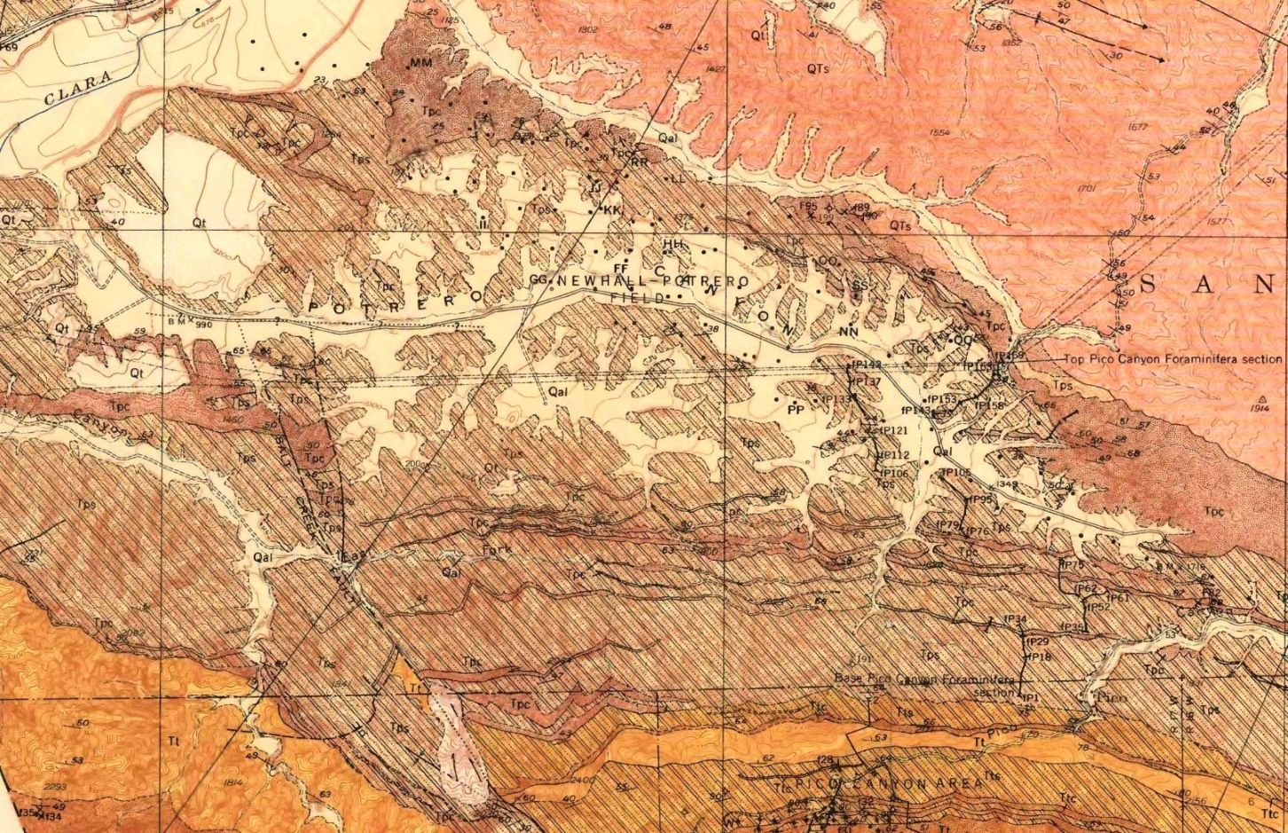
Plate 44 from Winterer & Durham, 1962 (see sources)
Youngest=>Qal: alluvium, Qt: terrace deposits (Upper Pleistocene & Recent); QTs: Saugus formation (Pliocene & lower Pleistocene); Tps,Tpc: Pico formation (Pliocene); Tt,Ttc,Tts: Towsley formation (Upper Miocene & lower Pliocene)<=Oldest
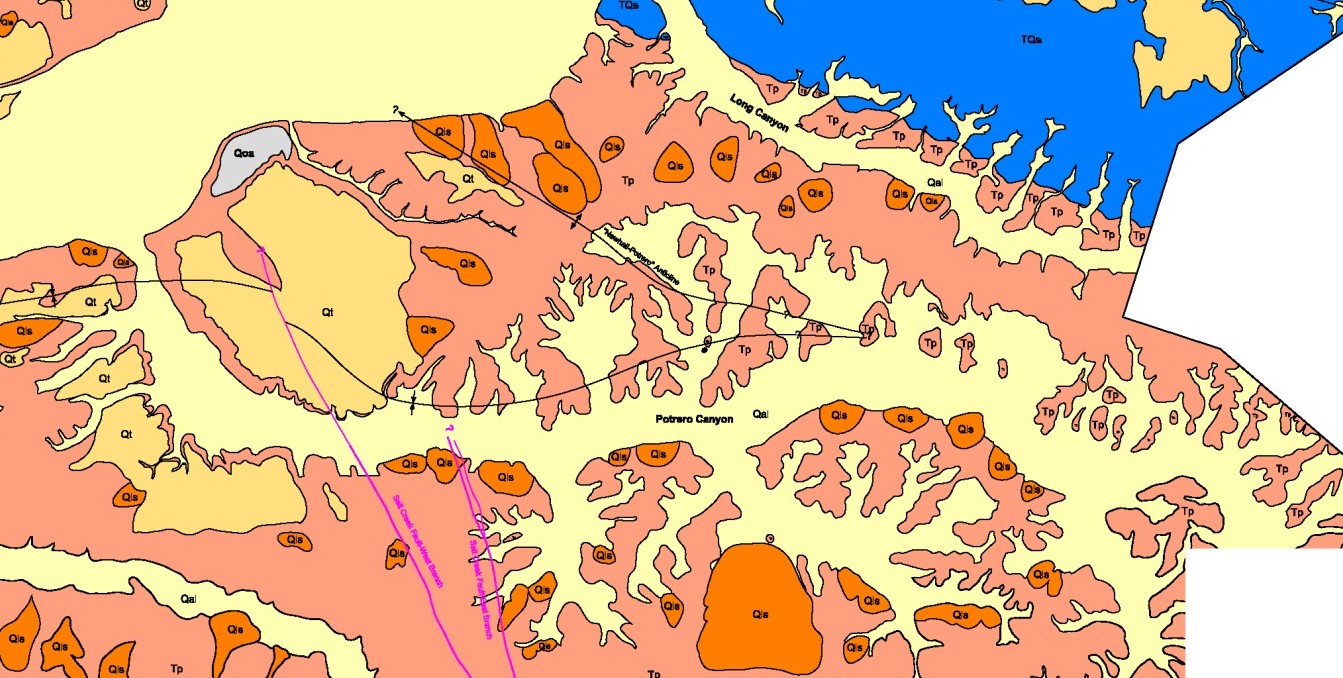
This less-busy map is from the Newhall Ranch draft environment impact report. The complete map can be seen here.
The underground structure of the Newhall-Potrere oil field is more complicated than the nearby Pico Canyon field, just to its north. While the Pico field is on the north slope of the sharply folded Pico anticline, the Newhall-Potrero field is on a long, narrow, faulted, northwesterly-plunging, asymmetrical anticline parallel to the Pico anticline. Dips on the north flank average 40 degrees while dips on the south flank average 70 degrees.
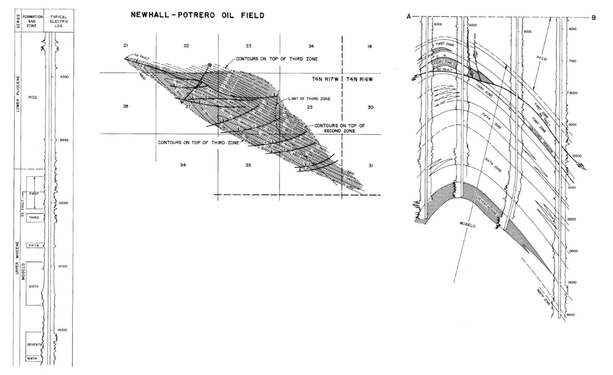
Drilling on the Newhall-Potrelo field showed that there were seven oil producing pools or zones at various depths. Here is a chart showing when each zone was discovered, by what well, and at what depths.
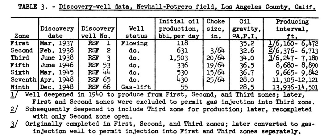
From Loomis, Fried, & Crowell, 1952, Table 3, p. 6 (see sources)
The following is a section of a diagram showing a north-south cross-section of the underground structure of the Pico, Newhall-Potrero (N-P), and Castaic Junction fields (from Gordon, 2020). It includes the oil-producing zones in green. The amount of folding and faulting is very significant and determined where the oil pools were. The structural top of the Pico anticline is much higher than that of the N-P anticline. You can follow the Towsley and Monterey (Mohnian) formations as they drop steeply down the Pico anticline until they reach the N-P anticline, where they makes a small up loop and then more or less level out under the Castaic Jct. field. The oil in the Pico anticline migrated up into shallow pools near the top while the oil in the N-P anticline formed in many pools deeper down. That explains why the Pico wells were only hundreds of feet deep while the N-P wells were thousands of feet deep. The complete diagram (with legend) can be seen here.
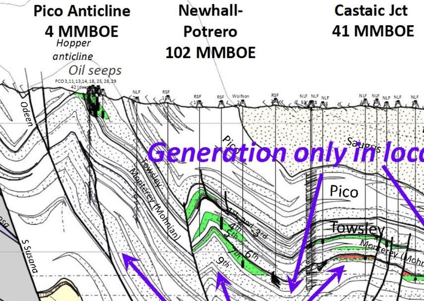
From Gordon, 2020, p. 15. MMboe = millions of barrels of oil equivalent - the amount of energy that is equivalent to the amount of energy found in a barrel of crude oil.
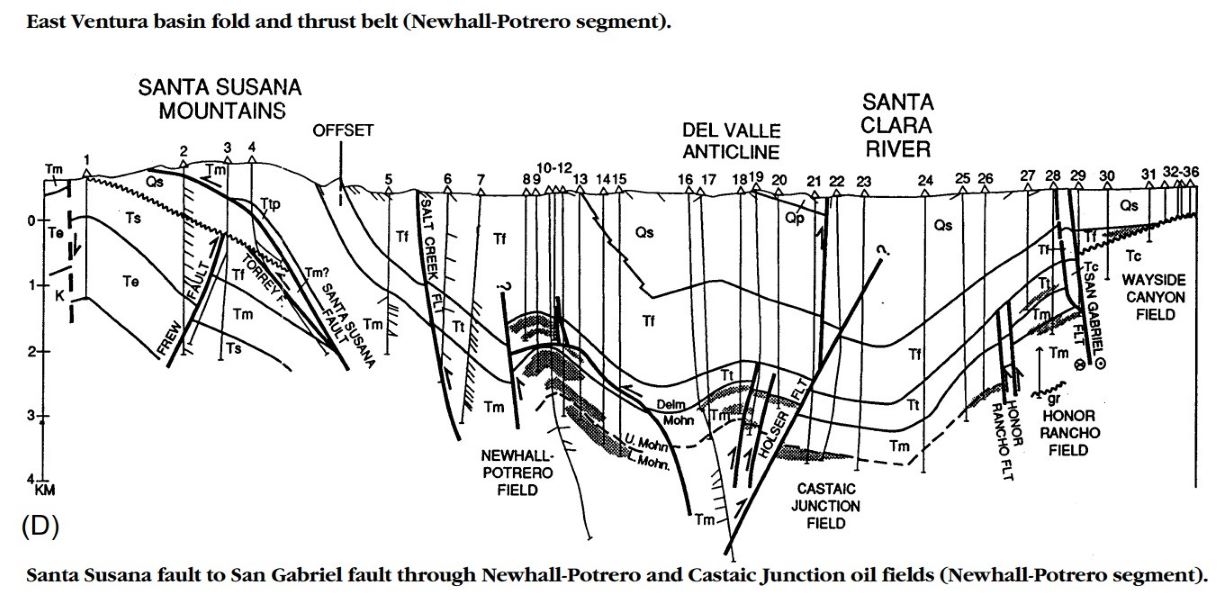
An earlier version appeared in Yeats, Huftile & Stitt (1994). The geologic formation names are: Qp - Pacoima, Qs - Saugus, Ts - Sespe, Tf - Fernando (now called Pico), Tm - Modelo, Tt - Towsley, and Tc - Castaic. The "Q" stands for Quaternary and the "T" for Tertiary. The Tertiary formations are older than the Quaternary formations. The numbers (1-36) indicate well numbers. While drilling, the types of rocks encountered are reported in the well records. These are used to plot out the underground geology. The authors stated (p. 1062) that "prior to post Saugus tilting, the Newhall-Potrero structure was a southwest-facing monocline controlled by a reverse fault that has not continued upward into strata younger than Modelo Formation. The Newhall-Potrero anticline cannot be a fault-propagation fold because it lacks a backlimb; the northeast limb formed after the monocline did."
This contour map and cross section is from the Geology and Oil Development History of the Ventura Basin, Ventura-Ojai-Santa Paula-Piru-Castaic Junction, Field Trip Guide, Gregg Wilkerson, November, 2018, p. 124. Wilkerson's source for the diagram is a CalGEM (formerly the Division of Gas & Geothermal Resources) document, although he doesn't identify the actual document. Slightly larger version here.