Tunnel Area Photos
The Tunnel area contains a lot of trash and the refinery is a mess. Warning: the refinery, including Beale's Cut, is on private property. Even as late as 1988, the refinery was fined for excessive sulfur dioxide emissions so there are hazardous wastes there.

Here is the gate at the entrance of Remsen Street. This road used to be called Clampitt Road, but part of it was changed to Remsen for some reason. The road into the old Newhall Refinery is still called Clampitt Road. The sign says "Property of the City of Santa Clarita". They (actually us since we are the city) only own a section of the Remsen Road and none of the land. The land is owned by Forum Engineering (at least as of 3/2010). The locked gate is there to keep out people who used to drive in and illegally dump. The "propery of" sign was taken down in 2011. (photo taken on 2/13/2010)

On the opposite side of the road (the Tunnel area extends west across Sierra Highway) is this Live Oak Manor stone arch gate way. It was built in 1926 by John Olmstead. See the "Live Oak Manor and the Stone Gate Way Arch" webpage for the history of the gate way. (2/13/2010)

This flat area is north and east of the road. Old maps show that there were structures here and there are some foundations still left. (2/13/2010)

Remains of old water well with electric pump on top (3/13/2010)

Next to Highway 14 is the concrete channel of the existing Newhall Creek. The creek starts at the refinery, travels north down the west side of Remsen Street, goes under the road, and follows this cement channel for a few hundred yards. Then leaves this channel and flows northwest for a short distance where is goes under Sierra Highway. (3/13/2010)

Marker for Saugus Pipeline. Based on how exposed the concrete base is, this has been here a long time. I don't know if it marks the position of the pipe in the next photo, but it's in the right spot. (4/3/2010)

Exposed underground gas pipe in the creek next to the road. I don't know whether this is the Midway gas pipeline layed in 1912-13 (see oil history page), but it is at the correct location and is the correct size. There are also other underground pipes here. Here is where Newhall Creek goes north under Remsen Street. (3/13/2010)

Here is where Newhall Creek goes under Sierra Highway (3/13/2010)

Remsen Street (2/13/2010)

From the high ground looking north at the intersection of Remsen Street and Sierra Highway. You can just see the Live Oak Manor stone arch and my white pickup truck in the distance. (2/13/2010)

Looking toward the south, you can see the flat middle area and the higher Newhall Refinery in the distance with Highway 14 on the left (east) and Sierra Highway on the right (west) (2/13/2010)

Newhall Creek (3/13/2010)

Head of Newhall Creek looking north. The refinery is behind me. (4/3/2010)

Large flat area in the middle of the Tunnel area looking toward the west (2/13/2010)

Large palm tree among the oaks (2/13/2010)

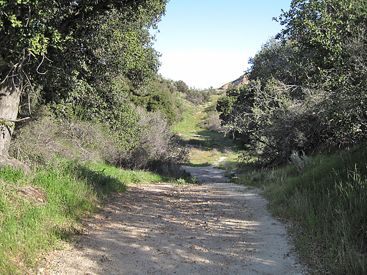
Old road to Zenith 6 oil well site (2/13/2010)

Like the oaks in Elsmere Canyon, the oaks here were also tagged probably for the lone gone Valley Gateway project of the early 1990's (2/13/2010)

A lot of trash piled up. Some of those cans look like you should stay away from them. (2/13/2010)

Same trash looking east (2/13/2010)

In the trashy area is this capped pipe sticking out of the ground. It has a welded cap just like an abandoned well should have, but there is no physical evidence around the pipe that indicates that it was an oil well and DOG records do not show an oil well here. (2/13/2010)

Looking south from the trashy area you see that you are below the northern edge of the refinery (2/13/2010)

Water tank (2/13/2010)

Los Pinetos Road Highway 14 underpass looking east. This underpass is considered important because animals can travel back and forth under the freeway here (a wildlife corridor). It's a lot safer for them then trying to cross the freeway. The underpass is 82 feet wide by 142 feet deep and from 20-25 feet in height. (2/13/2010)

Same underpass from other side looking west. We are now at the eastern edge of the Tunnel area. There is a road coming down from the right (north) that you can hike which meets up with the Elsmere Canyon trail. The gate to this road is about at the start of public land. There is also a utility road the parallels the freeway on the left (south). This is private property, but the road eventually joins another road that goes north and runs into the Elsmere Canyon road that comes up from the south face of the canyon. There were some oil wells in this area. (2/13/2010)

In June of 2011, a study of the wildlife of the Los Pinetos Underpass was completed at the request of the MRCA as part of the Senior Practicum in Environmental Science at UCLA. Here is one of their cameras just outside the eastern entrance to the underpass. (6/9/2011)

Entering the refinery on Clampitt Road (more photos on refinery page) (11/29/2009)


