Rice Canyon, Santa Clarita, California
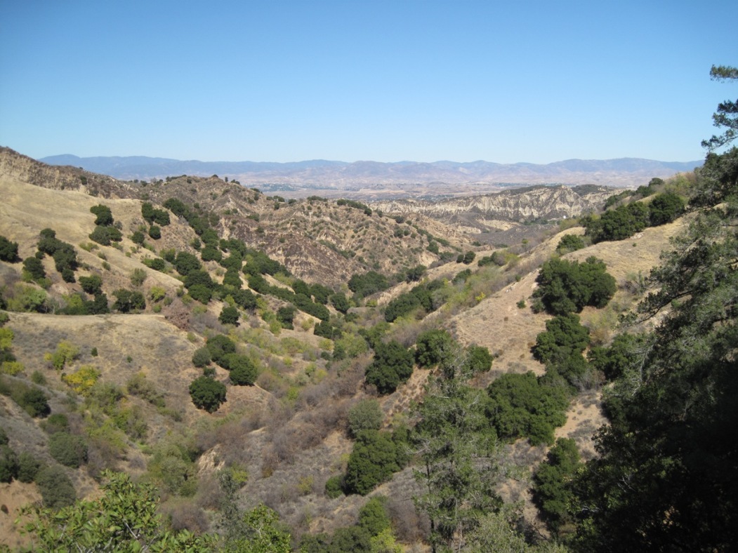
Northeast view out of Rice Canyon (photo taken on 10/17/2009)
Rice Canyon is east of Wiley Canyon and Leaming Canyon and is a tributary of East Canyon. It bisects the Pico Anticline just like Pico, Towsley, and Wiley Canyons. It was named for Joseph Rice, who filed the first claim in 1865. Around 1900, another Rice, Wilbur P., bought land in the canyon around 1900 and drilled wells there. He was not related to Joseph.
Rice Canyon was mentioned by Peckham in his 1882 report of his travels to the region in 1866, but not by name. It was called Grizzly Run Canyon in a Los Angeles County Miscellaneous record in 1865 (Los Angeles County Recorder Records Miscellaneous, Book 1, Page 209) which consolidated the Rice Petroleum Mining Company and the Grizzly Run Petroleum Claim, both in today's Rice Canyon.
The first mention of Rice Canyon that I have found is from the "Resources of the Pacific Slope" by J. Ross Browne (San Francisco, I.H. Bancroft and Company, 1868) on page 262:
"The oil stratum varies in width, being in some places a mile or more, as in Rice canon, in others only a few hundred feet; but is continuous for many miles."
Rice's claims were bought by Dr. Vincent Gelcich in the 1873 and then bought by Charles Felton for Pacific Coast Oil in 1880.
There were 14 documented wells drilled in Rice Canyon starting in 1899. In 1936 there was a major plane crash in the canyon that killed 12 people.
The land up the canyon east of the creek bed up to the top of the ridge between Rice and East Canyons is still privately owned. See below for maps.
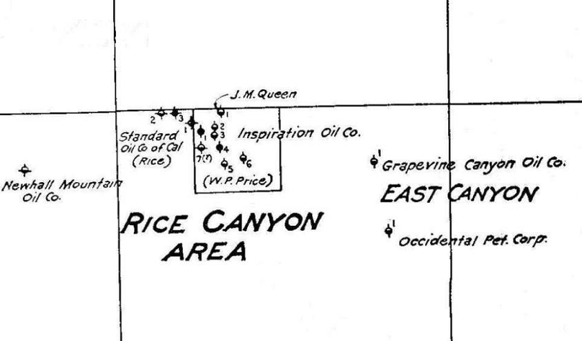
Here is a map from 1934 showing the Standard land (the old Rice claim) and the W.P. Rice (misspelled as Price) land. That W.P. Rice square is still privately owned.
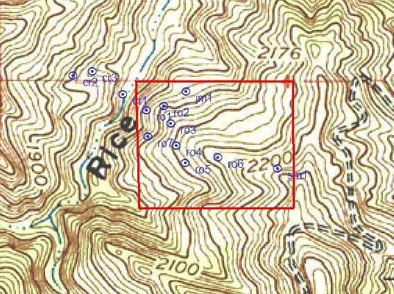
On a topo map you can see the approximate outline of the land not owned by Standard. The Standard land is now owned by the Santa Monica Mountains Conservancy, but the private area is still private. That is why there is no official trail from the East Canyon road shown on the right down into Rice Canyon, although now there is one now (2022).
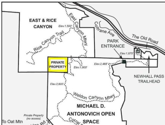
Here is a map from the Santa Monica Conservancy website also showing that the land is privately owned.