Locations of some Newhall Townsite Wells
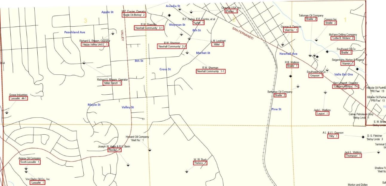
Part of Map 254 from the old Division of Oil, Gas & Geothermal Resources (DOGGR). The locations of many of the Newhall Townsite oil field wells are shown (names in red boxes). I added some of the modern street names in blue. Note how large the oil field is. Some of the top (north) has been cut off. It appears that DOGGR put every well that wasn't part of one of the canyon oil fields into the Newhall Townsite oil field. Larger version of this map here. Original full PDF Map 254 from DOGGR here. DOGGR estimated the GPS coordinates based on the locations given in the well records. GPS didn't exist when the Newhall Townsite wells were drilled.
Some of the well records contained rough maps showing the location of the wells. When I could, I compared the map with a modern aerial photo (from Google Maps). Some I couldn't do that, so only the maps are shown.
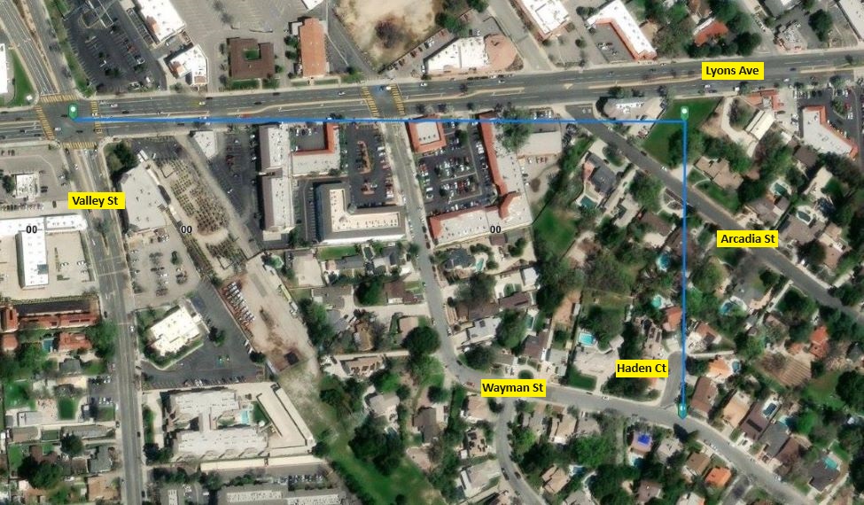
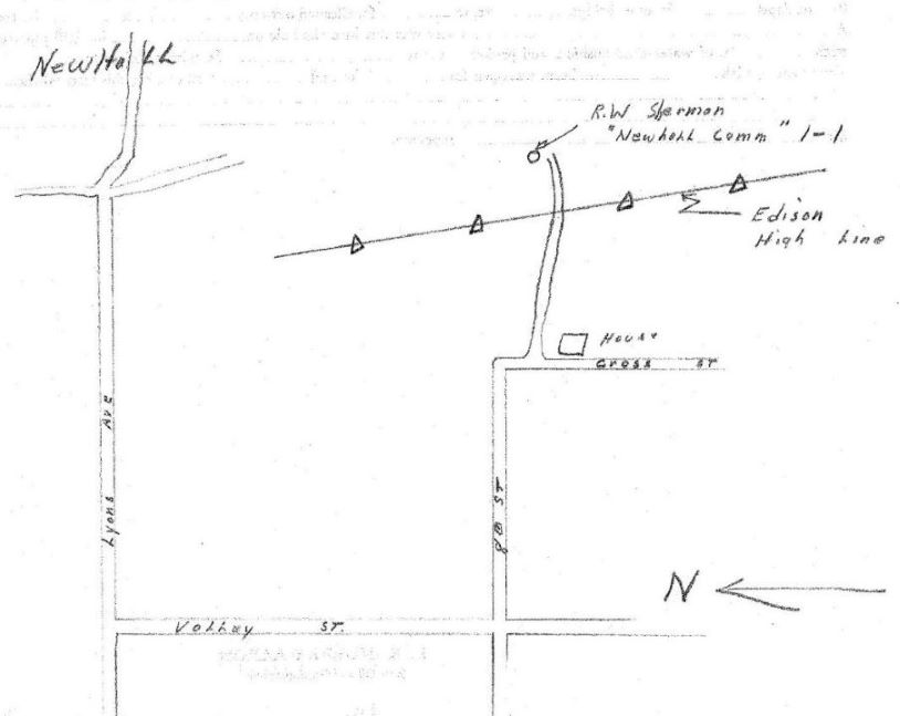
The first well we will look at is the Newhall-Community 3-1 (API No. 037-13240), the well that started all the excitement in Newhall. There was no map in the well records, but its location was stated as "approximately 1550 feet easterly & 800 feet southerly at right angles from the center line intersection of Valley St. and Lyons Ave." Plotting those directions on the PLSS map viewer website, we get the above aerial photo. Lyons Ave. does not run exactly east/west so a line directly to the east from the point of intersection of the two streets would be a little below Lyons. The website does not give street names, so I added them. From the map, the well location was near the intersection of Wayman Street and Haden Court, but it's hard to tell how accurate the directions were. In 1986, the Division of Oil & Gas tried to located the well, but couldn't find it.
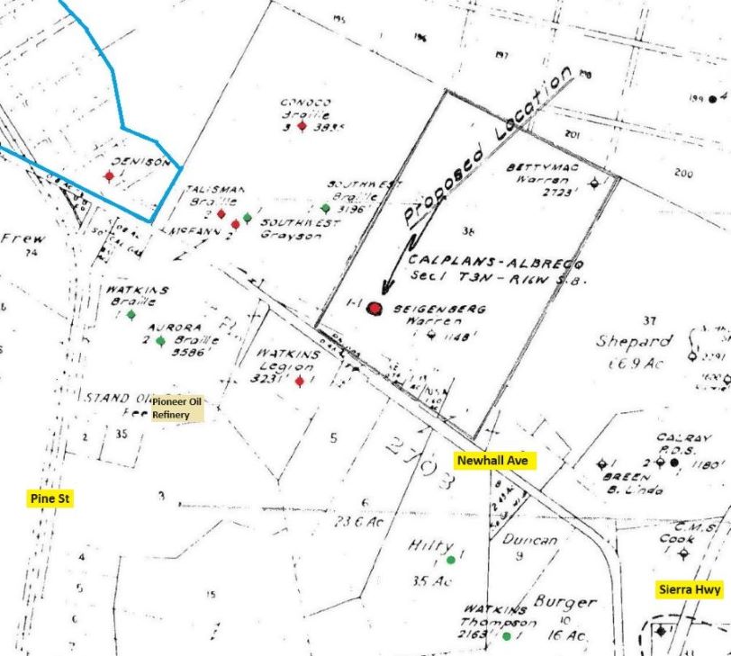
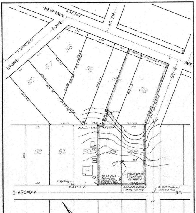
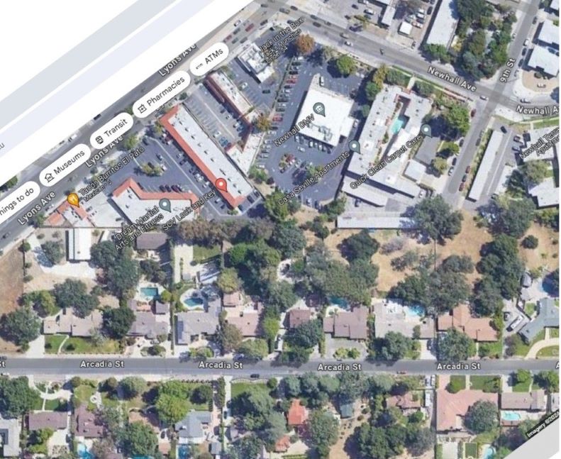
Map showing the proposed location of the Calplans-Albrecq No. 1 oil well from the well records for that well (037-21888). The map shows the eastern end of the Newhall Townsite oil field and I added the modern street names. Newhall Avenue was San Fernando Road at that time. I have colored the wells that were part of the Newhall Townsite field. Red means no oil was found and green means oil was found. Note that only one well (Denison 1) was in the original Newhall townsite area (enclosed by blue line). Original map from well records seen here.
Location of Eagle Oil Bishop 2 well (037-12808). Original map here.
Location of Lutge 1 (037-13121). Original map here.
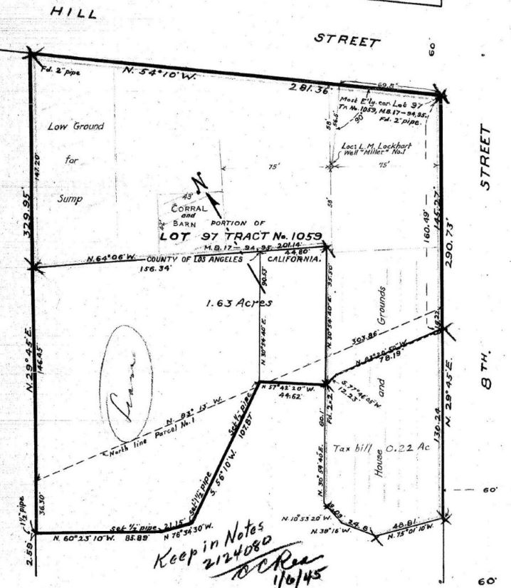
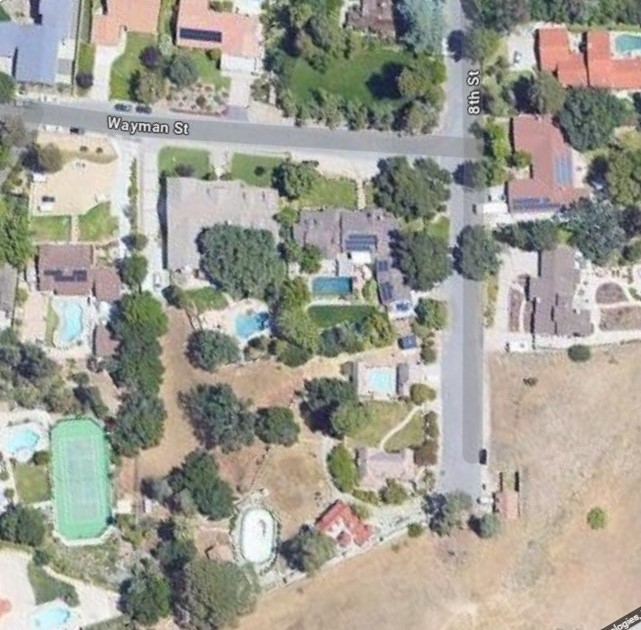
Location of Miller 1 (037-12817). Hill Street is now Wayman Street. Original map here.
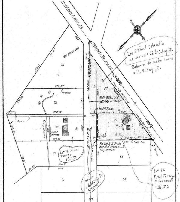
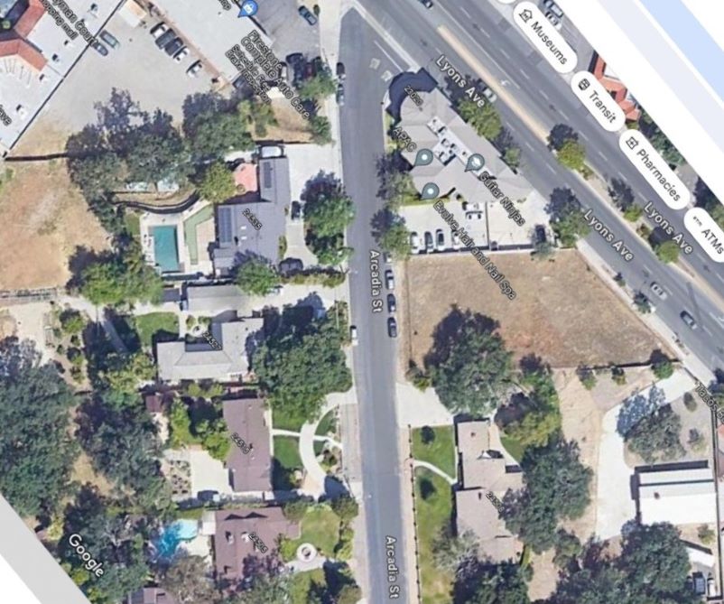
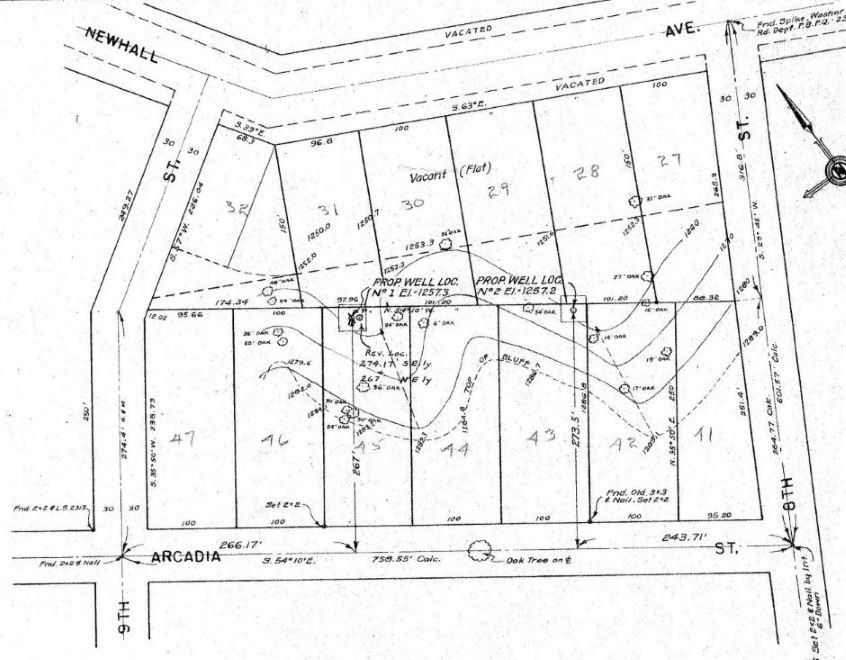
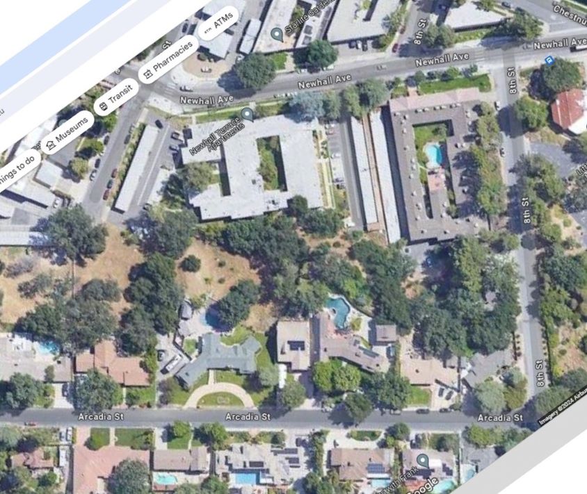
Location of Newhall Community 1-1 (037-13238). This hand-drawn map is way out of proportion as you can tell from the aerial below. Original map here.
Location of Phillips 1 (037-12811). Original map here.
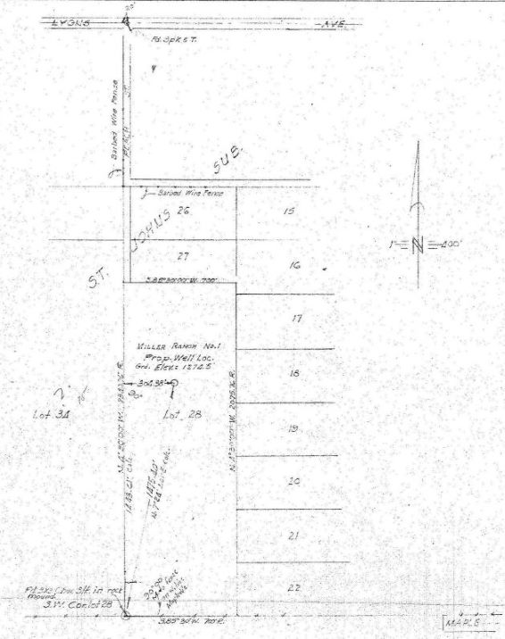
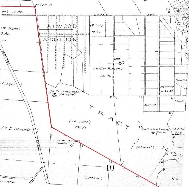
Location of Miller Ranch 1 (037-13212). This well will take a few more steps to show in a modern aerial. We see Lyons Ave. on the top, Peach (now Peachland) St. perpendicular to Lyons, and Maple on the bottom. Original map here.
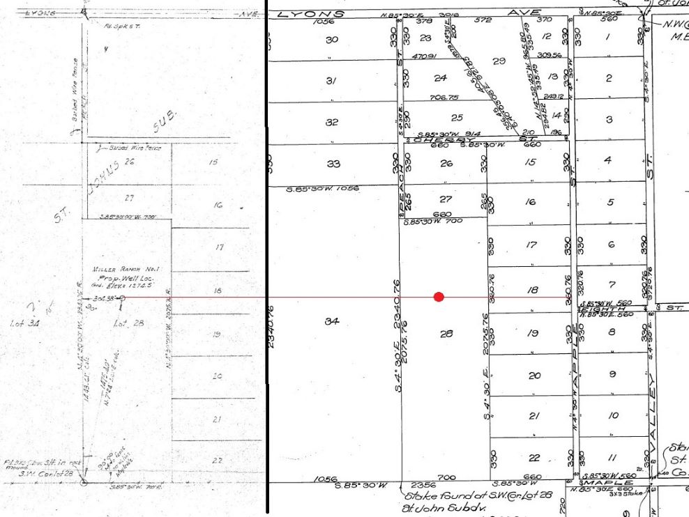
To get more details, I have pasted next to it part of the map for Tract 1437 (full tract map here) showing the same area. I have also added a red dot where approximately where the well was on that map.
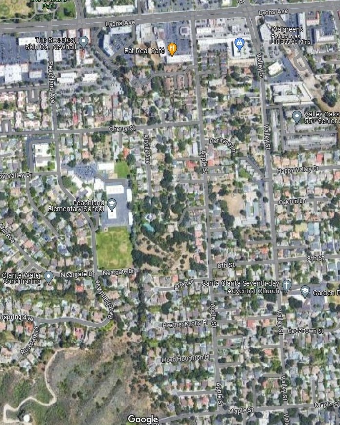
Here is the aerial view. The area is really too big to get a good view.
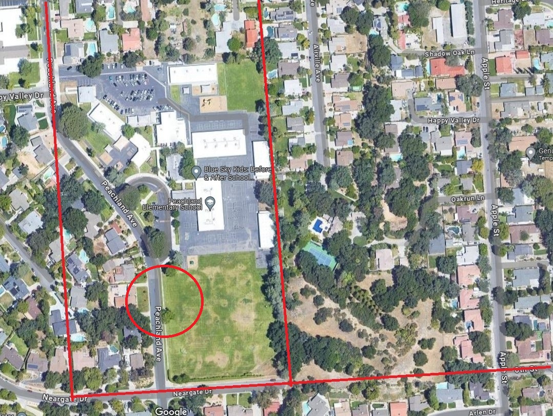
Even though we zoomed in, it is still somewhat difficult to put a dot where the well was, so I put a circle where I think the well was. The red line at the bottom is the extension of Eighth St. The line on the left is the straight line extension of Peachland from Lyons. The line on the right is the estimated east border of Miller Ranch.
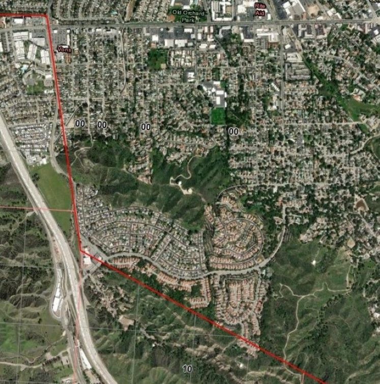
There was a second map in the in Miller Ranch 1 (037-13212) records showing a larger area. I added the red line on both the map and the aerial photo. Original map here.
The next group of maps from the well records do not have aerial maps associated with them.
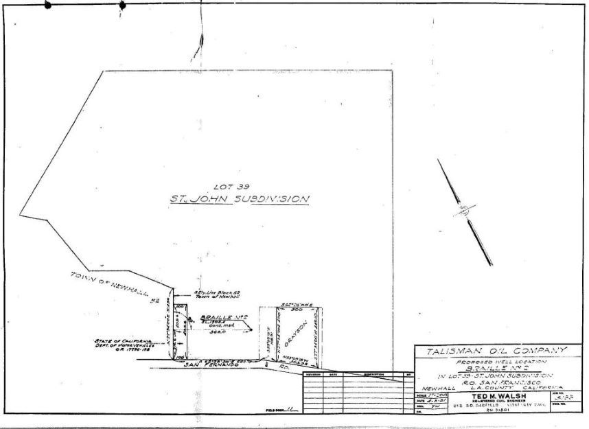
Braille 2 (037-12833). Original map here.
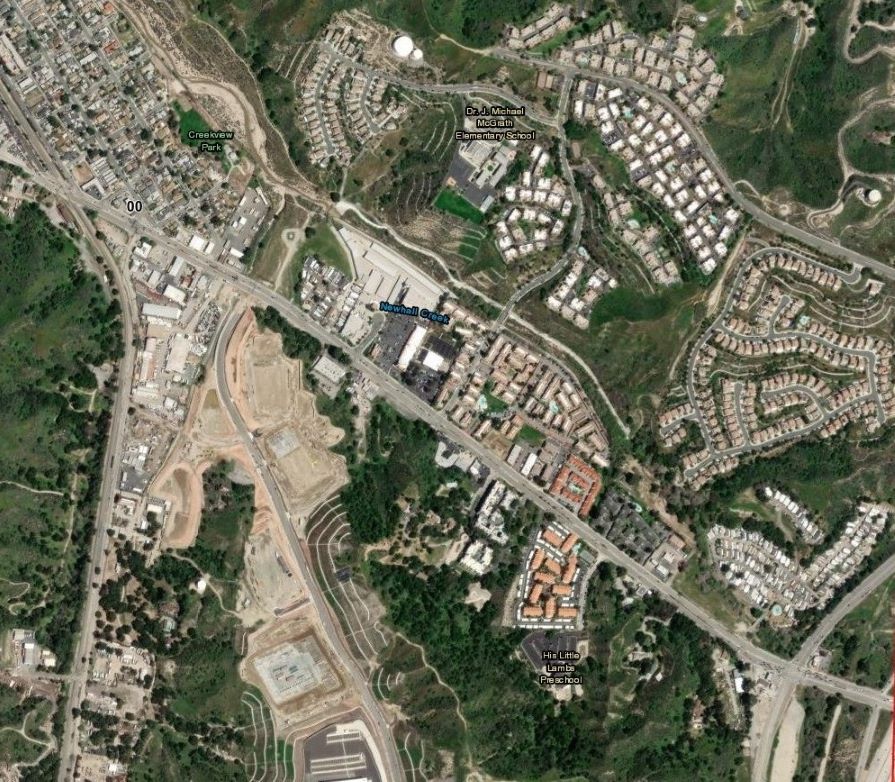
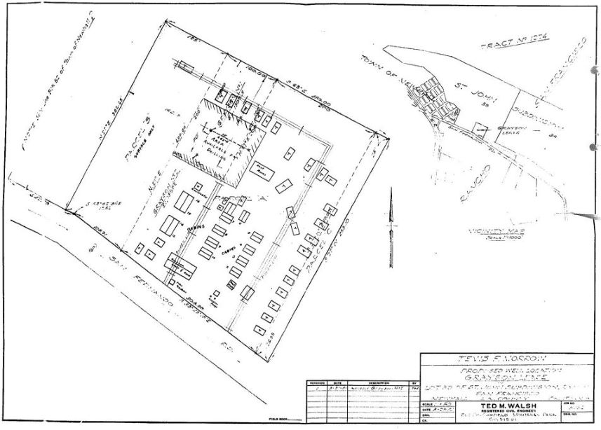
Grayson 1 (037-13243) had two maps associated with it. The one above (original map here) and the one below (original map here). The below map shows Art Grayson's Shady Auto Park (now called the Newhall Mobile Home Park on Newhall Ave.).
Happy Valley Unit E 1 (037-13211). Original map here.
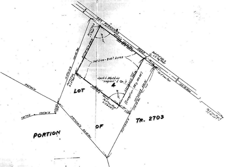
Legion 1 (037-12842). Original map here.
Lottie B McFann 2 (037-13138). Original map here.
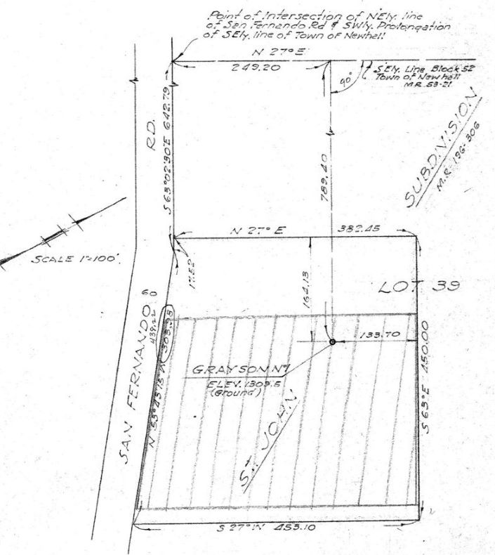
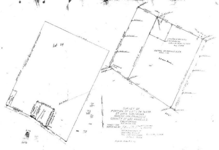
Lot 39 of the St. Johns Subdivision was the location of many wells including Grayson 1, Calplans-Albrecq 1, and some of the Braille wells. For your information, here is where that lot was located - just north of Newhall Ave. east of its intersection with Railroad Ave. (now Pine St.) and the railroad tracks. It is also north of the Pioneer Refinery, called "Refinery" on this map.
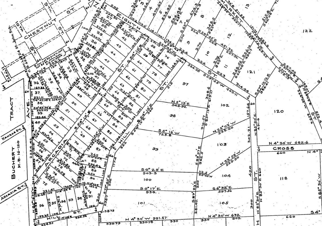
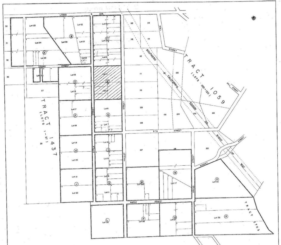
Tract 1059 was also mentioned in some of the well locations. Here is part of that map. Newhall Community 1-1 was in Lot 121. Newhall Community 2-1 was in Lot 121. Newhall Community 3-1 (based on my estimate) was in Lot 86 or 87. The full map can be seen here.