TUNNEL STATION BRIDGE, City of Los Angeles, California
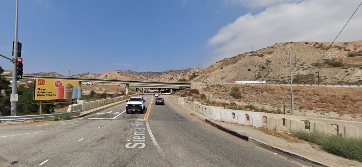
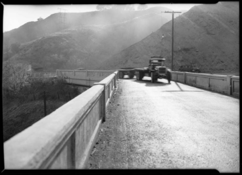
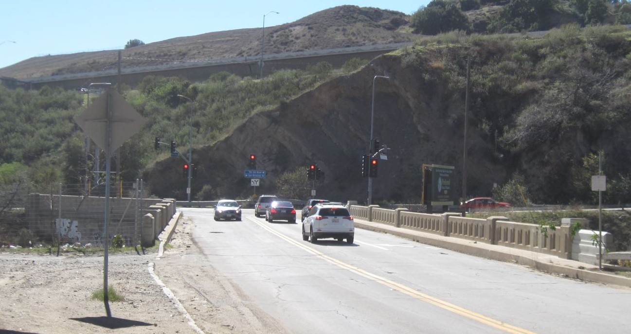
The white truck coming at you is on the Tunnel Station bridge. Image from Google Maps (taken September, 2024).
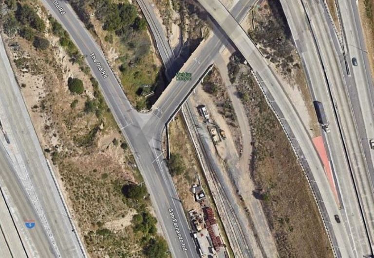
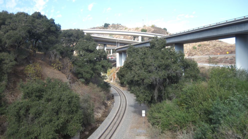
View from above also from Google Maps.
1875-1906: TUNNEL STATION
In the Newhall Pass, below the junction of the 14 and 5 freeways, at the southern end of Sierra Highway, where it makes a "T" connection with The Old Road and San Fernando Road, there is a small three-lane bridge that spans the railroad tracks. This is the Tunnel Station bridge. It is also sometimes called a viaduct. Tunnel Station was a railroad stop just to the south of the south portal of the San Fernando railroad tunnel. Work began on the tunnel in March of 1875 and by the end of that year, the laying of the tracks was completed from Los Angeles up to the south portal of the tunnel. Soon after that, Tunnel Station was built.(1) While the tunnel was being bored, trains from Los Angeles and San Fernando would unload their supplies and passengers at the new station and then return. Passengers still traveling north would take a stagecoach to Lyon's Station through Fremont Pass (now called Beale's Cut) and then to Andrew's Station.(2) The tunnel was considered complete after the timbering of the tunnel was done in August of 1876.(3)
The below photo, taken in 1877, shows the railroad line and Tunnel Station. The south portal of the tunnel in the distance (in the red circle). There is also one siding next to the main tracks. The siding was probably constructed at the same time the tracks were laid. Today, the sidings (there were once multiple sidings) do not connect to the main track and there is no depot. Trains don't stop there anymore, although the Tunnel Station designation is stil indicated on many modern maps. Various topo maps of the area can be seen here.
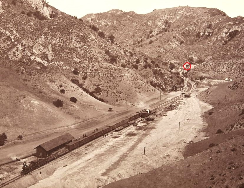
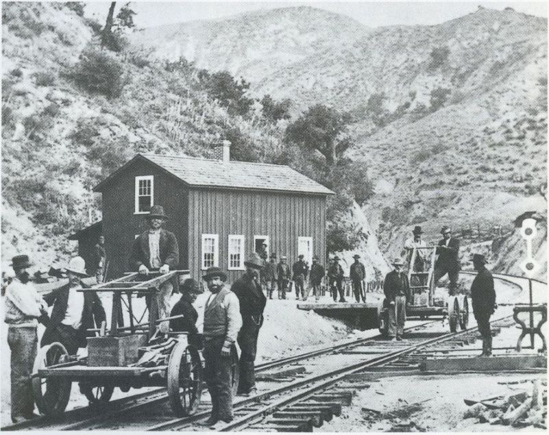
Photo by Carleton Watkins of Tunnel Station taken in July or August of 1877. View north towards the south portal of the Newhall train tunnel, which is barely visible in the distance in the red circle. The building parallel to tracks at the lower left where the train is stopped is the depot/bunkhouse.(4)
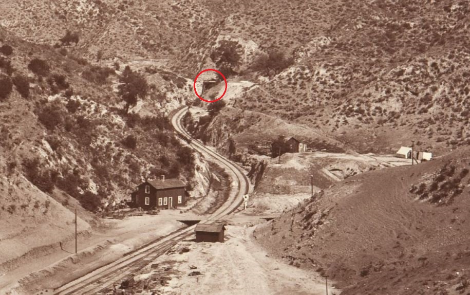
Closer view of the previous photo. The road to the Fremont Pass (Beale's Cut) heads to the right in front of the two-story section house where there is a little bridges over the gully at the left of the railroad tracks. The Tunnel Station bridge would eventually be built there. A section house was used for housing railroad workers and/or equipment. In the right center, on the right side of the tracks is a bunk house. In front of the section house, also on the right side of the tracks, is a tool house. The tents on the far right center may be the last remnants of one of a Chinese worker camp. They were reported to be living in white tents. At the bottom left of the photo on the right siding, are the two personal railroad cars of Carleton Watkins. One was for his and his assistant's living quarters and other one was for his photographic equipment and supplies. The middle white structure could have been his portable dark room.
This photo was in the Valley Times of October 28, 1948, and is another photo taken by Carleton Watkins in 1887 while he was here. It shows track gangs gathering at the section house preparing to go to work. The photo is supposed to be in the Union Pacific Museum, but I couldn't find it. The quality of the photo in the newspaper was very poor, but I was able to find a better copy in the book Railroading through the Antelope Valley, by Phil Serpico, Omni Publications, Palmdale, Ca., 2000, p. 75.
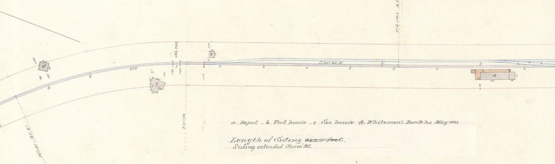
1883 diagram of the layout of San Fernando Tunnel Station. It shows the buildings in the above Watkins' photo. (Los Angeles County - San Fernando: Southern Pacific, San Fernando Tunnel Station plan, Nineteenth-century Southern Pacific and Predecessor Companies Station drawings, MS 872, California State Railroad Museum Library & Archives, Sacramento, California.) Complete layout here.
1907-1912: FIRST BRIDGE
There had always been a problem getting through the Fremont Pass due to its steep grade approaching both portals (about 22-26%). It was reported to be the "steepest hill in the United States on a public road."(5) The 1900's brought even more traffic and the introduction of the automobile. Something had to be done to lower the grade. There was also another problem down at the Southern Pacific railroad tracks near Tunnel Station. The train had to be stopped if travelers to Newhall/Saugus needed to cross the tracks and there were apparently multiple places for them to cross the tracks. To be safe, any train going either direction had to slow down, even if they didn't need to stop at Tunnel Station. Something had to done about that.
In October of 1907, the Los Angeles County Highway Commission, based on the advice of chief Engineer Arthur L. Loder, recommended to the Los Angeles County Board of Supervisors the replacement of Fremont Pass with a tunnel .(6) This work would include the improvement of San Fernando Road at both approaches to the new tunnel and other road improvements in the county. When the entire work was completed it "will do away with several dangerous railroad crossings and curves."(7) Although not stated in the article, this could only be done with a bridge.
The Supervisors agreed but money was needed. A bond issue of $3,500,000 was planned, but needed to be approved by the voters of the county. To get the public interested and excited about the project, a "Good Roads" campaign was begun touting all the benefits of the planned road improvements in the county. The campaign was successful and the bond issue was easily approved on July 31, 1908.(8) The plans and specifications still had to be completed. The Highway Commission finally submitted them to the Board of Supervisors in November of 1909.(9) The contract for the tunnel work (but not the Tunnel Station bridge) was given to E.E. Shaffer. He began work at the end of December of 1909.(10) The tunnel was finally open to the public on December 21, 1910, almost a year after the work had started.(11)
However, the Tunnel Station bridge still needed to be built. In January of 1911, the Los Angeles Times reported that plans have been prepared and approved for road work on the south side of the Newhall tunnel to the upper end of Los Angeles aqueduct and would include a "massive reinforced concrete viaduct crossing Southern Pacific tracks at Tunnel Station." The roadway would also be constructed on the west side of the railroad tracks, where it is today, eliminating three dangerous railroad crossings. The planned work was supposed to be completed during the early spring.(12) The contractor was not named and I could not locate it even after much research. The Engineering News of May 25, 1911 (Vol. 25 No. 61), also mentioned the viaduct using about the same news as was in the Times.
In the Los Angeles Times of July 13, 1911 we are told that the bridge has not been completed yet. "Only one large bridge remains to be completed, that crossing the Southern Pacific at Tunnel station." The status of the bridge is not mentioned in the Los Angeles Times of July 22, 1911, where it was reported that "a project is afoot to do away with several bad railroad crossings, by making a new highway parallel to the line." A later Times edition said that the "Southern Pacific is interested in the move, and may contribute to the expense." They would eventually pay $5,000.(13)
Since construction of the bridge was going on in July, it had to have been finished by the end of 1911. It wouldn't have taken more than five or six months. In March of 1912 it was reported that "Contractors are now finishing the grading on the Newhall tunnel road. It will be soon ready for macadamizing [covering it with small, closely packed broken stone]. The county bridge will pass over the Southern Pacific tracks, so that motorists will in future be able to avoid the dangerous grade crossing at that point."(14)
The new bridge was 22 feet wide. The road is called San Fernado Road. Tunnel Station viaduct, Los Angeles Times Photographic Archives, UCLA Library Special Collections, Charles E. Young Research Library, University of California, Los Angeles. Published in the Los Angeles Times of July 1, 1928.
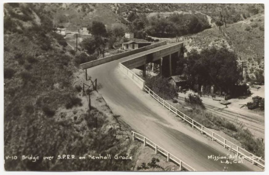
From California State Library, Photographic postcards. "View of a bridge over Southern Pacific Railroad tracks on the Newhall Grade in Los Angeles County; buildings along tracks near bridge; solid concrete rail along edge of bridge; rail-fence along edge of road." Mission Art Company, Los Angeles, California, publisher. Ca. 1920's. This photo looks slightly newer than last photo because, unlike the last photo, there is a white picket fence in this one.
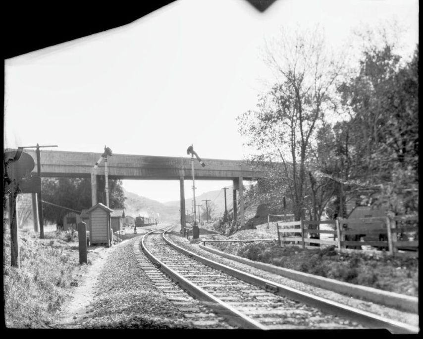
1928. Looking southeast. From the California State Railroad Museum, CSRM Negative Collection.
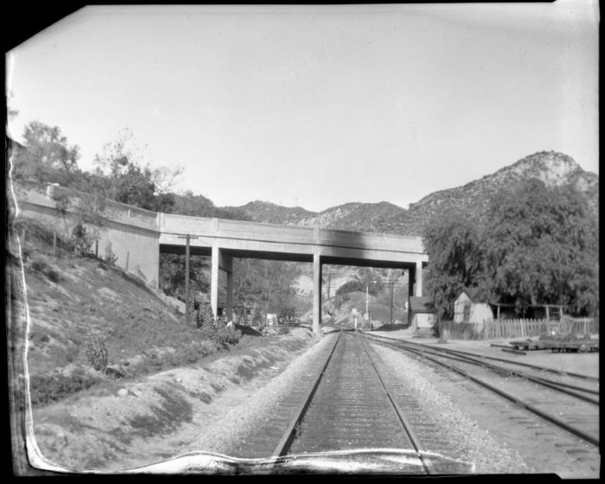
1928. Looking northwest. From the California State Railroad Museum, CSRM Negative Collection.
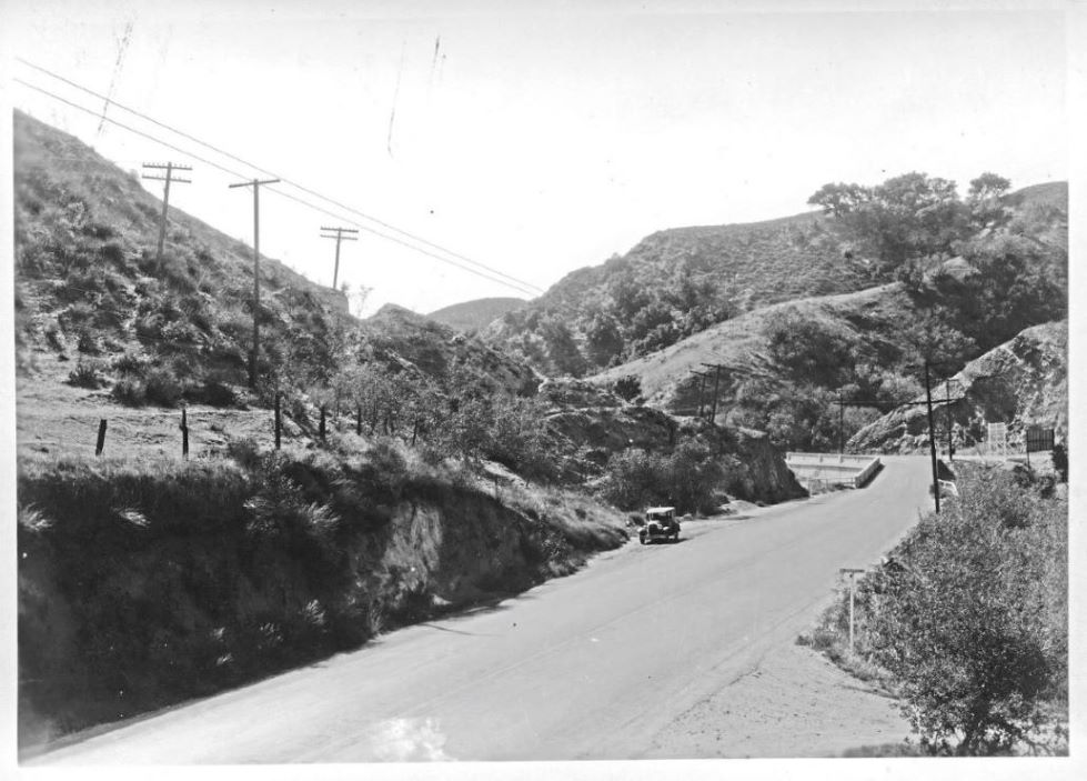
Approach to the bridge from the south side. Note on the left that construction has started on Highway 99, the so-called "Newhall Cutoff." That would be completed in 1930. Today it is The Old Road. No construction in previous two images, but this photo also shows the same fence as was in the last photo. Title: "Roadway near Newhall, Southern California, 1929." Dick Whittington Photography Collection 1924-1987, USC Libraries Special Collections, University of Southern California Libraries.
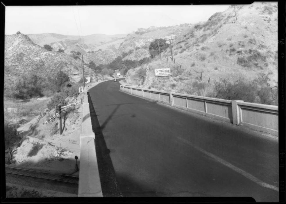
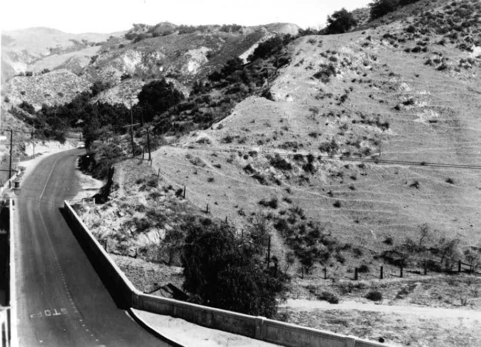
View towards the north over the bridge. Past the bridge on the left is the entrance to "Canyon Park" in Weldon Canyon. "Roadway near Newhall, Southern California, 1929." Dick Whittington Photography Collection 1924-1987, USC Libraries Special Collections, University of Southern California Libraries.
On the bridge looking north. "Roadway near Newhall, Southern California, 1929." Dick Whittington Photography Collection 1924-1987, USC Libraries Special Collections, University of Southern California Libraries.
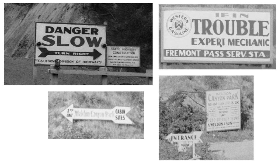
Some of the road signs from the last few photos.
On the bridge looking south. "Roadway near Newhall, Southern California, 1929." Dick Whittington Photography Collection 1924-1987, USC Libraries Special Collections, University of Southern California Libraries.
View south. Photo date October 17, 1933. The turnoff at the bottom right of the photo is called El Portal Road and heads to Weldon Canyon Park. California Historical Society Collection 1860-1960, University of Southern California Libraries.
View towards hillside where extension of Foothill Boulevard will soon be constructed to join with San Fernando Road (now Sierra Highway) just south of the bridge. Note that in the bottom middle of the photo there is now an arch of concrete in front of the barrier in the inner part of the right hand turn. This was not in earlier photos so it must have been added when Highway 99 (now The Old Road) was completed in 1930. Undated, ca. 1933-1934. California Historical Society Collection 1860-1960, University of Southern California Libraries.
1913-1933: BOTTLENECK
Where the new bridge joined San Fernando Road an "L" intersection was created. In other words, the driver going either direction had to make an approximate 90 degree turn. That was a problem. Many accidents were caused from cars going too fast causing them to swerve out of their lane.
The Newhall Signal was founded in 1919 as a weekly newspaper and the tunnel, road, and bridge would become a sore point for them for many years. The Signal of July 28, 1922, reported that many drivers "were unacquainted with the road and did not know of the very sharp angle in the viaduct. The person - whoever he was - who built that viaduct should never have been turned loose to perpetrate such a piece of engineering for public use and we wonder why it has not been remedied long ago. There is no excuse for such a piece of work and it will sometime be changed."
From the Newhall Signal of July 13, 1923: "Although our Chamber of Commerce has appealed to the Auto Club for co-operation in changing the viaduct over the railroad track at Tunnel Station, nothing has yet been really accomplished. It has been suggested that a light be placed there, but what is needed is a change in the course of the boulevard and the sharp corner taken off the viaduct. This is one of the worst pieces of civil engineering to be found anywhere and the only way to rectify the mistake is to partly do the work over."
"Congestion on the San Fernando road is such that relief must be afforded...The amount of travel on this road so limits the 'passing periods' that at certain times of day the speed of traffic is determined practically by that of the slower moving vehicles." - Los Angeles Evening Express, August 4, 1923.
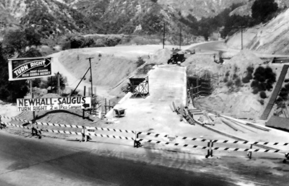
From the Los Angeles Daily News of May 12, 1927, comes the idea of "an extension southerly from a point just east of the viaduct at Tunnel station to the connection with the state highway at the north city limits of San Fernando." This would ultimately be the Foothill Boulevard extension of 1934.
In the late 1920's it was recognized that part of the bottleneck in the Newhall pass area was "at and below Tunnel station." That was the bridge and the sharp turn onto San Fernando Road. The May/June issue of California Highways and Public Works contained an article titled "Breaking the Newhall Bottleneck" addressing this issue. An August 1920 traffic census taken in a 24 hour period through the pass counted 1,207 vehicles. A 24 hour traffic census taken in early 1928 counted 23,160 vehicles.(15) The Los Angeles Times of July 1, 1928, provided a map (see below) showing the plans that were supposed to help alleviate the situation. (An earlier version of the map was in the Los Angeles Times of April 22, 1928.)
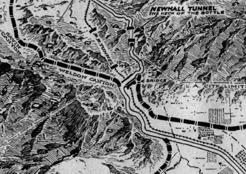
The above plans would include a new Gavin/Weldon Canyon bypass road (today's Old Road) joining San Fernando Road (which today is, from this point and on north through Newhall, is Sierra Highway) just south of the Tunnel Station bridge (where the intersection would still be at a dangerous angle) and a new trunk road connecting Foothill Boulevard to San Fernando Road just north of the bridge. Critics complained that since the main bottleneck occurred at the tunnel, widening the road and doing something about the tunnel should be accomplished first.(16) The plans also provided for the existing road between Saugus and San Fernando to be widened and either the construction of a second tunnel or the "daylighting" (turning it into a cut) of the Newhall tunnel.(17)
The Signal of June 21, 1928, commented against the plans:
"Anyone who has taken a moment's thought as to the junction of the proposed Weldon Canyon road with the present road at the railroad viaduct south of the tunnel, will realize that it means the construction of a death trap that will rival anything in the state. The present sitiuation there is bad enough, but joining the other road on would be ten times worse. And it will take more engineering sense than has been displayed there to solve the problem. In fact, the construction of the Weldon Canyon road will just about force the opening of a new road to the south, for if the through traffic is near as great over it as the engineers seem to think, the use of the viaduct as now situated will be too dangerous for use, in any heavy traffic."
As far as I can tell, no one had been killed in a road accident at this location so far.
The Gavin and Weldon canyons bypass highway was approved. Construction was started in December of 1928(18) and completed in July of 1930.(19)
The Los Angeles Times of March 29, 1929, reported that the "San Fernando Chamber of Commerce and the Automobile Club of Southern Califoria have asked the [Los Angeles] City Council to ... construct an adequate viaduct [i.e. wider] over the Southern Pacific tracks at Tunnel Station. The matter has been referred to the City Engineer and the Council's Tunnels, Bridges, and Viaducts Committee."
The Signal of June 6, 1929, kept up their constant complaining about the bridge:
"The viaduct over the railroad track south of the tunnel is the scene of numerous wrecks since the paving has been done, and the speed of all cars over the road is much faster. No less than three serious accidents, and several of minor importance, have taken place in the last three months. To effectually prevent accidents there, it will be necessary to put up boulevard stops in both directions, for the cars from the south are generally the cause of the break when they come up the hill at top speed and swing around the corner, often running clear across to the north rail, and if a driver is going down, he gets caught, with no possibility of escape. The city of Los Angeles should see to this matter at once."
On June 14, 1929, the Van Nuys News reported that:
"The improvement of San Fernando road between the north boundary of the city of San Fernando and Tunnel station, a distance of about four and one half miles, providing a connecting link with the terminus of the state highway at that point has been ordered by the [Los Angeles] City Council. The order received at the district engineer's office here directs that the plans include the widening of the highway from thirty-six to seventy feet. Although not specified, it is expected that asphalt concrete paving will be used to conform to the present type of pavement. The order also provides for the widening and improvement of the existing bridge over the Southern Pacific tracks at Tunnel Station. The estimated cost of the improvement was given at about $200,000."
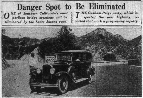
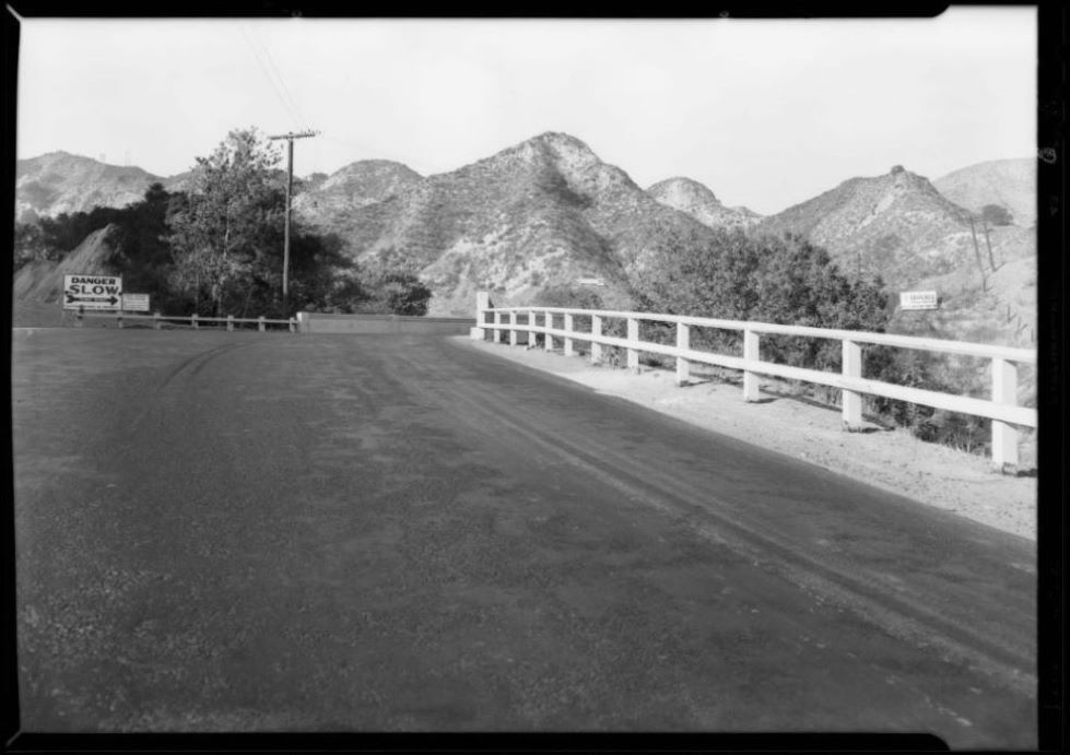
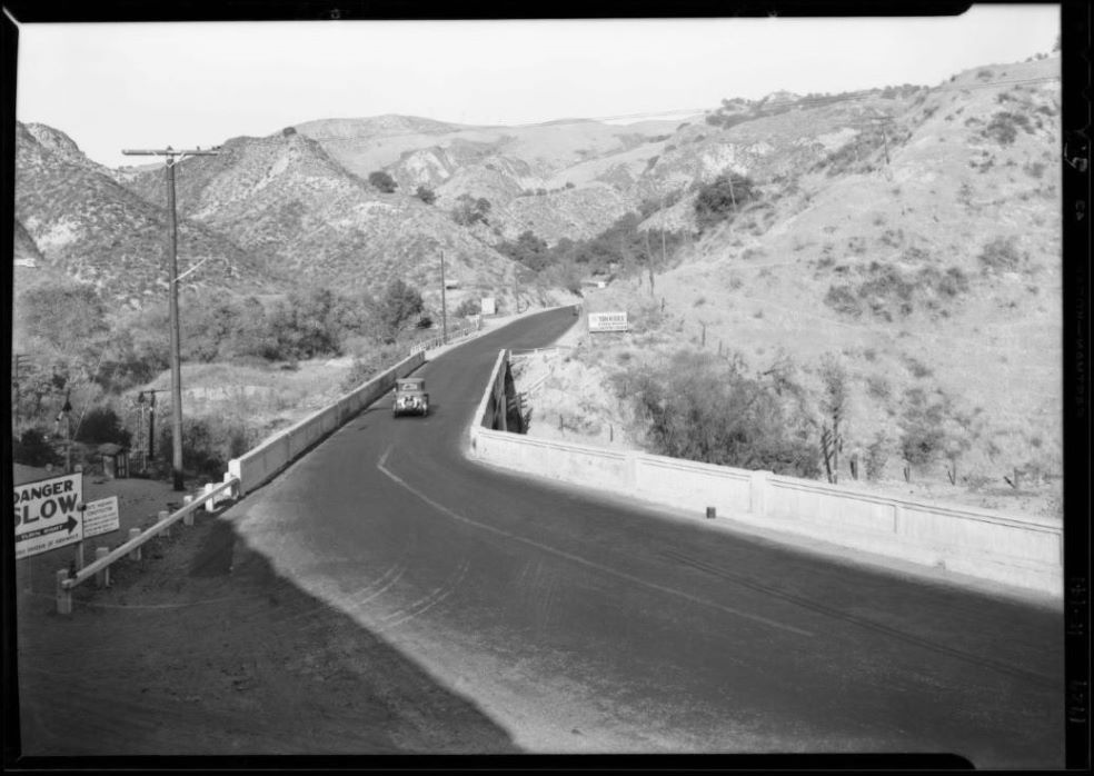
Photo showing the dangerous intersection of the Tunnel Station bridge (to the right) and the new Weldon Canyon cutoff (to the left). A "Danger, Slow" sign is in the middle. (Los Angeles Examiner, September 8, 1929.)
The first deaths that I could find at the bridge occurred Monday October 21, 1929. Two men riding in a motorcycle crashed into a car. One died instantly and the other died later on in the hospital. Evidently, the motorcycle was traveling too fast rounding the corner at the bridge (ignoring the "Danger, Slow" sign) and swerved into the car. The car was greatly damaged but the driver was not injured.(20) The Signal of November 21, 1929, reported another accident "charged up to the dangerous railroad viaduct, a collision taking place Monday evening at that point between a truck and a sedan, the latter carrying six Mexicans. The sedan was completely wrecked, but no one was seriously injured."
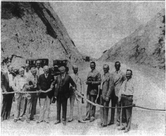
On July 30, 1930, the approximately 8.6 mile long Weldon Canyon highway between San Fernando and Castaic was formally opened by C.C. Young, the Governor of California. Photo from the Los Angeles Examiner of July 31, 1930.
The Los Angeles Evening Express of September 27, 1930, reported "Relief of traffic congestion and danger on the 22-foot bridge at Tunnel station, where the new Weldon Canyon state highway makes a direct route connection to Castaic while San Fernando road turns sharp to Saugus, will be completed soon. The city engineer began today the preparation of plans to widen the structure to 40 feet." The Building and Engineering News of December 20, 1930, stated that "Plans are being prepared for the widening of Tunnel Station Bridge on San Fernando Road crosses the Southern Pacific Ry. east of Newhall tunnel. Will be reinforced concrete and cost about $35,000."
Evidently, a stop sign was placed on San Fernando road after the completion of the Weldon Canyon cutoff highway. The Signal of February 5, 1931, reported that the "usual jam at the death trap on the railroad viaduct south of the tunnel, took place Sunday. The stop signal, as before was the first cause of the trouble, though traffic officers helped a great deal, by directing traffic without regard to the stop sign."
From the Building and Engineering News of August 29, 1931, Page 20: "Merrill Butler, chief city bridge engineer, 657 City Hall, is completing plans for Tunnel Station Bridge. Will consist of building two wedge shaped structures to widen the present structure and re-align roadway; bridge will be of reinforced concrete girder type; approx. 300 ft. in length; estimated cost $35,000. Work will be paid for in cash. Bids will be asked within 30 days."
The bridge project at Tunnel station would "probably be under construction in 1932."(21) "Widening of the bridge at tunnel station" is "awaiting an allocation by the county."(22) The Signal of April 28, 1932 reported that due to the county Board of Supervisors not allocating funds, "there is no prospect of the widening of the viaduct across the Southern Pacific track just south of the Newhall tunnel."
Even though funds were not available, the City of Los Angeles still applied to the Railroad Commission for authority to widen the Tunnel Station bridge accross the Southern Pacific tracts by adding reinforced concrete girder construction to each side to provide for a 40-ft roadway and on 4-ft sidewalk.(23) The Los Angeles Times of April 14, 1933, reported that: "Los Angeles is authorized to re-construct and widen a public overhead crossing known as Tunnel Station bridge on the Newhall Pass road at separated grades over the main line of the Southern Pacific Company between San Fernando and Newhall in a State Railroad Commission order just issued [on April 10]."
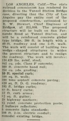
From the Pacific Constructor of May 27, 1933, Page 17.
1933-1935: CONSTRUCTION OF FOOTHILL BOULEVARD BYPASS
However, there were still problems getting funds for the bridge. In the meantime, it was re-proposed to construct a "North San Fernando Road", a connection north of the Southern Pacific tracks between Burbank and the San Fernando Road just north of the Tunnel station bridge and parallel to San Fernando Road. A similar road here had been planned many years ago and can be seen on the above 1928 LA Times map. Funding for this road would be paid for out of money obtained from the federal government under the National Industrial Recovery Act.(24) It was then proposed to construct a less expensive road from San Fernando Road, just north of the bridge, east to Foothill Boulevard near the Olive View Sanitarium, a distance of only about 3.5 miles.(25) In October of 1933, the Los Angeles City Council, in their two-year budget, allocated $35,000 to widen and remodel the Tunnel Station bridge. The money would come from the city's share of the state gasoline tax.(26)
The by-pass road would be done before the widening of the bridge. The Signal of November 30, 1933, reported that work on that road would start soon. Funds allocated to the project would be $275,000. On December 6, 1933, the State Highway commission awarded the contract to J.L. McClain of Los Angeles who bid $216,962. Work started on the new bypass road on January 18, 1934.(27)
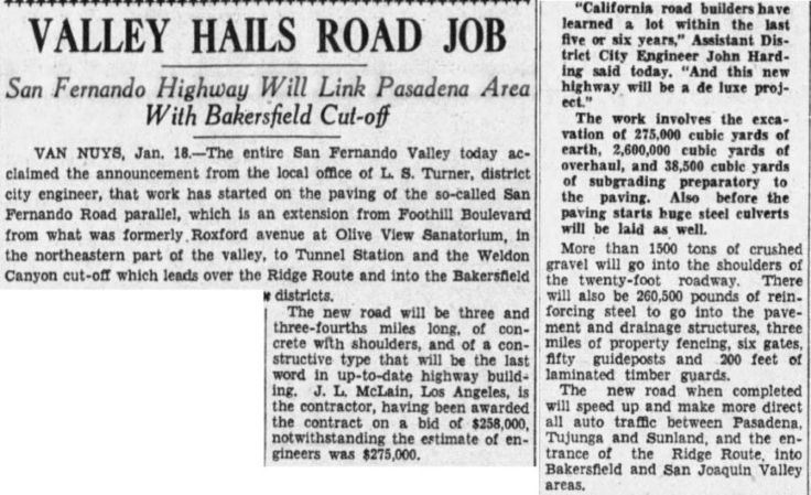
Los Angeles Times, January 19, 1934. Here the bid is reported as $258,000, so I'm not sure what the actual winning bid really was.
On March 12, 1934, the Van Nuys News reported that the road was 50% complete as far as grading was concerned. It later reported that the paving was 60% complete and the entire job should be finished in 60 more days.(28) According to the Signal of August 30, the road was almost complete and that a double approach would be put in where the new road meets San Fernando road just north of the bridge.
Finally, from the Los Angeles Times of November 25, 1934:
"Work has been completed on the construction of a highway between Olive View and Tunnel Station in Los Angeles county, a distance of 3.5 miles, it is reported to the Automobile Club of Southern California engineering department."
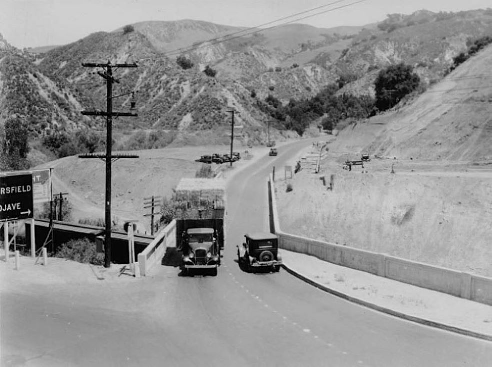
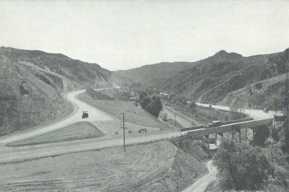
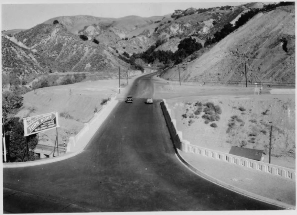
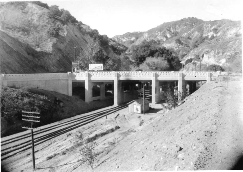
Construction started on Foothill Boulevard extension. The old entrance to Weldon Canyon Park is now a large flat lot. The main entrance is evidently off of the new Weldon/Gavin Canyon state highway. Title: "Automobiles crossing Tunnel Station Bridge over the Southern Pacific Railway tracks, January 16, 1935." California Historical Society Collection 1860-1960, University of Southern California Libraries.
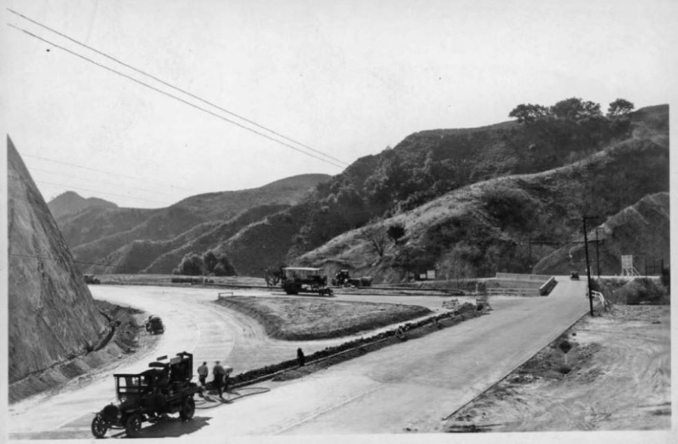
View to the south showing San Fernando Road and Tunnel Station Bridge with Foothill Boulevard extension nearly completed. This is the so-called double approach at the intersection of the two roads. Early 1935. California Historical Society Collection 1860-1960, University of Southern California Libraries.
Foothill Boulevard work nears completion, California Highways and Public Works, Nov.-Dec. 1934, p. 21. See story here.
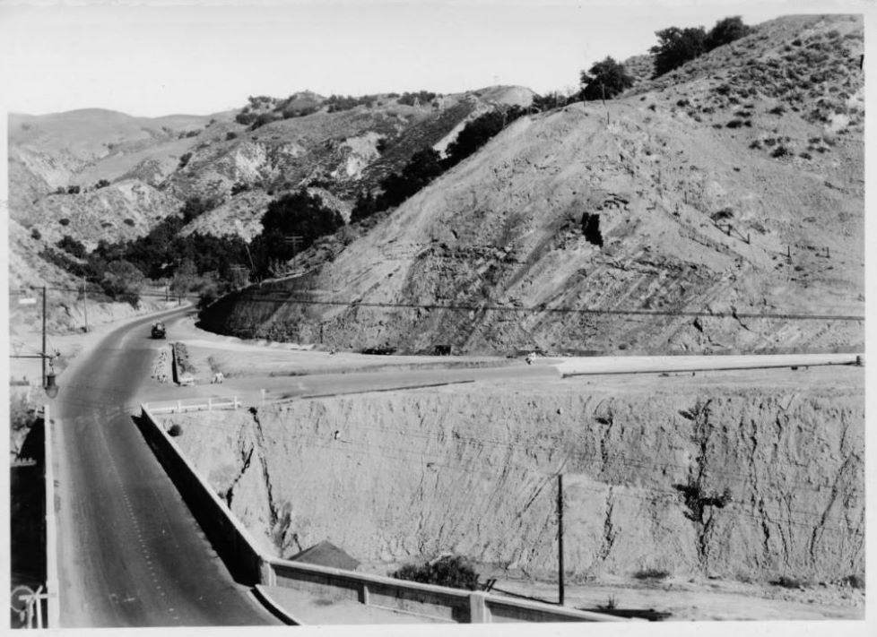
View to the north showing bridge with Foothill Boulevard nearly completed, 1935. California Historical Society Collection 1860-1960, University of Southern California Libraries.
1934-1936: BRIDGE WIDENED
Returning to the Tunnel Station bridge, the LA Times of April 12, 1934, reported that Creighton, Inc. submitted the low bid for the bridge widening of $33,398.76. In the meantime, the LA City Council authorized the agreement already reached with the Southern Pacific Company for widening of the Tunnel Station bridge.(29) The Los Angeles Daily News of June 9, 1934, reported that the job would be financed by state gasoline tax funds. The Daily News also said that the contract was awarded to Person & Thiele on their bid of $33,387.
However, there was a legal problem with the contract (and five others) that needed to be resolved with the State Supreme Court due to a lawsuit filed by an unsuccessful bidder on one of the contracts. Since the money would be provided by the state, the state contract wage scale was suppose to be followed, but these contracts were following the city wage scale. The court had to decide whether the contracts were legal or void.(30) If the contracts were found invalid, they would have to be re-bid.(31) In December, the State Supreme Court ruled that state wage scales must be followed for contracts involving the use of state funds. This ruling voided the contracts.(32)
New specifications for all the contracts involved had to be prepared.(33) The State Highway Department approved the new plans for the bridge in February and they were given the Los Angeles Board of Public Works, who would call for bids.(34) Bidding would be opened on March 20, 1935. The estimated cost for the widening of the bridge was $43,000.(35) The Lynch-Canon Engineering company submitted the low bid of $39,993.(36) I guess that state wages were higher than city wages which would explain why the bids were higher than before.
Construction on the bridge began in June of 1935. The original plan was to keep one side of the bridge open for traffic during the estimated three months of construction, but that was not considered feasible anymore. Traffic would be detoured over the newly completed Foothill Boulevard extension.(37) The Los Angeles Times of September 22, 1935, reported that the bridge should be sufficiently completed within the month to allow some traffic through. Another month would be needed to fully complete the job. The new bridge would have three traffic lanes, the same number it has today (in 2025). On November 10, the LA Times reported that traffic was permitted over the bridge, but there was still some work being done.
From the Newhall Signal of December 12, 1935:
"Viaduct is Completed - At last the Viaduct over the S. P. tracks south of the tunnel is complete and the contractor has moved out. The structure is a splendid piece of work, and a credit to the state and the road."
The Van Nuys News of December 19 reported that
"The new bridge carrying San Fernando Road over the Southern Pacific railway tracks near Tunnel station in San Fernando Road was accepted for the city by the Board of Public works Monday. The enlarged bridge removes a traffic hazard that existed at that point for many years. The old bridge was too narrow to accommodate the heavy traffic to and from the Antelope and Owens River valleys, and accidents were frequent."
The Los Angeles Times, January 12, 1936:
"Another long-needed improvement just completed is the new viaduct at Tunnel Station on San Fernando Road, eliminating the old narrow bridge 'death trap' over the railroad tracks south of Newhall Tunnel. This viaduct is a gateway to the alternate Bakersfield route via Saugus, as well as to Mint Canyon and Owens Valley highways, which are now entirely modern except for Newhall Tunnel. This will be eliminated for a new bore during the next biennial [2-year] period, it is expected."
It would take more than two years for the tunnel to be eliminated. In January of 1935, it had already been decided that a cut ("daylighting") would replace the Newhall Tunnel(38) and that would not occur until 1939.
Bridge closed for widening (image found on internet but actual original source unknown).
Title: "View of the deck of the widened Tunnel Station Bridge, December 13, 1935." Note that there are no lights on the bridge. California Historical Society Collection 1860-1960, University of Southern California Libraries.
Title: "View of the Tunnel Station Bridge, December 13, 1935." California Historical Society Collection 1860-1960, University of Southern California Libraries.
Bridge widening completed, California Highways and Public Works, June 1936, p. 25.
View to the south. The newly widened bridge now has five raised lights on it. California Historical Society Collection 1860-1960, University of Southern California Libraries.
Close-up of the raised lights. There are two on the right and three on the left (one is out). The evidence for those light poles are still evident today (see recent photos below).
LATER YEARS AND EARTHQUAKES
In August of 1944 a truck lost control about a mile above the Tunnel Station bridge while traveling south down San Fernando Road from Newhall. The out-of-control truck passed over the bridge and smashed straight into the embankment where the road ends at the "T" intersection. The driver and one passenger were seriously injured but another passenger was killed instantly. However, the second passenger died in the hospital a few days later.(39)
On October 29, 1949, a Blue Star Memorial Highway Marker, a gift from the Garden Club of America, was dedicated and placed by the West Valley American Legion on Highway 99 at the Tunnel Station Bridge. The marker was a memorial to all who had served in World War II. This was part of a nationwide project with many Blue Star markers like this one placed, or would be placed, on highways all over the country.(40) However, in 1953, changes in the road required the removal of the marker. On November 11, 1954, the marker was re-dedicated in McCambridge Park in Burbank, where it still stands today.(41)
While some of the freeways were collapsing during the 1971 San Fernando and the 1994 Northridge earthquakes, the Tunnel Station bridge stood strong. In fact, in fact in some cases it became the main artery in and out of Santa Clarita. The bridge did have some retrofitting done after the 1994 quake, but that was not because of any substantial damage. Most of the Los Angeles bridges were being retrofitted to make them safe for any future earthquakes.
In May of 2004, the JRP Historical Consulting firm prepared a City of Los Angeles Monumental Bridges (1900-1950) report for the State of California Department of Transportation (Caltrans). This report would indicate whether a bridge should be considered historically significant or not. The parameters used were too detailed to go into here (and the report can be found on Caltrans' website), but they decided that the Tunnel Station bridge did "not appear eligible as a City of Los Angeles Monumental Bridge." Based on the bridge's historical and current importance, and the unique art deco style of the bridge architecture, I disagree with the report's conclusion for the bridge.
Tunnel Station, Roy D. Graves Pictorial Collection, BANC PIC 1905.17500-ALB, The Bancroft Library, University of California, Berkeley. Undated, ca 1940's. View about north. Lights seen on bridge.
Tunnel Station, Roy D. Graves Pictorial Collection, BANC PIC 1905.17500-ALB, The Bancroft Library, University of California, Berkeley. Undated, ca 1940's. View north probably taken at the same time as previous photo. Lights on bridge easily seen.
1949 image from Caltrans. The lights can still be seen on the bridge. View south towards San Fernando Valley. This was copied from Mike Ballard's excellant website Southern California Regional Rocks and Roads.
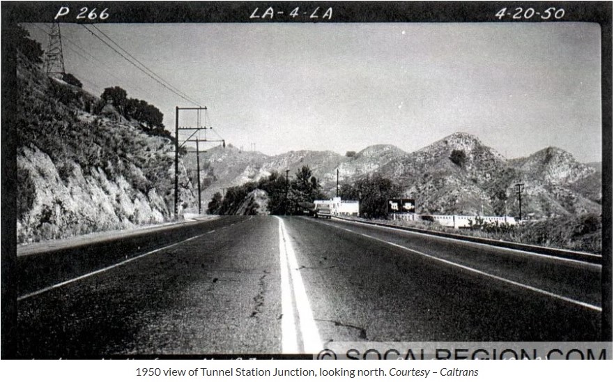
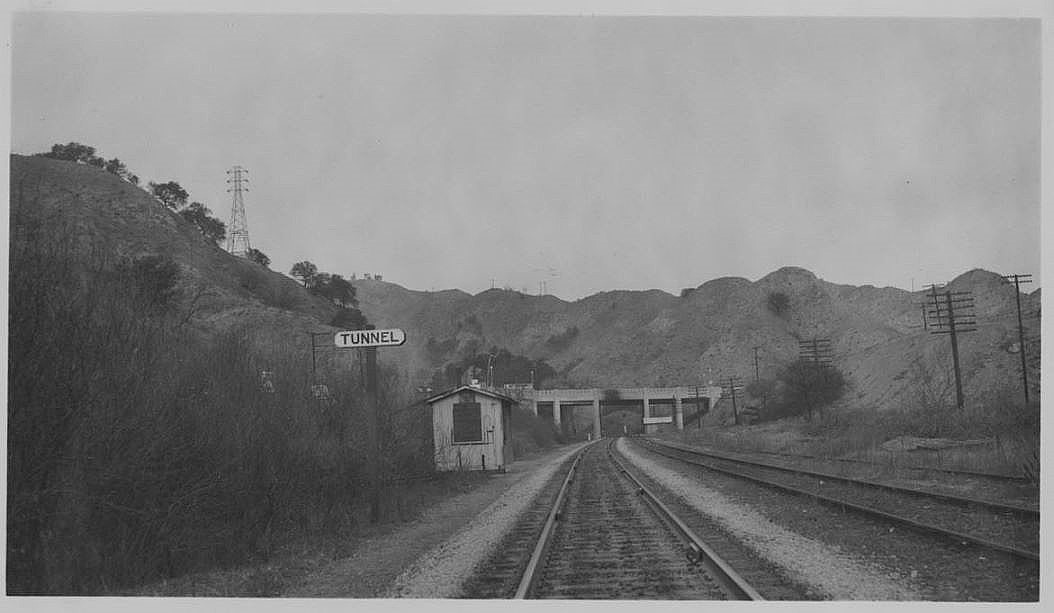
1950 image from Caltrans. Lights can just be seen on bridge on the right of the photo. From Mike Ballard's website Southern California Regional Rocks and Roads.
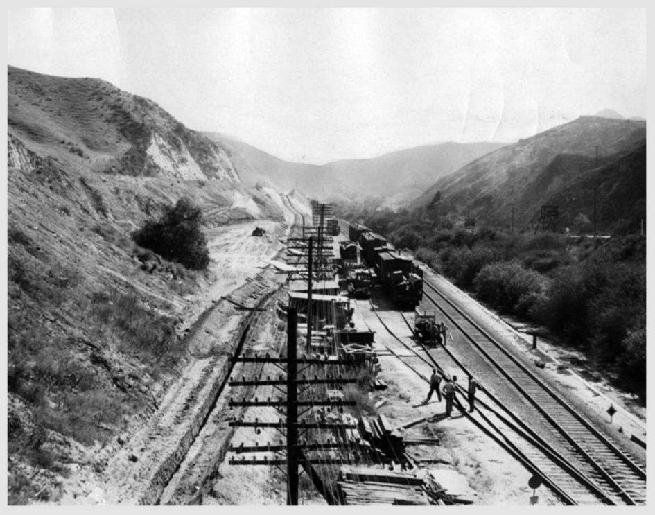
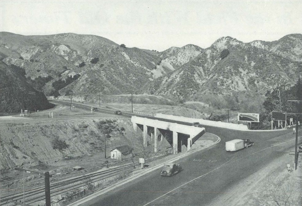
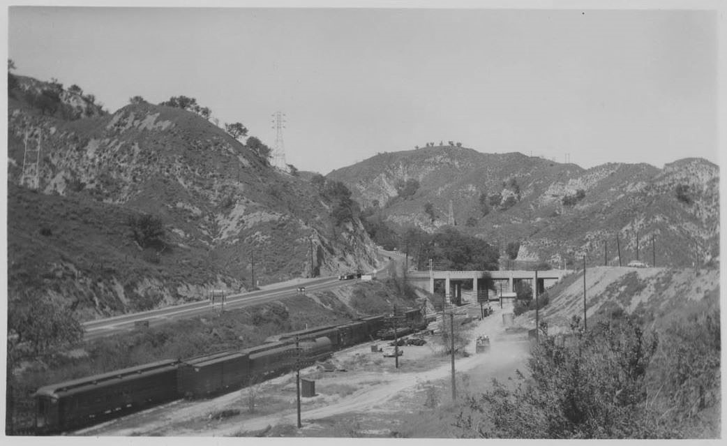
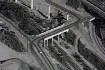
January 1, 1954: "Project under way - A two-year job of rerouting San Fernando Road south from junction of Highways 6 and 99 [today that is intersection of Sierra Highway and San Fernando Road/The Old Road] got underway a few days ago." View south from Tunnel Station bridge To the right is San Fernando Road and to the upper left is Foothill Boulevard. The original siding now has its own siding. Valley Times Photo Collection, Los Angeles Public Library.
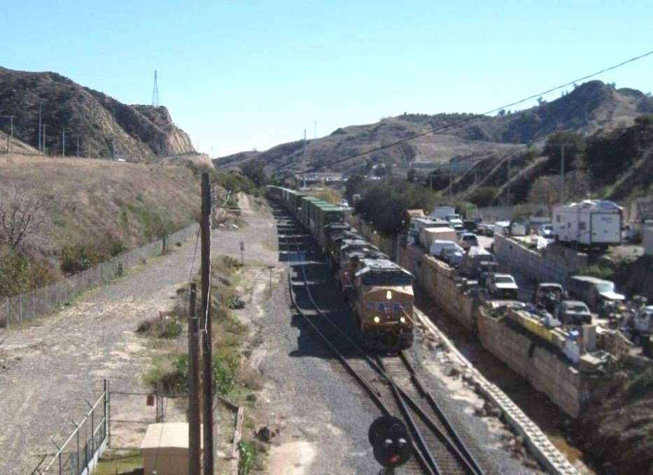
Similar view taken on February 23, 2025, more than 70 years after the above photo was taken.
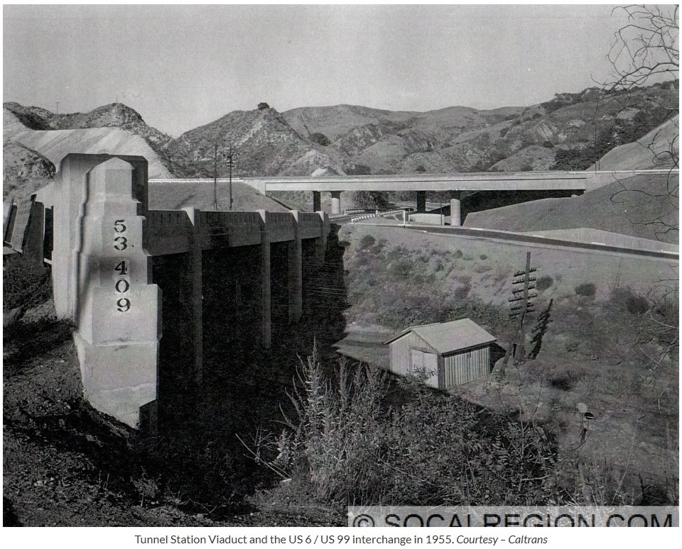
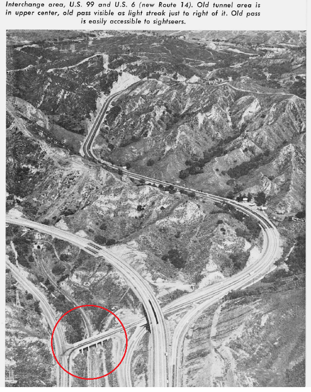
US 99 is to the the left of the bridge. Today it is San Fernado Road up to the bridge intersection and The Old Road after the intersection. The road going over the bridge and looping around into Newhall was US 6, the new (at that time) Route 14. Now it is Sierra Highway. From the California Highways and Public Works magazine of March-April 1964.
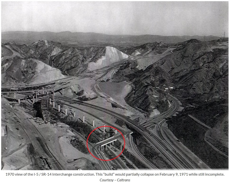
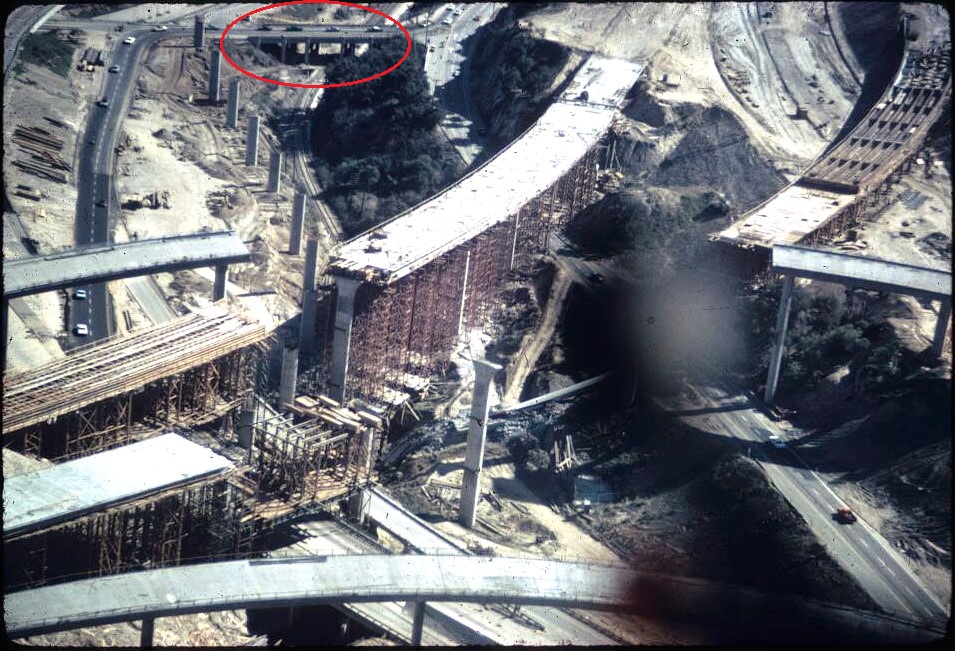
Photo taken after the February 9, 1971, San Fernando (a.k.a. Sylmar) earthquake. The Tunnel Station bridge is at the top and had no reported damage (that I could find). It became an important route in and out of the Santa Clarita Valley until the freeways were rebuilt.
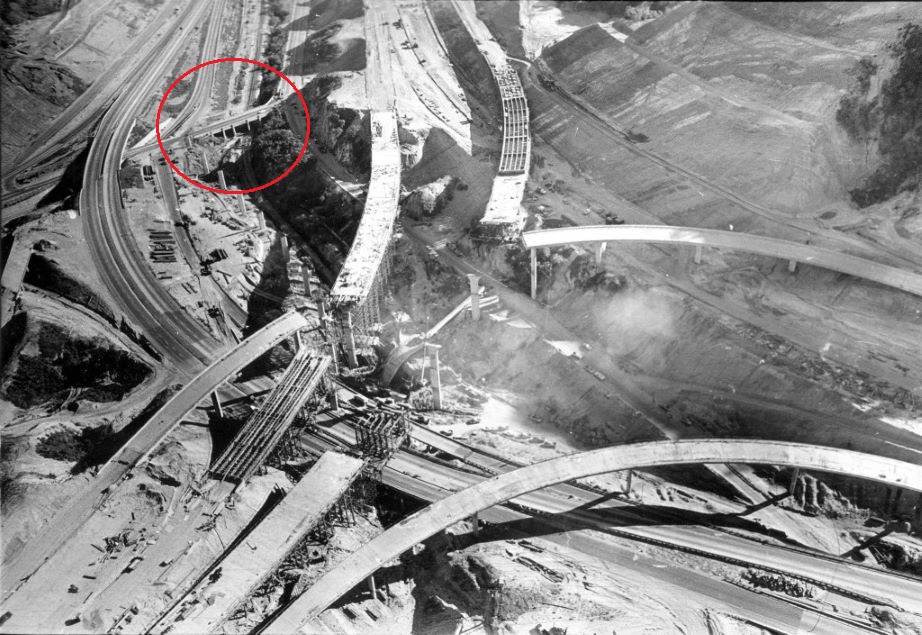
Another photo after the 1971 San Fernando earthquake.
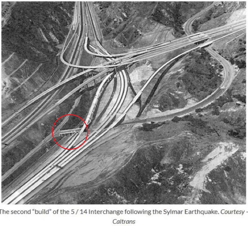
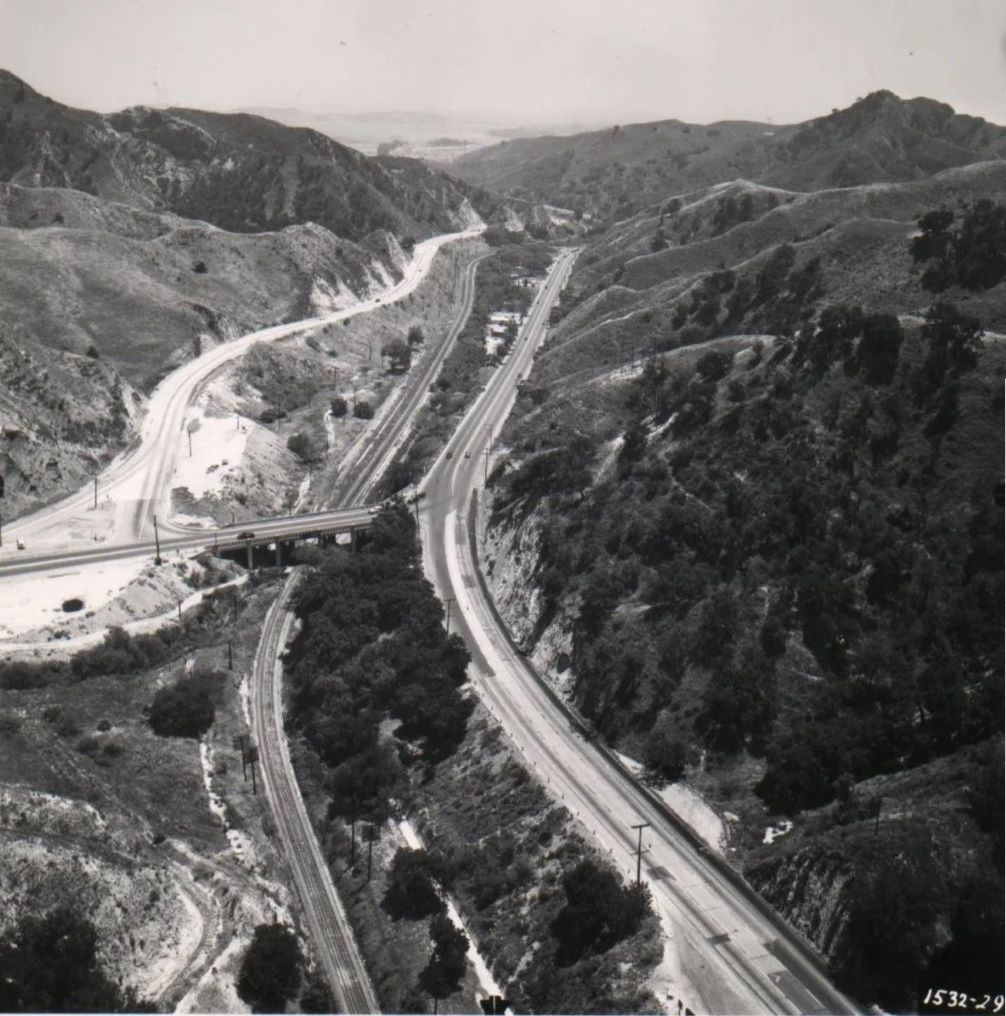
ca. 1972 image from Caltrans showing the Tunnel Station bridge from Mike Ballard's website Southern California Regional Rocks and Roads.
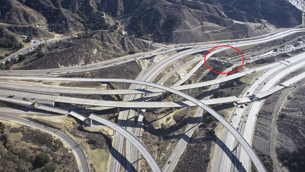
Photo taken after the January 17, 1994, Northridge earthquake. Again, I found no reported damage to the bridge. Like 1971, it again became an important route in and out of the Santa Clarita Valley until the freeways were rebuilt.
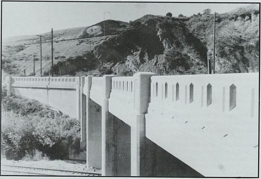
Image from That Ribbon of Highway II - Highway 99 From the State Capital to the Mexican Border by Jill Livingston, Living Gold Press, California, 1999, p. 78.
THE BRIDGE SUPPORTS
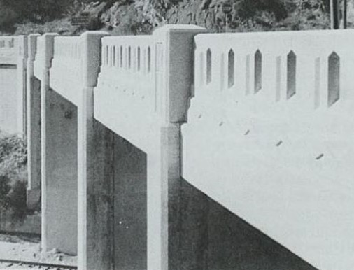
The supports (or footings or piers) of the bridge have undergone three changes over the years as the following images will show. Note also that the bridge guardrail (or barrier) has also changed. The old bridge had a solid concrete guardrail. After it was widened, the guardrail had a 1930's style "art deco" look. Art deco was a popular design style of that time.
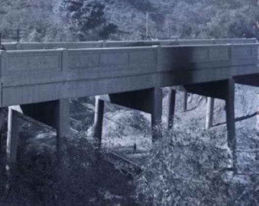
This image shows the original bridge supports in 1928. It also shows the solid guardrail.

In 1935, the widened bridge had these supports. They are certainly stronger than the original ones, but there are still large gaps in them. The guardrail now has an art deco look with holes.
This image from 1970 still shows the gaps (although difficult to see here).
The supports are now solid as shown in this 1999 photo. I believe the openings in the bridge footings were strengthened and filled in after the 1994 earthquake as part of the Caltrans Seismic Retrofit program, which was created after the 1994 quake.
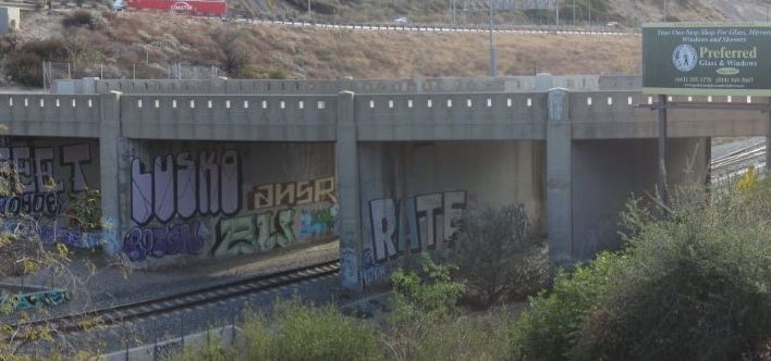
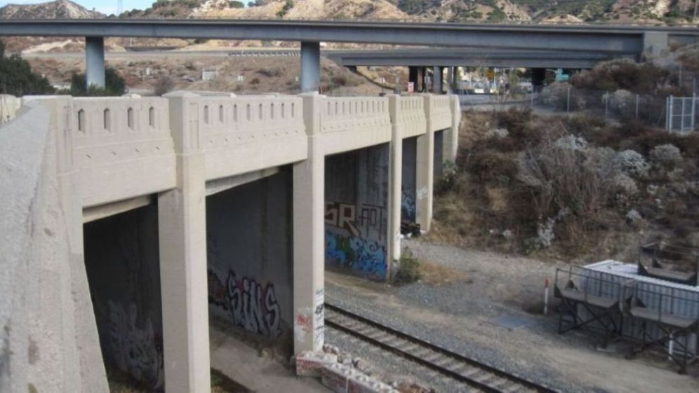
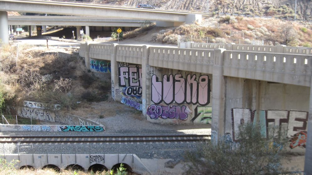
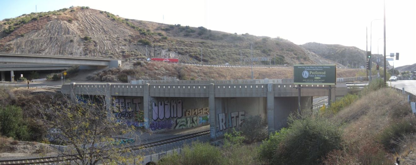
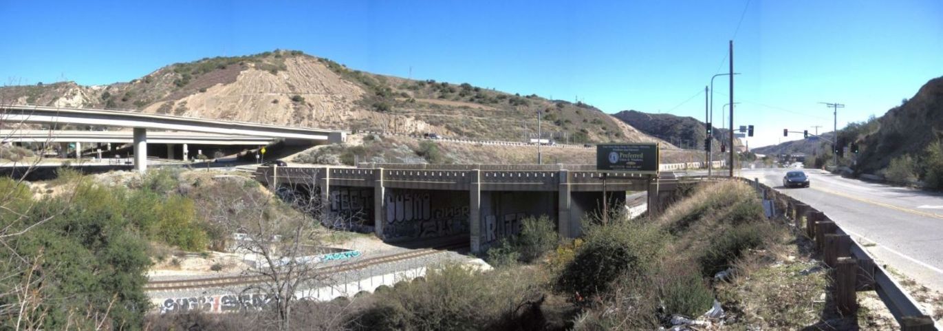
Solid supports covered with graffiti in 2024.
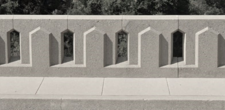
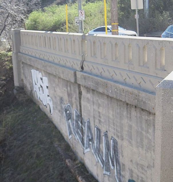
The art deco style of the bridge guardrail on the bridge street side.
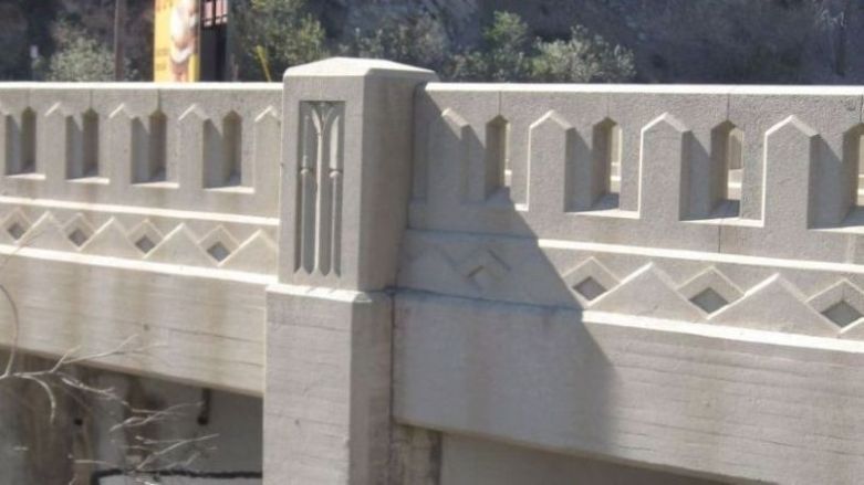
The bridge outside art deco style.
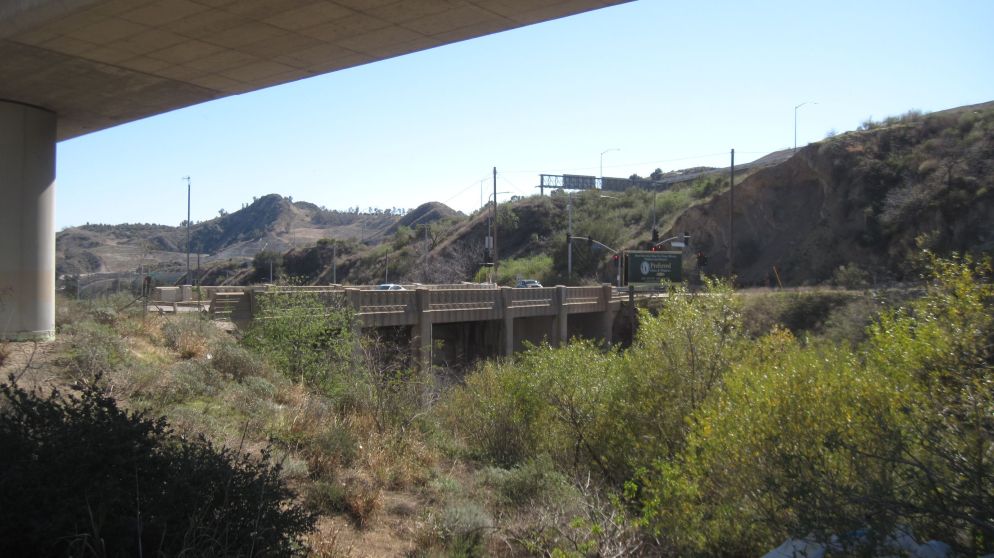
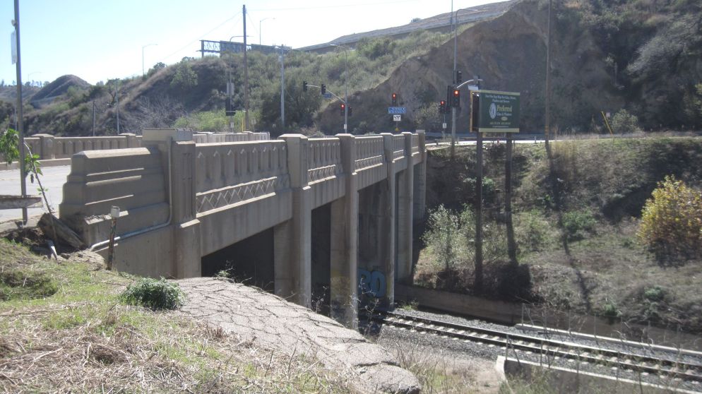
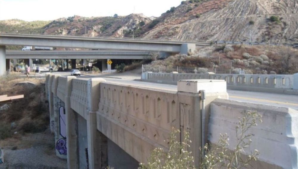
THE BRIDGE TODAY
The bridge is still important today. It is heavily used during rush hour and when there are blockages on the 5 or 14 freeways. However, the condition of the bridge is rather shameful. The pavement really needs to be redone. Also, the amount of graffiti on the bridge is embarrassing. Why hasn't it been painted over?
Walking up Sierra Highway towards the Tunnel Station bridge and San Fernando Road. Photo taken on February 23, 2025.
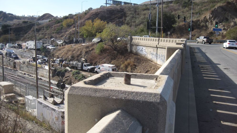
The southeast (towards the San Fernando Valley) side of the bridge. Here we see where one of the light poles was. The base was bolted into this square area with the electrical wires coming up the pipe in the center. On the far side there appears to be a crack. That crack is also visible in the bridge photo in the 1999 Livingston book That Ribbon of Highway (shown above). December 1, 2024.
On the opposite side of the railroad tracks on the same side of the bridge is another old light pole base. December 1, 2024.
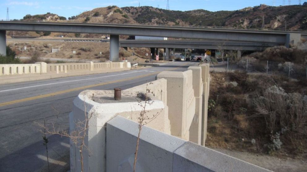
This is the third light pole base on this side of the bridge. December 1, 2024.
Same view without the light pole base. December 1, 2024.
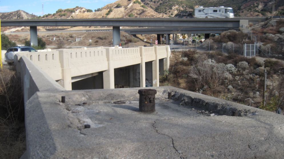
Closer view of the crack. The offset is about four inches at the top and seems to taper down to almost no offset at the bottom. A light pole base is at the far end. The cars are on San Fernando Road. The crack was probably caused by one of the major earthquakes - either in 1971 or 1994. At this location, there shouldn't be any structural danger to the actual bridge. February 23, 2025.
View of the north facing side of the bridge. February 23, 2025.
Closer view. The railroad tunnel would be about 1/4 mile up the tracks to the right (north). One of the two light pole bases on this side of the bridge is shown here. It is covered with a square locked top. There is an electrical wire pipe entering the locked box so there are probably still live wires inside that need to be protected. February 23, 2025.
Now I'm on San Fernando Road with the railroad tunnel to the left. Why is all that graffiti there? Who is responsible for removing it? December 1, 2024.
Another view of the north facing side of the bridge. Here is the other old light pole base with its locked top and electrical wire pipe. December 1, 2024.
December 1, 2024.
February 23, 2025.
Looking north from the bridge. Tunnel out of sight. December 1, 2024.
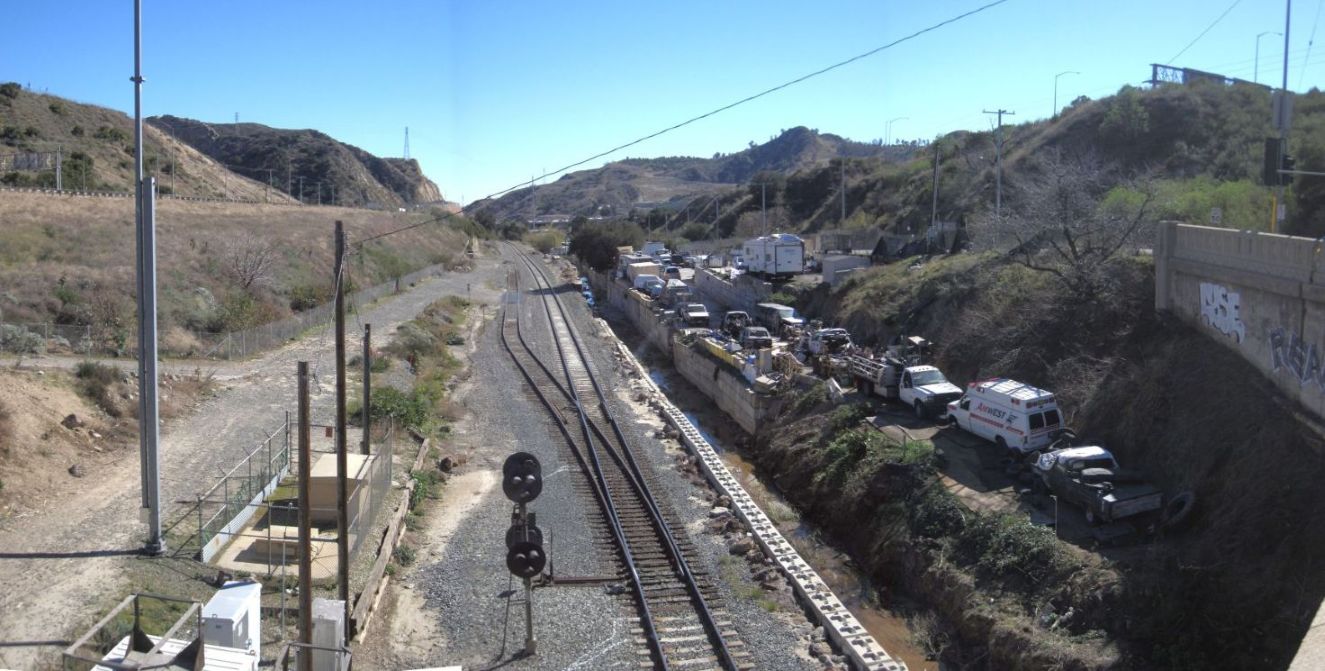
Looking nearly south from the bridge. On the right is San Fernando Road. Note that the one track siding ends in the distance without re-connecting to the main track. On the right is a vehicle grave yard. February 23, 2025.
SOURCES
(1) Los Angeles Herald, January 1, 1876.
(2) Santa Barbara Daily Press, June 2, 1876.
(3) Los Angeles Evening Express, September 29, 1876.
(4) Los Angeles Herald, January 1, 1876.
(5) Los Angeles Times, October 20, 1907.
(6) Los Angeles Times, October 4, October 20, 1907.
(7) Los Angeles Times, December 6, 1910.
(8) Los Angeles Times, July 31, 1908.
(9) Los Angeles Herald, November 21, 1909.
(10) Los Angeles Herald, December 23, 1909; Los Angeles Times, December 28, 1909.
(11) Los Angeles Evening Express, December 21, 1910.
(12) Los Angeles Times, Annual Midwinter Insert, Number VI, Part VI, 24 pages, January 12, 1911.
(13) Los Angeles Times, August 6, 1912.
(14) Los Angeles Times, March 29, 1912.
(15) Van Nuys News, July 17, 1928.
(16) Newhall Signal, July 19, 1928.
(17) Newhall Signal, July 12, 1928.
(18) Los Angeles Evening Express, December 28, 1928.
(19) Los Angeles Times, July 27, 1930.
(20) Newhall Signal, October 24, October 31, 1929.
(21) Los Angeles Daily News, December 26, 1931.
(22) Van Nuys News, April 4, 1932.
(23) Pacific Constructor, November 15, 1932, Page 22.
(24) Hollywood Citizen News, July 18, 1933.
(25) Newhall Signal, August 10, 1933.
(26) Los Angeles Times, October 5, 1933.
(27) Van Nuys Daily News, January 18, 1934.
(28) Van Nuys Daily News, June 28, 1934.
(29) Los Angeles Times, May 27, 1934.
(30) Van Nuys News, September 17, 1934.
(31) Los Angeles Daily News, November 10, 1934.
(32) Los Angeles Daily News, January 3, 1935.
(33) Los Angeles Times, January 17, 1935.
(34) Van Nuys News, February 28, 1935.
(35) Van Nuys News, March 7, 1935.
(36) Los Angeles Daily News, March 21, 1935.
(37) Van Nuys News, June 20, 1935.
(38) Newhall Signal, January 10, 1935.
(39) Van Nuys News, August 3, August 7, 1944.
(40) Van Nuys News, October 27, November 3, 1949.
(41) Valley Times, November 6, 1954; Los Angeles Times, November 11, 1954.