Newhall Oil District, Santa Clarita, California
Website created and maintained by Stan Walker
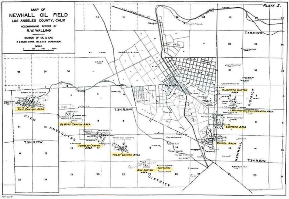
This is a 1934 map of the Newhall Oil Field from Walling, R. W., 1934, Report on Newhall Oil Field: California Oil Fields, Summary of Operations of the State Oil and Gas Supervisor: Department of Natural Resources, Division of Oil and Gas, Vol. 20 No. 2. You can see how the Pico Anticline forms, what Walling calls, the Pico Anticline District. Click here for a larger PDF version (1.6MB).
This site originally was only about Elsmere Canyon. Over the years it expanded to include many other subjects, the largest being the Newhall Oil District. Therefore, the first section is now called the Newhall Oil District, which includes the oil history, geology, paleontology, an occasional biography, and other subjects, of all the canyons that make up that oil district. It also includes Placerita Canyon, which became its own oil field in 1949, the Newhall-Potrero oil field, and the Newhall-Townsite oil field.
There were other oil fields in Santa Clarita that I did not cover. Examples include Bouquet Canyon (with 10 wells recorded in DOGGR records), Castaic Hills (82 wells), Castaic Junction (84 wells), Del Valle (147 wells), Hasley Canyon (38 wells), Honor Rancho (107 wells), and Saugus (10 wells). Also, many other wildcat wells were drilled in Santa Clarita in areas that never became an oil field.
Some of the history that I write about does not match what is on the SCVHistory website. Earlier SCV historians did not have the resources that are available today, in particular the internet. For example, research in newspapers has been greatly improved with sites such as newspapers dot com. Another example is the digitalization of many history books and magazines, also available on the internet. As more and more historic documents become available, future historians will probably find new information to add to my website and fix any of my errors. Leon Warden, with assistance from others, is doing his best to fix any errors on the SCVHistory website.
There are many outside links on this website. As time goes by, it is not unusual for a link to become broken or obsolete. I will fix or remove the ones that I become aware of.
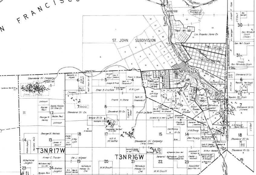
Section of "Map of the Piru-Simi-Newhall Oil Fields, Ventura & Los Angeles Counties, California State Mining Bureau, Dept. of Petroleum & Gas, Revised to Oct. 20 1921" from the SCVHistory website. A larger version of this section of the map can be viewed here. The complete map can be viewed on the SCVHistory website here.
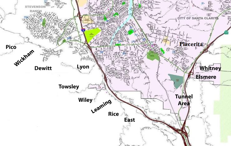
Location of the canyons. Pico, Towsley/Wiley, Rice/East, Elsmere/Whitney, and Placerita have parking areas and are open for public hiking.

stanw at earthlink dot net
Copyright © 2026 Stan Walker. All rights reserved.
All photographs, unless otherwise noted, are owned by Stan Walker